


Get to know Ningjiang District
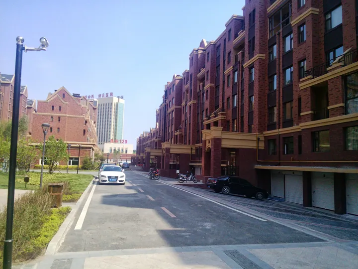
Photo adjustments
Full frame retained; proportionally resized and converted to WebP. No retouching or changes to the photographed subject. Card displays may crop the view.
- Administrative area
- District · 市辖区
- Part of
- Songyuan
- Chinese name
- 宁江区
- Local areas
- District guide
Area & population
- Area in the source
- 1,250.02 km²
- Population · 2020 census
- 619,364
- Administrative seat
- Wenhua Subdistrict
Source: cited geographic source, as of the dates shown.
Setting and landscape
The Songhua runs through the city, and the built-up area of Songyuan spreads across the river: Ningjiang on one side and the town of Qian Gorlos (前郭尔罗斯镇) on the other. The district borders Fuyu (扶余) to the east and Qian Gorlos County (前郭县) to the west and south, and faces Zhaoyuan County (肇源县) in Heilongjiang across the river to the north. It sits where Jilin, Heilongjiang and Inner Mongolia meet. About 4,000 hectares of forest along the river are listed as a provincial forest park, and the district is known in and beyond Jilin for more than 40 kinds of freshwater fish. Beneath it lie oil, natural gas and oil shale.
History
The district takes its name from Ningjiang Prefecture (宁江州), set up here under the Liao dynasty. Earlier the area belonged to the kingdom of Buyeo (夫余国) and, under the Tang, to the Fuyu prefecture of Balhae (渤海国). After the Qing posted the Bodune (伯都讷) deputy military governor to the region in 1692, a new walled town, Bodune New City (伯都讷新城), was built the following year on what is now the heart of Ningjiang's urban area north of the river. The district government lists the Changgangzi Bronze Age site (长岗子青铜文化遗址), the Liao-Jin ancient city of Bodune (伯都讷辽金古城遗址) and the Xiongjialiang site (熊家亮遗址) among its historic remains.
Getting oriented
Seven railways pass through the city, among them the Beijing–Harbin (京哈) and Hunchun–Ulanhot (珲乌) lines, and the Beijing–Harbin and Daqing–Guangzhou (大广) expressways cross the district. From Songyuan Port (松原港) on the Songhua, boats can run directly to Jilin city, Qiqihar, Harbin and Jiamusi.
Highlights
- Bodune Liao-Jin ancient city site 伯都讷辽金古城遗址: Liao-Jin walled-town site listed by the district government among its historic remains.
- Changgangzi Bronze Age site 长岗子青铜文化遗址: Bronze Age site listed by the district government.
Sources for this guide
松原市宁江区人民政府 - 宁江区简介 · Ningjiang District People's Government, Songyuan
宁江区 - 维基百科,自由的百科全书 · Chinese Wikipedia · CC BY-SA 4.0
松原市 (吉林省) - 维基百科,自由的百科全书 · Chinese Wikipedia · CC BY-SA 4.0
扶余市人民政府 - 历史沿革 · Fuyu Municipal People's Government
Original English written from the listed sources and checked sentence by sentence against quoted extracts by a separate reviewer. Updated 2026-09-25.
Explore Ningjiang District
Core places to explore, with English and Chinese names.
Ningjiang District 宁江区
Plan your visit
Getting there
Ningjiang District is about 3 km in a straight line from central Songyuan. Search for 宁江区 in a map app to find stations and your accommodation.
Where to stay →More in Songyuan
Sources & geographic information
Administrative names and parent areas: Official geographic directory · Reference date 2026-09-06.
Some facts checked against 宁江区 — Wikipedia contributors, CC BY-SA 4.0.
Some facts checked against 松原市 (吉林省) — Wikipedia contributors, CC BY-SA 4.0.
Map data © OpenStreetMap contributors. Pins mark approximate centres, not entrances or boundaries.