

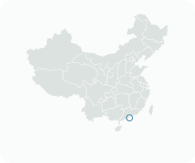
Get to know Novos Aterros da Areia Preta

Photo adjustments
EXIF orientation normalized; resized without changing aspect ratio; converted to WebP. No subject edits.
- Administrative area
- Statistical area · 統計分區
- Part of
- Macau
- Chinese name
- 黑沙環新填海區
- Local areas
- Statistical area guide
Setting and history
Areia Preta was a bay that has been filled in since the 1930s. The commercial and residential part north of Avenida de Venceslau de Morais (慕拉士大馬路) and Rua dos Pescadores (漁翁街) was reclaimed in two stages beginning in the 1980s, and seven white public and private housing blocks were the first buildings on it. In planning for the New Urban Zone (澳門新城區) the reclaimed part of Areia Preta is treated as a zone of its own.
Along Avenida da Ponte da Amizade (友誼橋大馬路) the shore looks north across the water to Zhuhai and east to Zone A of the New Urban Zone and the artificial island of the Zhuhai–Macao border crossing (珠澳口岸人工島). The south-eastern end of Areia Preta is where the Friendship Bridge (友誼大橋) begins, and its north-western end joins the Border Gate (關閘) area.
What to see
The Pearl of the Orient (東方明珠) stands in the Rotunda da Amizade (友誼圓形地). One of the monuments to Sino-Portuguese friendship, it was designed by a Portuguese sculptor and unveiled on 10 June 1997. Two orange steel arches, 11.3 metres high, cross each other to symbolise two cultures meeting, and they are ringed by stainless-steel spheres with fountains. The name has since become shorthand for the luxury estates built nearby.
Areia Preta Urban Park (黑沙環公園) is an L-shaped park laid out on reclaimed land between Avenida 1º de Maio (勞動節大馬路) and Avenida Leste do Hipódromo (馬場東大馬路). Work began in March 2003 and it opened on 27 October that year. Its palm-lined paths are mostly paved in Portuguese-style stone, and a footbridge near the sea leads to the Areia Preta Waterfront Park (黑沙環海濱公園). The park holds two public libraries: the Wong Ieng Kuan Library (黃營均圖書館), open since 2004, and the Wong Ieng Kuan Children's Library (黃營均兒童圖書館) in the north of the park, opened in 2011.
Highlights
- Pearl of the Orient 東方明珠: A Sino-Portuguese friendship monument of crossed orange steel arches, unveiled in 1997.
- Areia Preta Urban Park 黑沙環公園: An L-shaped park opened in 2003 on reclaimed land, with two libraries and a footbridge to the waterfront park.
Sources for this guide
黑沙環 - 維基百科,自由的百科全書 · Wikipedia (Chinese) · CC BY-SA 4.0
黑沙環公園 - 維基百科,自由的百科全書 · Wikipedia (Chinese) · CC BY-SA 4.0
東方明珠 (澳門) - 維基百科,自由的百科全書 · Wikipedia (Chinese) · CC BY-SA 4.0
黑沙環公園黃營均兒童圖書館 – 澳門特別行政區政府入口網站 · Macao SAR Government Portal (Public Administration directory)
Original English written from the listed sources and checked sentence by sentence against quoted extracts by a separate reviewer. Updated 2026-09-23.
Find Novos Aterros da Areia Preta
A reliable area-level map point is not available in the current sources.
Plan your visit
Getting there
Search for 黑沙環新填海區 in a map app to find stations and your accommodation.
Where to stay →More in Macau
Sources & geographic information
Administrative names and parent areas: Official geographic directory · Reference date 2026-09-06.
DSEC statistical-zone directory
MGTO and IAM: Spider Tree viewing locations
Macao Public Library: Branches and opening-hours directory
Macao Public Library: Mobile Library 2026
Some facts checked against 黑沙環 — Wikipedia contributors, CC BY-SA 4.0.
Some facts checked against 黑沙環公園 — Wikipedia contributors, CC BY-SA 4.0.
Some facts checked against 東方明珠 (澳門) — Wikipedia contributors, CC BY-SA 4.0.
Map data © OpenStreetMap contributors. Pins mark approximate centres, not entrances or boundaries.