

Get to know Horta e Costa e Ouvidor Arriaga
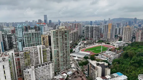
Photo adjustments
EXIF orientation normalized; resized without changing aspect ratio; converted to WebP. No subject edits.
- Administrative area
- Statistical area · 統計分區
- Part of
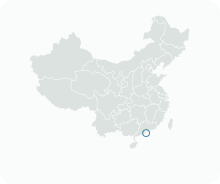
- Macau
- Chinese name
- 高士德及雅廉訪區
- Local areas
- Statistical area guide
History
Avenida de Horta e Costa, a 795-metre east-west artery, was named in 1905 after José Maria de Sousa Horta e Costa, governor of Macau from 1894 to 1897. Its first Chinese rendering (柯高馬路) was dropped because in Cantonese it sounded vulgar. Two-storey houses lined it at first; from the 1970s it became the mixed shop-and-flat street it is now. When the Guia Tunnel (松山隧道) opened in the 1990s, a flyover was built at its south-east end to feed the tunnel, and the banyans in the central strip were cut down. Early stone street-name markers survive at both ends.
Avenida do Ouvidor Arriaga, 805 metres long, runs parallel between Avenida do Coronel Mesquita and Avenida de Horta e Costa. It is named after Miguel José de Arriaga Brum da Silveira, who came to Macau from Portugal in 1802 and served as a special judge (ouvidor) of the Senate. The Chinese name keeps only the syllable Ya (雅) for his name and renders his office as Lianfang (廉訪), an old title from the Yuan-dynasty surveillance commission. Its two-storey garden villas began to give way to apartment blocks in the 1960s.
What to see
The Red Market is officially the Almirante Lacerda Municipal Market. Architect Júlio Alberto Fernandes Basto designed it as a three-storey red-brick Art Deco building with a central clock tower and watchtowers at each corner; work began in 1935 and it opened in 1936, when the sea still lapped beside it. It was Macau's first indoor fresh market and was classified as a Building of Architectural Interest in 1992. After a two-year renovation announced in early 2022, nearly 130 vendors of seafood, fruit, vegetables and other fresh produce returned to their stalls.
Highlights
- Red Market 紅街市: Art Deco market of 1936 by Júlio Alberto Fernandes Basto, Macau's first indoor fresh market, classified in 1992.
- Avenida de Horta e Costa 高士德大馬路: Named in 1905 after a governor of 1894 to 1897; early stone street-name markers survive at both ends.
- Avenida do Ouvidor Arriaga 雅廉訪大馬路: Named after a magistrate who arrived in 1802; its Chinese name borrows a Yuan-dynasty official title.
Sources for this guide
DSEC statistical zones (CensusGIS layer Zona_Unidade_Zona_2019Q4) · Statistics and Census Service (DSEC), Macao SAR Government
Revitalising the historic Red Market · Government Information Bureau (GCS), Macao SAR Government
高士德大马路 · Chinese Wikipedia · CC BY-SA 4.0
雅廉访大马路 · Chinese Wikipedia · CC BY-SA 4.0
Original English written from the listed sources and checked sentence by sentence against quoted extracts by a separate reviewer. Updated 2026-09-23.
Find Horta e Costa e Ouvidor Arriaga
A reliable area-level map point is not available in the current sources.
Plan your visit
Getting there
Search for 高士德及雅廉訪區 in a map app to find stations and your accommodation.
Where to stay →More in Macau
Sources & geographic information
Administrative names and parent areas: Official geographic directory · Reference date 2026-09-06.
DSEC statistical-zone directory
Government Information Bureau: Revitalising the historic Red Market
MGTO: Guia Hill Pedestrian Tunnel and Walking System
Some facts checked against 高士德大马路 — Wikipedia contributors, CC BY-SA 4.0.
Some facts checked against 雅廉访大马路 — Wikipedia contributors, CC BY-SA 4.0.
Map data © OpenStreetMap contributors. Pins mark approximate centres, not entrances or boundaries.