


Get to know Qingtongxia
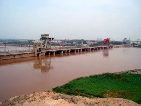
Photo adjustments
Full frame retained; resized proportionally to a maximum dimension of 960 pixels and converted to WebP quality 88. No crop, retouch, generated elements, or subject alteration. Final website rendition: full frame retained, proportionally resized to at most 720 pixels and converted to WebP. No additional retouching or subject alteration. Card displays may crop the view.
- Administrative area
- County-level city · 县级市
- Part of
- Wuzhong
- Chinese name
- 青铜峡市
- Local areas
- County-level city guide
Area & population
- Area in the source
- 1,907.57 km²
- Population · 2010 census
- 264,717
- Administrative seat
- Yumin Subdistrict
Source: cited geographic source, as of the dates shown.
Setting and landscape
The land steps down from southwest to northeast, from mountains and low hills through alluvial fans to the Yellow River floodplain and the reservoir; the city government gives the elevation as 1,150 to 1,170 metres. The climate is dry: the city government gives 177.8 millimetres of rain a year, evaporation of 1,946 millimetres and about 2,980 hours of sunshine. The Qingtongxia Reservoir (青铜峡水库) was built in 1967, and since the 1990s the reservoir area has become what Chinese Wikipedia calls the largest Yellow River floodplain wetland in Ningxia, with lakes and the Bainiaotan (百鸟滩, hundred-bird shoal) islands.
History
The canals date from the Qin and Han onwards and include the Qin Canal (秦渠), Han Canal (汉渠) and Tanglai Canal (唐徕渠), and in October 2017 the ancient Yellow River irrigation system of Ningxia was listed as a World Heritage Irrigation Structure, the first on the Yellow River's main stream. In the early Western Han a Lingwu County (灵武县) was set up west of today's Shaogang (邵岗). The county seat of Ningshuo (宁朔县), created in 1724, moved to Xiaoba (小坝堡), today's city centre, in 1943, and Qingtongxia was formed on 15 August 1960 from Jinji (金积) and Ningshuo counties.
What to see
The 108 Pagodas (一百零八塔) stand on the bank of the Yellow River about 20 kilometres west-southwest of the city, 1.5 kilometres west of the old gorge above the reservoir. Chinese Wikipedia describes them as China's largest group of lama-style pagodas: 108 brick stupas on 12 terraces, arranged in rows of 1, 3, 3, 5 and so on up to 19 to form a triangle facing east. Their date is unknown, but Western Xia relics have been found inside, and they became a national key cultural relic protection site in 1988. The city government also points to Qingtongxia Bird Island (青铜峡鸟岛), a wetland where swans and egrets live, the ten-li gorge of the Yellow River with its legends of Yu the Great, the Niushou Mountain (牛首山) temple group and the Ming Great Wall at Bei Chakou (北岔口).
Food and local products
The city government lists Qingtongxia among China's three best source areas for wine grapes, with 22 wineries, and it is known as a "home of tribute rice" (贡米之乡). Dairy herds are concentrated on the northern foot of Niushou Mountain.
Getting oriented
Yinchuan (银川) is 50 kilometres away and Hedong airport 55 kilometres. The Baotou–Lanzhou railway and the Beijing–Tibet Expressway cross the city.
Highlights
- 108 Pagodas 一百零八塔: 108 brick stupas on 12 terraces above the Yellow River; national key site since 1988.
- Qingtongxia Bird Island 青铜峡鸟岛: Reservoir wetland where swans and egrets live.
- Niushou Mountain temples 牛首山寺庙群: Temple group named by the city government among its historic sites.
- Qingtongxia wine grapes 酿酒葡萄: Listed by the city government among China's three best source areas, with 22 wineries.
Sources for this guide
青铜峡市 - 维基百科,自由的百科全书 · Chinese Wikipedia · CC BY-SA 4.0
古峡概况_青铜峡市人民政府 · Qingtongxia City People's Government
自然地理_青铜峡市人民政府 · Qingtongxia City People's Government
一百零八塔 - 维基百科,自由的百科全书 · Chinese Wikipedia · CC BY-SA 4.0
Original English written from the listed sources and checked sentence by sentence against quoted extracts by a separate reviewer. Updated 2026-09-26.
Explore Qingtongxia
Core places to explore, with English and Chinese names.
Places to explore around Qingtongxia
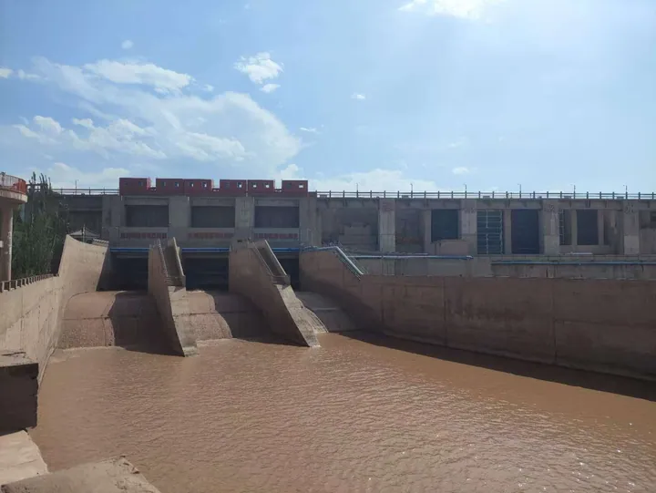 The Qingtongxia dam on the Yellow River within the Qingtongxia Grand Canyon scenic area ·
 Plan your visit
Getting there
Qingtongxia is about 20 km in a straight line from central Wuzhong. Search for 青铜峡市 in a map app to find stations and your accommodation.
Where to stay →Build your route
Start with Qingtongxia Yellow River Grand Canyon. The linked place guides have entrance and visit details.
Continue with Wuzhong →More in Wuzhong
Sources & geographic information
Administrative names and parent areas: Official geographic directory · Reference date 2026-09-06.
Some facts checked against 青铜峡市 — Wikipedia contributors, CC BY-SA 4.0.
Some facts checked against 一百零八塔 — Wikipedia contributors, CC BY-SA 4.0.
Photo: Qingtongxia Yellow River Grand Canyon · HCCB3947 · CC BY-SA 4.0. Full frame retained; proportionally resized and converted to WebP. No retouching or changes to the photographed subject. Card displays may crop the view.

Map data © OpenStreetMap contributors. Pins mark approximate centres, not entrances or boundaries.