


Photo adjustments
Wikimedia thumbnail; fitted to the ranking-card frame.
Explore the region
About Jinsha Island · Tengger Desert Wetland
Jinsha Island · Tengger Desert Wetland (腾格里沙漠湿地·金沙岛旅游区) is a 4A-rated lake and wetland scenic area on the southeastern edge of the Tengger Desert (腾格里沙漠), 8 km from the centre of Zhongwei (中卫), Ningxia.
The Ningxia Department of Culture and Tourism gives the area 22 km² in all, with about 10,000 mu of water, and also lists it as a national water-conservancy scenic area. The water is spread over seven lakes of different sizes that are almost all joined underground, which is why they are called the "seven linked lakes of the wetland" (湿地七连湖); Gaodun Lake (高墩湖) is one of them. Jinsha Mountain (金沙山), a sand hill about 30 m high in the northwest corner, is the highest point of the wetland.
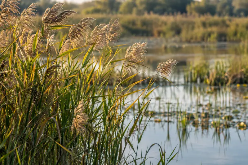
The department records 15 kinds of desert fish and 136 bird species here, including black storks, whooper swans and golden eagles, all nationally protected. Luoyan Tan (落雁滩), a natural reed flat, carries a legend that Wang Zhaojun (昭君) passed this way on her journey beyond the frontier and geese forgot to beat their wings at the sight of her.
The area also holds a stretch of Great Wall about 4 km long. The department's site note dates it to the reign of Emperor Wu of the Western Han, with repairs in the Sui and Tang and a last renovation in the middle of the Ming; it dates the beacon-tower site inside the area to the same Han reign. The planted gardens include lavender on Jinsha Island, rose, chrysanthemum and lotus gardens, and an orchard island.
What to look for
- Jinsha Mountain (金沙山), a 30 m sand hill and the wetland's highest point
- The seven linked lakes, including Gaodun Lake (高墩湖)
- About 4 km of Great Wall remains and a beacon-tower site dated to Emperor Wu of the Western Han
- Lavender fields in the Jinsha Island herb garden
- Rose garden of 422 mu and a 100-mu chrysanthemum garden planted with marigolds
- Lotus garden, in flower from mid to late July
- Luoyan Tan (落雁滩) reed flat, tied to the Wang Zhaojun legend
- Orchard island of 730 mu growing Zhongwei soft pears, Zhongning round jujubes, grapes, strawberries and apples
The surrounding area
The desert-and-river landscape around Shapotou, suitable for a distinct scenic stay.
Location & getting there
Combine your visit
Choose from these complementary stops when planning your visit.
-
Visitor entrance金沙岛游客入口
Choose the open lake-and-garden route.
-
Lake viewpoints湿地湖泊观景处
Observe reeds, water and the sand-edge setting.
-
Seasonal gardens当季花卉园区
Add the gardens currently in display.
This is a suggested combination, not a timed route; confirm the opening and transport arrangements for your date.
Find Jinsha Island · Tengger Desert Wetland
腾格里沙漠湿地·金沙岛旅游区 · 中卫市
The pin marks the area, not the entrance.
More places nearby
Approximate straight-line distances between map pins, not travel distances.
Zhongwei Gaomiao 中卫高庙
7 km awayZhongwei Gaomiao is a densely layered temple whose halls rise through successive platforms. Buddhist, Daoist and Confucian elements share the complex. The Mahavira Hall, South Heavenly Gate and upper pavilions are linked by…
View guide →Zhongwei Drum Tower 中卫鼓楼
7 km awayZhongwei’s Drum Tower anchors the intersecting streets of the old town. The upper timber building rises in several tiers above a substantial base, creating a recognisable skyline from each approach. The monument’s history…
View guide →Zhongwei Xiangshan Park 中卫香山公园
8 km awayXiangshan Park provides a lakeside green space in southern Zhongwei, away from the busier old-town monuments. Paths around Xiangshan Lake and planted banks make it suitable for an unhurried walk or a break between journeys…
View guide →Sources & visit information
Written from the linked sources and checked sentence by sentence against quoted extracts by a separate reviewer on 2026-09-23. Opening hours, admission and access arrangements are not covered; confirm current visitor information with the site.