

Photo adjustments
Full frame retained; proportionally resized and converted to WebP. No retouching or changes to the photographed subject. Card displays may crop the view.
Explore the region
About Wuyuan
Huangling gives a concentrated view of restored houses, drying trays and terraces, while Wangkou preserves a different village setting around its clan buildings and river. These are separate destinations within the county. Choose a small group of villages and spend time with their courtyards and street patterns instead of treating Wuyuan as one compact old town.
Wuyuan was established in 740, during the Tang dynasty's Kaiyuan era (开元), when parts of Xiuning county's Huiyu district and Leping county's Huaijin district were combined into a new county, with its seat at Qinghua (清华镇); in 901 the seat moved to what is now Ziyang town (紫阳镇). Under the Yuan dynasty Wuyuan was made a prefecture in 1295 and reverted to a county under the Ming dynasty in 1369. Wuyuan was one of six counties under the former Huizhou prefecture (徽州府) and is considered one of the birthplaces of Huizhou culture.
Wuyuan county lies in northeastern Jiangxi province, bordering Zhejiang's Kaihua county to the east, Anhui's Xiuning county to the north, Jingdezhen, Fuliang and Leping to the west, and Dexing to the south. The east and north are mountainous while the centre and south have more hills and basins, with the terrain higher in the north and lower in the south; the highest peak, Leigu Peak (擂鼓峰), rises 1629 meters on the border with Xiuning. The county has a mid-subtropical monsoon climate with moderate temperatures, plentiful rainfall and four distinct seasons.
What to look for
- Huangling’s hillside houses and crop-drying displays.
- Wangkou’s village lanes and clan architecture beside the river.
Location & getting there
Getting to Wuyuan
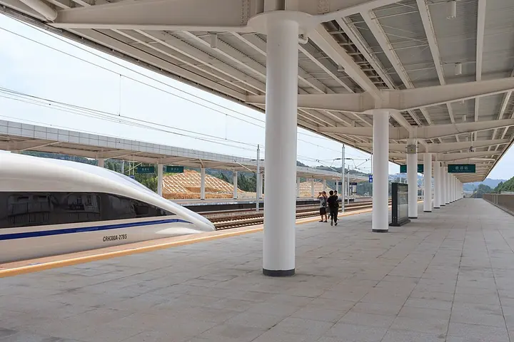
Wuyuan railway station is the regional arrival point. Arrange onward road transport to the specific villages on your route; Huangling and Wangkou are outside the county-town station area.
Combine your visit
A suggested sequence linking the specific features of this visit.
-
Wangkou汪口
Begin with the river village and its clan-building setting.
-
Huangling篁岭
Continue by road to the contrasting hillside village and terraces.
This order is editorial. Confirm access and any transfers between stops; it does not establish a walking route, same-day connection or common admission ticket.
Find Wuyuan
婺源 · 上饶市
The pin marks the area, not the entrance.
More places nearby
Approximate straight-line distances between map pins, not travel distances.
Wangkou 汪口
18 km awayWangkou is a Huizhou village in Jiangwan, Wuyuan, surrounded by water on three sides. Founded in the Song period, it developed as a settlement of the Yu lineage.
View guide →Huangling, Wuyuan 篁岭
27 km awayHuangling climbs a hillside above Wuyuan’s fields, its white walls and dark tiles arranged around the reconstructed Tianjie street. Wooden racks and round drying trays create the village’s celebrated shaiqiu imagery. The…
View guide →Yaoli 瑶里
42 km awayYaoli’s old streets follow the Yao River through a valley northeast of Jingdezhen. Merchant houses and ancestral buildings recall a settlement connected with porcelain materials and tea. Cheng Ancestral Hall gives a communal…
View guide →Sources & visit information
The sources below support the place-specific description and arrival information. Suggested combinations are editorial planning ideas; confirm current opening, entry arrangements and transport services for your date.
Visitor information adapted and edited from Wikivoyage contributors, “Wuyuan” · CC BY-SA 4.0.
Visitor information adapted and edited from Wikipedia contributors, “婺源县” · CC BY-SA 4.0. Source revision 90017546.
Background paragraphs translated and condensed from Wikipedia contributors, "婺源县", Chinese Wikipedia · CC BY-SA 4.0. Source revision 90017546.