


Explore the region
About Keluke Lake
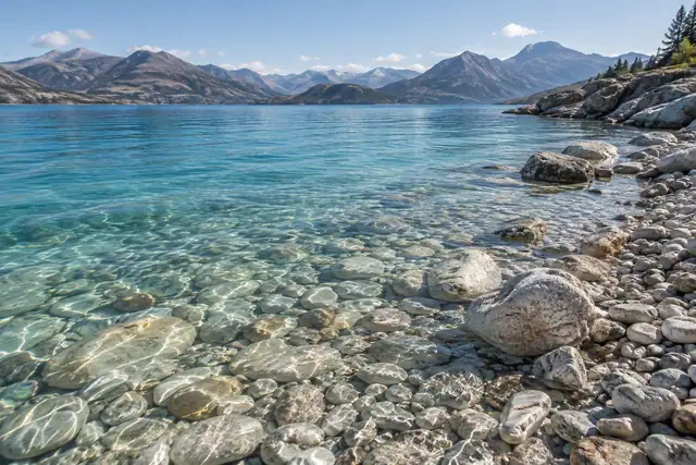
The Bayin River helps feed it, and its outflow connects with saline Tuosu Lake. Reeds, marshy ground and open water distinguish this landscape from the basin’s bright salt pools. The two lakes belong to a protected wetland system, so the visitor experience should stay within the currently permitted shore area.
Keluke Lake is also called Keluke Hu (克鲁克湖) or Kuerleike Hu (库尔雷克湖). It lies on the south slope of the Zongwulong Mountains (宗务隆山) and borders Tuosu Lake (托素湖) to its south. The lake surface sits at an elevation of 2,817 metres and covers an area of 56.7 square kilometres, with a catchment area of 12,360 square kilometres.
Two rivers feed the lake: the Bayin River (巴音河) and the Balagen River (巴勒根河); water also drains west through the Lianshui River (连水河) into Tuosu Lake. The lake's eastern shore forms the low-lying, marshy Bayin River valley, the western shore carries extensive thorny shrubland, and the northern and southern shores are largely saline-alkali and gravel ground. The lake is rich in aquatic products and has been extensively developed for this use, and it now forms part of the Keluke Lake-Tuosu Lake provincial nature reserve (可鲁克湖-托素湖省级自然保护区).
What to look for
- The freshwater lake contrasts with nearby saline Tuosu Lake.
- Reedbeds and marshes show the importance of the incoming rivers.
Location & getting there
Getting to Keluke Lake
Start from Delingha and navigate to the authorised Keluke Lake visitor access. Arrange a return vehicle before setting out. A map point on the lake does not identify a drivable shore or permission to enter the reserve.
Combine your visit
Choose from these complementary stops when planning your visit.
-
Authorised lake access可鲁克湖开放入口
Confirm the permitted shore route.
-
Open-water viewpoint湖面观景处
Look across the freshwater lake.
-
Permitted wetland edge开放湿地边缘
Observe reedbeds from the established path.
Keep to authorised access and avoid entering reedbeds, nesting areas or unsurfaced reserve tracks. Tuosu Lake needs its own current access check.
Find Keluke Lake
可鲁克湖 · 海西州
The pin marks the area, not the entrance.
More places nearby
Approximate straight-line distances between map pins, not travel distances.
Dachaidan Lake 大柴旦湖
157 km awayDachaidan Lake, also called Ike Qaidam Lake, is the broader salt-lake basin associated with Dachaidan’s Emerald Lake visitor area. Mineral-rich water, saline flats and former extraction pools give the landscape its varied…
View guide →Dachaidan Emerald Lake 大柴旦翡翠湖
158 km awayDachaidan Emerald Lake is a managed collection of former extraction pools near Dachaidan town. Their blue and green tones contrast with white salt edges, with the appearance changing under different light and weather. The pools…
View guide →Qarhan Salt Lake 察尔汗盐湖
159 km awayQarhan is an extensive salt-flat system containing several brine lakes, rather than one uninterrupted lake. Dabusun is a major component, and the wider landscape supports large-scale mineral production. The visitor area presents…
View guide →Sources & visit information
The linked encyclopedia sources support background and place descriptions. Current opening hours, ticket prices, booking rules and transport schedules have not been independently verified for this guide. Confirm them with the venue or operator before travelling.
- 可鲁克湖 — Wikipedia geographic and historical reference ↗
- Chinese Wikipedia: 可鲁克湖 (revision 80249400, 2023-12-26) ↗
Geographic and historical facts selectively adapted from Wikipedia contributors, 可鲁克湖 · CC BY-SA 4.0. Source revision 80249400.
Background paragraphs translated and condensed from Wikipedia contributors, "可鲁克湖", Chinese Wikipedia · CC BY-SA 4.0. Source revision 80249400.