

Photo adjustments
Full frame retained; proportionally resized and converted to WebP. No retouching or changes to the photographed subject. Card displays may crop the view.
Explore the region
About Karakul (China)
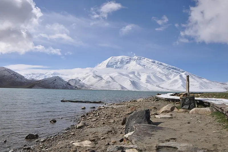
Still conditions can create striking reflections, while wind changes the colour and texture of the water. It is a landscape stop on a longer Pamir journey, with nearby settlements forming part of the lived-in surroundings. This is the Xinjiang lake, not the similarly named lake in Tajikistan.
The name Karakul means black lake. At 3,600 metres, it lies near the meeting point of three mountain ranges on the Pamir plateau, 196 kilometres southwest of Kashgar in Xinjiang. Surrounding summits remain snow-covered throughout the year. Meltwater from nearby glaciers strongly influences both the lake water and its sediment chemistry. Two Kyrgyz settlements stand along the shore: a small group of yurts and a village of stone houses on the western shore. The water ranges in colour from dark green to azure and light blue, with reflections of the surrounding mountains.
What to look for
- The lake provides views toward Muztagh Ata and the Kongur mountain group.
- Changing wind and light transform the water and reflections.
Location & getting there
Getting to Karakul (China)
Arrange the permitted road journey along G314 from Kashgar toward Tashkurgan and specify Karakul Lake in Akto County. Confirm the current entry and document requirements for your passport before departure, and use designated visitor stopping areas.
Combine your visit
Choose from these complementary stops when planning your visit.
-
Authorised lake viewpoint获准开放的湖泊观景点
Begin with the lake and mountain composition.
-
Muztagh Ata view慕士塔格峰远景
Look for the mountain when visibility allows.
-
Tashkurgan onward base塔什库尔干后续住宿点
Continue only as part of a planned road itinerary.
This is a suggested combination, not a timed route; confirm the opening and transport arrangements for your date.
Find Karakul (China)
喀拉库勒湖 · 克孜勒苏州
The pin marks the area, not the entrance.
More places nearby
Approximate straight-line distances between map pins, not travel distances.
Muztagh Ata 慕士塔格峰
19 km awayMuztagh Ata is a heavily glaciated mountain in the eastern Pamir region. Its broad snow-covered profile is a defining view from the Karakul and Karakoram Highway area. The mountain’s presence can be appreciated from authorised…
View guide →Oytagh Glacier Park 奥依塔克冰川公园
54 km awayOytagh Glacier Park, also called Kizilsu Glacier Park, combines glacier scenery with conifer forest, grassland and snow-covered mountains. The approach branches away from the main Pamir highway into the mountains west of Oytagh…
View guide →Tashkurgan 塔什库尔干
76 km awayTashkurgan is a highland town in the eastern Pamir region, with a ruined stone fortress above the surrounding settlement. Its historical position connected routes toward Kashgar, the southern Tarim Basin and lands farther west…
View guide →Sources & visit information
The linked encyclopedia sources support background and place descriptions. Current opening hours, ticket prices, booking rules and transport schedules have not been independently verified for this guide. Confirm them with the venue or operator before travelling.
- Karakul (Xinjiang) — Wikipedia geographic and historical reference ↗
- English Wikipedia: Karakul (Xinjiang) (revision 1366036005, 2026-07-25) ↗
Geographic and historical facts selectively adapted from Wikipedia contributors, Karakul (Xinjiang) · CC BY-SA 4.0. Source revision 1366036005.
Background paragraphs condensed from Wikipedia contributors, "Karakul (Xinjiang)", English Wikipedia · CC BY-SA 4.0. Source revision 1366036005.