

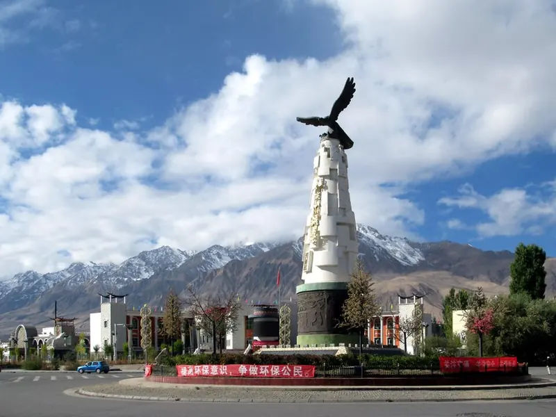
Photo adjustments
Full frame retained; proportionally resized and converted to WebP. No retouching or changes to the photographed subject. Card displays may crop the view.
Explore the region
About Tashkurgan
Its historical position connected routes toward Kashgar, the southern Tarim Basin and lands farther west. The town provides a base for mountain views and local cultural interpretation, but the broader county is much larger than the central visitor area. Plan the highland journey in stages rather than adding distant border stops casually.
The town's name means "stone fortress" in Turkic languages and refers to the fortress to its north. During the Han dynasty, about 2,000 years ago, it was the main centre of the Kingdom of Puli (蒲犁), recorded in early Chinese histories; it later became known as Varshadeh. Buddhist travellers passed through around 500 CE and 649 CE. A seventh-century description places the capital on a great rocky crag with a river behind it, a setting that an early-twentieth-century archaeological traveller found consistent with those earlier accounts.
What to look for
- The stone-fortress ruins explain the town’s name and strategic setting.
- The surrounding mountain basin gives the town a distinctive highland landscape.
Background & history
Tashkurgan, historically known as Sarikol and Shitoucheng, is a town in the far west of China, close to the country's border with Tajikistan. It is seat of Tashkurgan Tajik Autonomous County, in the autonomous region of Xinjiang. Tajiks – ethnic Pamiris who live in the Pamir Mountains of Xinjiang – make up a little over half of Tashkurgan's population. Tashkurgan was a significant stop on the Silk Road, with roads leading to major centers of trade such as Kashgar. It also served as the capital of a number of ancient and pre-modern kingdoms.
Excerpt from Wikipedia: Tashkurgan · Wikipedia contributors · CC BY-SA 4.0. Selected introductory sentences; formatting simplified. Background information, not current visitor-service advice.
The surrounding area
A southwestern urban and cultural chapter with craft streets, food and residential life.
Location & getting there
Getting to Tashkurgan
Arrange the permitted road or air connection to Tashkurgan and confirm the document requirements for your passport and onward route. Use the town or the named fortress visitor entrance for arrival, not a mountain or border coordinate.
Combine your visit
Choose from these complementary stops when planning your visit.
-
Stone Fortress石头城
Begin with the permitted archaeological route.
-
Town and basin views县城与盆地景观
Explore the public spaces around your base.
-
Planned Pamir continuation计划中的帕米尔后续行程
Add only the road sections and stops whose access has been confirmed.
This is a suggested combination, not a timed route; confirm the opening and transport arrangements for your date.
Find Tashkurgan
塔什库尔干 · 喀什地区
The pin marks the area, not the entrance.
More places nearby
Approximate straight-line distances between map pins, not travel distances.
Muztagh Ata 慕士塔格峰
57 km awayMuztagh Ata is a heavily glaciated mountain in the eastern Pamir region. Its broad snow-covered profile is a defining view from the Karakul and Karakoram Highway area. The mountain’s presence can be appreciated from authorised…
View guide →Karakul (China) 喀拉库勒湖
76 km awayKarakul in Akto County is a high-altitude lake beside the Karakoram Highway, with Muztagh Ata and the Kongur mountain group forming its wider setting. Still conditions can create striking reflections, while wind changes the…
View guide →Khunjerab Pass 红其拉甫口岸
104 km awayKhunjerab is the high international crossing between China and Pakistan on the Karakoram Highway. The snow-and-rock landscape and border gate are its principal visual features, but sightseeing at the Chinese gate and crossing…
View guide →Sources & visit information
The linked encyclopedia sources support background and place descriptions. Current opening hours, ticket prices, booking rules and transport schedules have not been independently verified for this guide. Confirm them with the venue or operator before travelling.
- Tashkurgan — Wikipedia geographic and historical reference ↗
- English Wikipedia: Tashkurgan (revision 1346403427, 2026-03-31) ↗
Geographic and historical facts selectively adapted from Wikipedia contributors, Tashkurgan · CC BY-SA 4.0. Source revision 1346403427.
Background paragraphs condensed from Wikipedia contributors, "Tashkurgan", English Wikipedia · CC BY-SA 4.0. Source revision 1346403427.