

Photo adjustments
Full frame retained; proportionally resized and converted to WebP. No retouching or changes to the photographed subject. Card displays may crop the view.
Explore the region
About Erlangjian Scenic Area
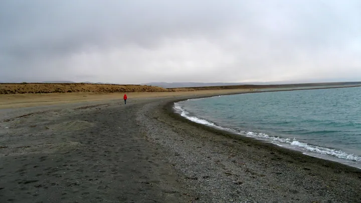
It offers a clearer arrival point than the lake’s broad regional pin, with open water, shoreline grassland and the distant mountain horizon as the main scenery. Boat services and other activities are separate choices; wind and current operations determine what is available on the day.
What to look for
- The lakeside landform provides views out across Qinghai Lake.
- Shore grassland contrasts with the wide water surface.
- Designated viewing areas make a compact introduction to the southern shore.
Location & getting there
Getting to Erlangjian Scenic Area
Use the Erlangjian scenic entrance beside the Daohu–Chaka road on the southern shore. Confirm your vehicle drop-off and return point before entering; onward travel around the lake is a separate road journey.
Combine your visit
Choose from these complementary stops when planning your visit.
-
Erlangjian entrance二郎剑景区入口
Check the open visitor route and activity options.
-
Lakeside viewing area湖畔观景区
Spend time with the water and mountain horizon.
-
Open shore paths开放湖岸步道
Continue within the designated visitor area.
This is a suggested combination, not a timed route; confirm the opening and transport arrangements for your date.
Find Erlangjian Scenic Area
二郎剑景区 · 海南州
The pin marks the area, not the entrance.
More places nearby
Approximate straight-line distances between map pins, not travel distances.
Sun and Moon Mountain 日月山
45 km awayRiyue Mountain marks a transition between the farming valleys around Xining and the pastoral landscapes towards Qinghai Lake. The pass is associated with the historical Tang–Tibet route and with legends of Princess Wencheng’s…
View guide →Atomic City Memorial Museum 原子城纪念馆
55 km awayAtomic City Memorial explains the history of the former nuclear-research base on the Jinyintan grassland. Its exhibition follows the base from planning and construction through research and retirement. Photographs and objects…
View guide →Qinghai Lake · regional lake reference 青海湖·全湖区域示意点
57 km awayQinghai Lake is a large saline lake in a closed basin on the northeastern plateau. Its broad water surface, surrounding grasslands and mountain horizon create a landscape experienced differently from each shore. The regional map…
View guide →Sources & visit information
The sources below support the place-specific description and arrival information. Suggested combinations are editorial planning ideas; confirm current opening, entry arrangements and transport services for your date.