

Explore the region
About Wangshun Mountain
The park was set up in 1991 and was raised to national forest-park rank by the State Forestry Administration in December 2000; in December 2004 the Lantian County government approved a management bureau to run it together with the Wangshun Mountain ecological forest farm. Following a UNESCO assessment in 2009 it became one of the core scenic areas of the Qinling Zhongnanshan Global Geopark, and in April 2014 the National Tourism Administration graded it a national AAAA tourist scenic area. The county's culture and tourism bureau puts forest cover at 95 per cent and counts more than 180 landscape features here, among them unusual pines, strange rocks, cloud seas, the remains of old temples and cliff-face inscriptions.
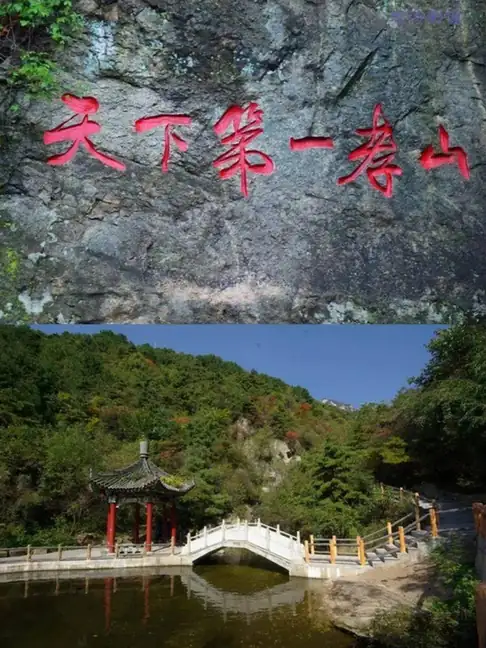
The geopark's administration centre describes a mountain of sharp peaks and deep ravines under intact forest vegetation, and names more than twenty summits in the scenic area, including Duxiufeng, Wuyunfeng, Xifeng, Shizifeng, Qianzhifeng and Kongqueliang. It puts the peak-and-ridge landform down to the long interplay of glacial freeze-thaw, running-water erosion and weathering, and lists granites of differing texture, xenoliths, spheroidal weathering, vertical jointing and cliff waterfalls among the results. The same note records the byname 天下第一孝山, 'the foremost mountain of filial piety under heaven', and a filial-piety display area is one of three touring zones the county says have been developed in the park, alongside a viewing-platform zone for the peak-and-ridge landform and a high-mountain adventure zone. A signed essay published by Xi'an Daily in 2021 ties the name to the story of the filial son Wang Shun, who carried earth to bury his mother, and records Yushan, Chefushan and Pingdingshan as other names for the mountain.
What to look for
- Yuhuangding, the 2,239-metre main summit; the county bureau's page says that from it one looks east to Mount Hua, north over the Wei River, south across ranges of hills and west to the old capital Chang'an
- The granite peak-and-ridge landform the geopark describes — granites of differing texture, xenoliths, spheroidal weathering, vertical jointing and cliff waterfalls
- The named peaks of the scenic area, among them Duxiufeng, Wuyunfeng, Xifeng, Shizifeng, Qianzhifeng and Kongqueliang
- The filial-piety culture display area, one of the three touring zones the county bureau says have been developed here
- Cliff-face inscriptions and the remains of old temples, which the county bureau counts among the park's 180-odd landscape features
Location & getting there
Getting to Wangshun Mountain
Check weather, trail access and the last return service. A mountain or forest area is not one entrance, and a map’s central pin may be far from the trailhead.
- Search for 王顺山 with 西安市 and 蓝田县.

Find Wangshun Mountain
王顺山 · 蓝田县
No reliable map pin yet: search by the Chinese name.
Sources & visit information
The linked sources support the identity and background described in this introduction. Opening hours, admission, activity availability and exact arrival arrangements have not been comprehensively checked. Confirm current visitor information with the venue; the original catalogue locality and editorial review flag are retained.
Image credits & notes (1)
- Wangshun Mountain · 王顺山Photo: sohu.comResized for the web; the photo itself has not been edited.