

Explore the region
Tap any red Chinese text to hear it in Mandarin.
What you come to see
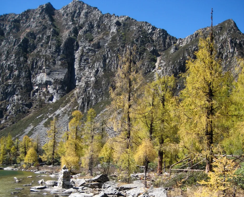
Dangling works best as a mountain-area visit, not as a single viewpoint. The village in Dandong Town is the inhabited base. Above it are old forest, meadow, snow peaks and a group of “haizi”, the local word used here for high alpine lakes. Huluhai (about 4,200 m) is the most legible first objective: the source describes its gourd shape as a barrier lake left after Quaternary glaciers retreated. Jiayilacuo, also called Niunaihai, lies at about 4,100 m in Qimei Township, around 7 km from Dangling village; Zhuoyongcuo, also called Dahaizi, is a neighbouring lake.
Read the landscape in layers: the valley settlement and timber-and-stone houses first, then forest and meadow, then lake basins under snow peaks. Dangling is also tied to Jiarong Tibetan village life and to the Red Army’s 1935 crossing of the mountain; provincial local-chronicles material records surviving Red Army stone slogans in the mountain area. Treat the village as a lived-in home, not a performance space: ask before entering a house or photographing people.
South of the village, the local-chronicles article describes Murichaqu and Bukachaqu hot springs about 4 km away. It reports outlet temperatures up to 75°C, so these are not casual bathing pools to approach without current local permission and safe facilities. The name and water details are historical descriptive information, not proof that either spring is currently open, managed or safe for bathing.
Plan around the trail status
This area has no single year-round “three-lake” itinerary. The village, individual lake approaches and any managed walking section are separate practical decisions. The latest dated public update available for this guide, on 8 October 2026, reported that snow had led Danba County to close all Dangling hiking routes from 5 October; by the morning of 8 October, the route was reported open only as far as Huluhai, while the Zhuoyongcuo section remained closed. No later public notice confirming full-route reopening was verified for 1 November 2026. Confirm the permitted segment with the current local manager or Danba tourism authority on the day you travel, and turn back if a section is closed.
Do not infer trail continuity or safety from a route name, a user track or an old photograph. Snow, ice, thin air and fast weather changes matter more than the apparent distance. Do not enter an unpermitted crossing, camp beside a closed trail or treat a lake or hot spring as a separately staffed attraction. The 2025 closure notice also shows that winter conditions can trigger a complete hiking ban until a safety assessment allows reopening.
A 2025 report described a managed programme for the village–Huluhai and village–Zhuoyongcuo walks, with guide services and no motor-vehicle transfer in the stated open area. Its quoted dates and prices were for that season, not a current 2026 tariff. This guide therefore does not quote a current ticket, guide, horse or shuttle fee: confirm whether a fee applies, what it covers, and whether a guide or escort is required before departure.
Getting there and staying in the village
For a road transfer, use the Chinese destination 党岭村 Dǎnglǐng Cūn, 丹巴县丹东镇 Dānbā Xiàn Dāndōng Zhèn. The village is the verified base named by the county government and by the managed-route report; no reliable rail station, metro line, public-bus route or fixed tourist shuttle to the trail was verified in the sources used here. Arrange a return ride before setting out, and confirm the actual village drop-off, parking point and current trail entrance locally rather than assuming that a map label is the hiking gate.
The county government’s introduction describes village homestays, Jiarong food and butter tea as part of the Dangling visit. Arrange overnight space and meals with a current local host before a long walk; do not assume that the trail itself has regular food, water or emergency services. Ask before entering homes, keep noise low, and do not treat residents or their daily routines as staged attractions.
This is a high-altitude outing. Build in time to rest, carry water and warm layers, and stop and descend if you feel unwell rather than pushing on to a lake. Because the permitted section can change after snow, confirm both the outward limit and the return plan before leaving the village.
Find Dangling Scenic Area
党岭 · 丹巴县
The pin marks the area, not the entrance.
Sources & visit information
Sources checked on 1 November 2026. Hours, tickets, reservations and transport can change; confirm with the operator before you go.
Image credits & notes (1)
- Huluhai in Dangling: golden Larix potaninii trees and a rocky mountain slope beside the water in autumn (photographed 15 October 2008). Photo: rduta on FlickrPhoto: CC BY 2.0