

Explore the region
About Haizishan Plateau Official Viewing Route
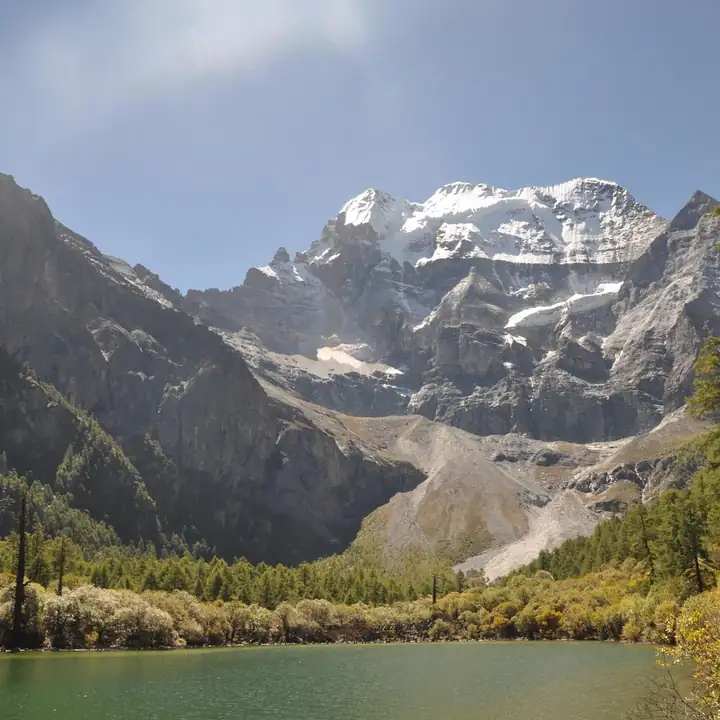
The national forestry and grassland administration describes Haizishan as the site of the Daocheng ancient ice cap of the Pleistocene, a relic of the Himalayan orogeny and of glacier retreat covering more than 3,200 square kilometres, with ice-erosion landforms including horns, old cirques, U-shaped troughs, ice-scoured hollows and cirque lakes. On the hummocky plateau between 3,600 and 5,020 metres, Yanshanian granite boulders lie everywhere and 1,145 alpine moraine lakes are scattered among red glacial erratics. Blue-green water gathers in the hollows around the rocks, forming 440 lakes of jade tone, large and small. Haizishan is one of the important water sources of the upper Yangtze: besides its lakes and rivers, more water is held in 1,400 square kilometres of cold marsh wetland, storing more than 4 billion cubic metres in all.
The reserve was established in 1995, covers 4,591.61 square kilometres and spans Litang and Daocheng counties, taking in the most important part of the ancient ice cap together with the snow mountains and glaciers above it and the old forest near the valleys. The county page places Haizishan in the plateau country of northern Daocheng, among the Sangdui, Rubu and Shengmu townships of the Daoba area and between Litang and Xiangcheng counties, assigns it to the Shaluli range of the Hengduan system, and derives the name from the 1,145 lakes within an area it gives as 3,237 square kilometres; the forestry administration's figure for the ancient ice cap is more than 3,200 square kilometres, and the two are reported here as their sources state them. The county page also gives a single altitude of 4,487 metres, where the forestry administration gives a range of 3,600 to 5,020 metres. The catalogue name's reference to officially open sections is not something either source settles; neither states which parts of the reserve are open.
Beyond the lakes, the county page describes countless great boulders piled across Haizishan, natural stone forms among them, and gullied ground with gentle slopes on every side.
What to look for
- The moraine lakes themselves, 1,145 of them scattered across the plateau between 3,600 and 5,020 metres.
- The Yanshanian granite boulders and the red glacial erratics they lie among.
- The ice-erosion landforms the forestry administration lists, including horns, old cirques, U-shaped troughs, ice-scoured hollows and cirque lakes.
- The cold marsh wetland, 1,400 square kilometres of it, which the forestry administration says holds more of the water than the lakes and rivers do.
Location & getting there
Getting to Haizishan Plateau Official Viewing Route
Use an authorised visitor route. Cave sections, geological sites and access roads can close independently, so confirm the area that your ticket covers.
- Search for 海子山正规开放路段 with 甘孜藏族自治州 and 稻城县.
Find Haizishan Plateau Official Viewing Route
海子山正规开放路段 · 稻城县
No reliable map pin yet: search by the Chinese name.
Sources & visit information
The linked sources support the identity and background described in this introduction. Opening hours, admission, activity availability and exact arrival arrangements have not been comprehensively checked. Confirm current visitor information with the venue; the original catalogue locality and editorial review flag are retained.
Image credits & notes (1)
- Haizishan Plateau Official Viewing Route · 海子山正规开放路段Photo: cn.tripadvisor.comResized for the web; the photo itself has not been edited.