

Photo adjustments
Wikimedia thumbnail; fitted to the ranking-card frame.
Explore the region
About Sayram Lake
Different shores offer different combinations of open water, meadow, wetland and woodland, so a circuit is more varied than one viewpoint suggests. Named stops such as Qinshuitan and the western grassland help organise a visit. Flowers, birds, ice and mountain visibility are seasonal features rather than guaranteed sights on every trip.
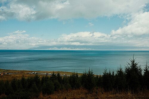
Sayram is a closed-basin lake at an elevation of 2,074 metres, covering about 453 square kilometres. Of its thirty-two incoming rivers, seven flow throughout the year. Precipitation, meltwater and groundwater supply the basin, while the surrounding glaciers occupy only about 4.28 square kilometres. The lake's water is slightly brackish.
The surrounding area preserves rock art, ancient tombs, temple ruins, stone inscriptions and former post stations along the northern Silk Road. Sayram became a National Key Scenic Area in 2004 and a National Wetland Park in 2007. Its tourist attraction rating rose from national AAAA in 2010 to AAAAA in April 2021.
What to look for
- Open lake views change with the surrounding grassland and mountain backdrop.
- Qinshuitan and the western shore introduce different lakeside habitats.
Location & getting there
Getting to Sayram Lake
Choose the Sayram Lake entrance and vehicle arrangement shown in your current booking. Confirm the permitted circuit, exit and return transport before setting off; the lake-centre pin is not an entrance.
Combine your visit
Choose from these complementary stops when planning your visit.
-
Qinshuitan亲水滩
Use an open shore-viewing stop.
-
Western lake grassland西海草原
Compare the meadow and lake setting.
-
Selected return-side viewpoint返程方向开放观景点
Choose a final stop that fits the permitted circuit.
This is a suggested combination, not a timed route; confirm the opening and transport arrangements for your date.
Find Sayram Lake
赛里木湖 · 博尔塔拉州
The pin marks the area, not the entrance.
More places nearby
Approximate straight-line distances between map pins, not travel distances.
Bortala Prefecture Museum 博尔塔拉蒙古自治州博物馆
73 km awayBortala Prefecture Museum introduces the history and communities of the region around Bole. Its building uses a composition inspired by Mongolian tents, with a larger central form between two smaller ones. Historical collections…
View guide →Ili Prefecture Museum 伊犁哈萨克自治州博物馆
77 km awayIli Prefecture Museum introduces the valley through archaeology, precious-metal finds and natural-history displays. The Boma tomb collection is particularly distinctive, including a gold mask set with red stones and richly…
View guide →Yining Hanren Street Bazaar 伊宁汉人街大巴扎
77 km awayHanren Street is part of Yining’s old commercial centre, where food stalls, shops and busy pedestrian activity make the market itself the attraction. The food bazaar developed from outdoor trading around Xinhua East Road…
View guide →Sources & visit information
The sources below support the place-specific description and arrival information. Suggested combinations are editorial planning ideas; confirm current opening, entry arrangements and transport services for your date.
- Bortala Government: Sayram scenic-area landscape and named zones ↗
- Sayram Lake — Wikipedia geographic and historical reference ↗
- Chinese Wikipedia: 赛里木湖 (revision 93535987, 2026-07-18) ↗
- English Wikipedia: Sayram Lake (revision 1366625907, 2026-07-29) ↗
Geographic and historical facts selectively adapted from Wikipedia contributors, Sayram Lake · CC BY-SA 4.0. Source revision 1366625907.
Background paragraphs translated and condensed from Wikipedia contributors, "赛里木湖", Chinese Wikipedia · CC BY-SA 4.0. Source revision 93535987.
Background paragraphs condensed from Wikipedia contributors, "Sayram Lake", English Wikipedia · CC BY-SA 4.0. Source revision 1366625907.