

Explore the region
About Tianshan Tomur Grand Canyon
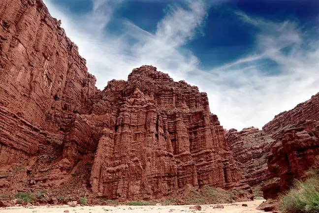
The regional culture and tourism department, on its own site, places the canyon in Wensu County and describes it as a natural scenic area where the landforms it names — 丹霞, 雅丹, 次雅丹, 岩盐喀斯特 and 盐丘底辟构造 — are gathered. The department files that entry under its national 5A scenic-area section. The Ministry of Culture and Tourism's data service records that the Tomur scenic area in Wensu County was rated a national 5A tourist attraction in December 2024 and is also a world natural heritage site, and places it at the foot of Tomur Peak (托木尔峰), the highest peak of the Tianshan.
The ministry record describes the scenery as combining canyon, wind-erosion, river and tectonic landforms, with a red-bed canyon (红层峡谷) and salt karst (岩盐喀斯特) among them, and notes that the site was once a necessary crossing of the Muzart ancient road (木扎特古道). The two official pages do not use the same name: the regional department's entry is headed 天山托木尔大峡谷景区 while the ministry's record is headed 阿克苏地区天山托木尔景区, and the record does not treat the two names as interchangeable.
Neither page gives the canyon's area, its opening arrangements or how it is administered.
What to look for
- The landform set the regional department lists for the site: 丹霞, 雅丹, 次雅丹, 岩盐喀斯特 and 盐丘底辟构造, gathered in one area
- The red-bed canyon (红层峡谷) and salt karst (岩盐喀斯特) scenery that the Ministry of Culture and Tourism's data service records here
- The line of the Muzart ancient road (木扎特古道), which the ministry record notes once had to cross this ground
- The setting at the foot of Tomur Peak (托木尔峰), which the ministry record gives as the highest peak of the Tianshan
Location & getting there
Getting to Tianshan Tomur Grand Canyon
Use an authorised visitor route. Cave sections, geological sites and access roads can close independently, so confirm the area that your ticket covers.
- Search for 天山托木尔大峡谷 with 阿克苏地区 and 温宿县.
Find Tianshan Tomur Grand Canyon
天山托木尔大峡谷 · 温宿县
No reliable map pin yet: search by the Chinese name.
Sources & visit information
The linked sources support the identity and background described in this introduction. Opening hours, admission, activity availability and exact arrival arrangements have not been comprehensively checked. Confirm current visitor information with the venue; the original catalogue locality and editorial review flag are retained.
Image credits & notes (1)
- Tianshan Tomur Grand Canyon · 天山托木尔大峡谷Photo: landagent · CC BY-SA 3.0Resized for the web; the photo itself has not been edited.
