

Explore the region
Tap any red Chinese text to hear it in Mandarin.
At a glance
Tangbula is a long S315 mountain corridor in eastern Nilka, where spruce, pasture, the Kash River, streams, rock country and hot springs unfold as a landscape rather than a single gated attraction.
Why come
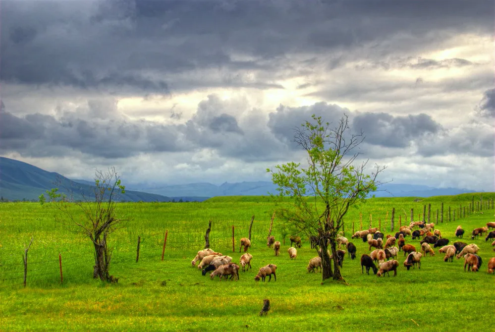
Tangbula is best understood as a changing road landscape in the east of Nilka County, not as one compact park with one entrance. The county describes the scenic area as more than 100 li from east to west, with the Tianshan mountains, grassland, rivers and hot springs forming its four broad landscape elements. It also records 113 gullies, which explains why the view keeps changing as the S315 follows the valley.
The name Tangbula is explained by the county as meaning a seal or imprint, with the popular extension “imperial seal”. The more useful visitor detail is physical: spruce-covered slopes, open pasture, the Kash River and side valleys appear in succession. The prefecture government’s description of the S315 section calls it a “hundred-li scroll, a natural gallery”; the county lists Tangbula as a national AAAA tourist area and a national forest park.
What to look for
Use the road as a sequence of viewpoints rather than trying to tick off one “main attraction”. The official regional descriptions identify Tangbula grassland and Mengkete grassland, with 19 streams in the latter; a small alpine lake known as “Little Tianchi”; Xionggou valley; and “Little Huashan”, a rocky landscape. They also mention rock paintings, Wusun tombs, a stone gate and a stone bridge, as well as four hot springs, including Bulu and Baergaiti in the older prefecture inventory. These are regional features, not a promise that every item is a signposted walk or an operating facility on the day you arrive.
Stop only at safe, permitted pull-offs and keep to marked roads or paths. Do not treat pasture, riverbanks, yurts or side gullies as unrestricted public space. If you meet herders or residents, ask before entering, photographing people, or photographing animals. Tangbula is a working mountain landscape as well as a scenic one.
Timing, tickets and practical limits
This is an exposed mountain landscape, so weather and road conditions matter more than a fixed “opening hour”. Nilka’s county description characterises the area as mountainous, with cool summers and large day–night temperature differences. It does not establish a fixed flower season for the gallery, and the official pages reviewed do not publish a single current opening-hours timetable for the whole corridor.
The current county page confirms the AAAA designation and forest-park status, but I could not verify a current whole-corridor ticket price, reservation channel or passport-specific entry rule. Do not infer that a fee, booking rule or shuttle for a separately managed hot spring, camp or inner scenic spot applies to the entire S315 gallery. Ask about any managed facility separately when you arrive.
The separate Mengkete scenic area inside the broader Tangbula area was reported as being in trial operation in 2024; that dated report is not a current ticket rule for the gallery as a whole.
If your plan approaches from Qiao’erma via the Duku Highway, note that the official 2026 notice closed G217 to social vehicles from 20:00 on 8 October because of winter snow and ice; the reopening date is to be determined by weather and road-clearing conditions. That closure does not by itself prove that every section of S315 is closed, so check the Nilka-side road status separately before setting out.
Getting there and getting back
The dependable geographic approach is east from Nilka County on Provincial Road S315. An older prefecture tourism entry gives the forest park as about 90 km east of the county seat, but the gallery is a long corridor and that 2009 distance is not a current entrance address. Use the Chinese destination name 唐布拉百里画廊 Tángbùlā Bǎilǐ Huàláng together with 尼勒克县 Nílèkè Xiàn, and agree the exact stopping point with your driver.
Nilka Railway Station (尼勒克站) is a county-level gateway rather than a Tangbula entrance: the county government places it about 40 km from the county seat. The same county material places Yining Airport and Nalati Airport on the two sides of the county, each more than 120 km from the county seat. From any of these gateways, continue to Nilka and then arrange a car or driver along S315; do not mistake transport to the county seat for transport to the gallery.
I found no current, reliably published scheduled public bus that serves the full Tangbula corridor or guarantees a return from a particular S315 stop. For a day trip, pre-arrange the return vehicle and a meeting point before leaving Nilka. Carry the Chinese name and the exact section you want to visit, and recheck weather, road controls and any facility-specific access on the day.
Find Tangbula Hundred-Mile Gallery
唐布拉百里画廊 · 尼勒克县
The pin marks the area, not the entrance.
Sources & visit information
Sources checked on 31 October 2026. Hours, tickets, reservations and transport can change; confirm with the operator before you go.
Image credits & notes (1)
- Tangbula grassland in Xinjiang, with sheep grazing across a green pasture beneath dark mountain clouds. Photo: lwtt93Photo: CC BY 2.0