


Get to know Nilka County
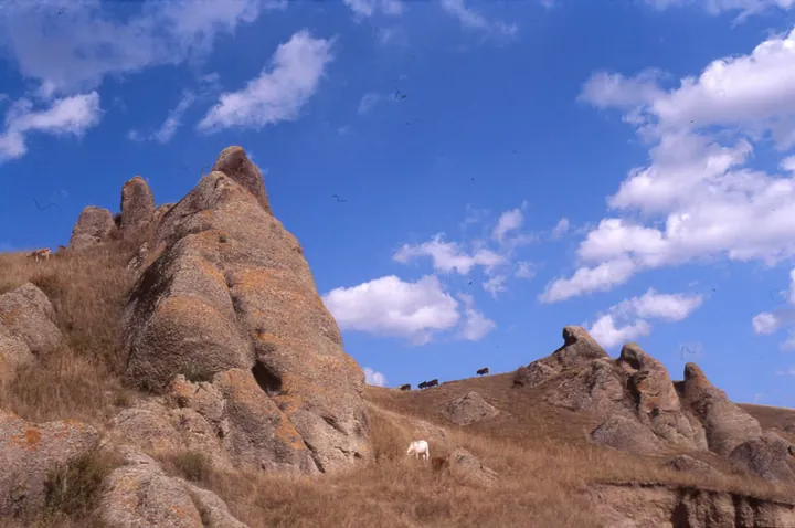
Photo adjustments
Full frame retained; proportionally resized and converted to WebP. No retouching or changes to the photographed subject. Card displays may crop the view.
- Administrative area
- County · 县
- Part of
- Ili Kazakh Autonomous Prefecture
- Chinese name
- 尼勒克县
- Local areas
- County guide
Area & population
- Area in the source
- 10,122.62 km²
- Population · 2020
- 155,737
- Administrative seat
- Nilqa Town
Source: cited geographic source, as of the dates shown.
Rivers and secondary woodland
The Kash River (喀什河) runs through the county from east to west, while the Kunes River (巩乃斯河) follows part of its southern edge. Nilka’s terrain slopes from northeast to southwest and is surrounded by high mountains. Natural secondary woodland extends for more than seventy kilometres along the Kash River valley. Jirentai Gorge (吉仁台峡谷) adds closely arranged peaks and unusually shaped rocks to the county’s landscapes.
A mine site and a road-building memorial
The Nulasai Ancient Copper Mine Site (奴拉赛古铜矿遗址) dates to the Spring and Autumn period. The county also has rock carvings and Wusun tomb groups (乌孙古墓群). At Jorma Martyrs’ Cemetery (乔尔玛烈士陵园) on the Duku Highway (独库公路), the county’s tourism itinerary commemorates the people who built the mountain road.
Sources for this guide
尼勒克县概况_县情概况_尼勒克县政府网 · Nilka County Government
尼勒克县景区精品线路规划_精品线路_尼勒克县政府网 · Nilka County Culture, Sports, Radio, Television and Tourism Bureau
Original English written from the listed sources and checked sentence by sentence against quoted extracts by a separate reviewer. Updated 2026-09-27.
Explore Nilka County
Core places to explore, with English and Chinese names.
Places to explore around Nilka County
 Tangbula Hundred-Mile Gallery · 唐布拉百里画廊
Tangbula Hundred-Mile Gallery唐布拉百里画廊
Tangbula Hundred-Mile Gallery (唐布拉百里画廊) is the landscape of the Tangbula section of Provincial Road S315 in the east of Nilka County (尼勒克县), Ili Kazakh Autonomous Prefecture, Xinjiang. The prefecture government gives that stretch the name "a hundred-li scroll, a natural gallery", and the county government records that the Tangbula scenic area there is a national-level forest park.
Read the place guide → AI illustration · AI 示意图(仅供参考,非该地点实拍)
Duku Highway Qiao'erma Rest Stop独库公路乔尔玛段正规停靠点
Qiao'erma (乔尔玛) is the place on the Duku Highway (独库公路) in Nilka County (尼勒克县), Ili Kazakh Autonomous Prefecture, Xinjiang, where National Highway 217 meets Provincial Road S315. The county government places the Qiao'erma Martyrs' Cemetery at that junction, in terrain it describes as glacier country between two mountain ranges.
Read the place guide →Plan your visit
Getting there
Nilka County is about 95 km in a straight line from central Ili Kazakh Autonomous Prefecture. Search for 尼勒克县 in a map app to find stations and your accommodation.
Where to stay →Build your route
Tangbula Hundred-Mile Gallery and Duku Highway Qiao'erma Rest Stop are both listed here. The linked place guides have entrance and visit details.
Continue with Ili Kazakh Autonomous Prefecture →More in Ili Kazakh Autonomous Prefecture
Sources & geographic information
Administrative names and parent areas: Official geographic directory · Reference date 2026-09-06.
Photo: Tangbula Hundred-Mile Gallery · Source photographer · License not provided. EXIF orientation normalized; resized without changing aspect ratio; converted to WebP. No subject edits.
Map data © OpenStreetMap contributors. Pins mark approximate centres, not entrances or boundaries.