


Get to know Suzhou
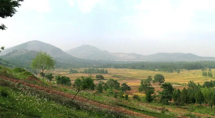
Photo adjustments
Full frame retained; proportionally resized and converted to WebP. No retouching or changes to the photographed subject. Card displays may crop the view.
- Administrative area
- Prefecture-level city · 地级市
- Part of
- Anhui
- Chinese name
- 宿州市
- Local areas
- 5 local areas
Area & population
- Area in the source
- 9,939.80 km²
- Population · 2020 census
- 5,324,476
- Administrative seat
- Yongqiao District
Source: cited geographic source, as of the dates shown.
Setting and landscape
Plain covers about 91 percent of the city. The Sui (濉河), Tuo (沱河), Kui (奎河) and Hui (浍河) rivers flow from north-west to south-east into the Huai River or Hongze Lake (洪泽湖), and the Xinbian River (新汴河), a man-made flood channel, runs 127 km through the city. North of the Sui rise island-like low hills, outliers of the Shandong uplands, among them Daguan Mountain (大官山) in Xiao County (萧县), 395 metres high.
History
The name comes from the state of Su (宿国), which the state of Song moved into its territory as a dependency in 684 BC. After the Sui dynasty dug the Grand Canal a trading town grew up at Yongqiao, which the Tang made the seat of a new Suzhou prefecture in 809. The city government counts the Daze Town Uprising, which it calls China's first peasant uprising, among the events this land witnessed; Sheguotai (涉故台) in Dazexiang Town (大泽乡镇), the uprising's birthplace, has been a provincial protected site since 1961. Sizhou opera (泗州戏), once called lahunqiang (拉魂腔, 'soul-pulling tune'), entered the first national intangible heritage list in 2006 on Suzhou's nomination.
What to see
The Si County (泗县) stretch of the Grand Canal's Tongji Channel (通济渠) belongs to the Grand Canal World Heritage property; the city culture and tourism bureau says its 28.1 km of old channel, still holding water, keeps the canal's original appearance most completely. Huangcangyu (皇藏峪), on Xiao County's south-eastern edge, is a national forest park and AAAA scenic area of original warm-temperate deciduous broadleaf forest; legend ties its name to Liu Bang (刘邦), the first Han emperor, hiding there. Lingbi County (灵璧县) is known as the home of Lingbi stone (灵璧石), counted among China's four famous stones; the AAAA Lingbi Stone Culture Park (灵璧奇石文化园) shows stones, local relics and Zhong Kui (钟馗) paintings in its Bianyang Tower (汴阳楼). The Lingbi government places the Gaixia battlefield (垓下古战场遗址), where Xiang Yu (项羽) was defeated in 202 BC, at Weiji Town (韦集镇).
Food and local products
Fuliji braised chicken (符离集烧鸡), created in the early 20th century and now a geographical-indication product and Anhui intangible-heritage item, is coated in sugar-and-honey water, fried golden and then simmered in brine. Xiao County mutton soup (萧县羊肉汤) is a milky broth famous for over 300 years, and Dangshan (砀山) grows large, crisp su pears (砀山酥梨) along the old Yellow River bed.
Getting oriented
Suzhou East Station (宿州东站) on the Beijing–Shanghai high-speed railway lies about 23 km in a straight line from the urban area, and the Xuzhou–Lanzhou high-speed line serves Dangshan South (砀山南站) and Xiaoxian North (萧县北站).
Highlights
- Grand Canal, Si County section 大运河通济渠泗县段: World Heritage stretch of the Tongji Channel at Caomiao Village, with the Si County Sui–Tang Grand Canal Museum nearby.
- Huangcangyu National Forest Park 皇藏峪国家森林公园: Forested valley 26 km from the Xiao County seat; a national forest park, AAAA scenic area and provincial nature reserve.
- Lingbi Stone Culture Park 灵璧奇石文化园: Park at the south entrance of the Lingbi county town, rated AAAA in 2013, built around a ring-shaped lake.
- Fuliji braised chicken 符离集烧鸡: Developed by Han Jingyu in the early 20th century; trussed with its legs folded in before frying and brine-simmering.
- Suzhou sa soup 宿州sa汤: Old-hen broth with 24 ingredients including wheat kernels, eaten with an egg beaten in; a municipal intangible-heritage item.
Sources for this guide
Introduction to Suzhou_The People's Government of Suzhou Municipality · People's Government of Suzhou Municipality (Anhui)
世界文化遗产——大运河通济渠泗县段_宿州市人民政府 · Suzhou Municipal Culture and Tourism Bureau, on the Suzhou city government portal
垓下古战场遗址(秦末汉初)_宿州市人民政府 · Lingbi County government (灵璧政府网), republished on the Suzhou city government portal
灵璧县奇石文化园_宿州市人民政府 · People's Government of Suzhou Municipality (Anhui)
宿州市 - 维基百科,自由的百科全书 · Chinese Wikipedia · CC BY-SA 4.0
泗州戏 - 中国非物质文化遗产网·中国非物质文化遗产数字博物馆 · China Intangible Cultural Heritage Network (ihchina.cn)
符离集烧鸡_宿州市人民政府 · Suzhou Municipal Culture and Tourism Bureau, on the Suzhou city government portal
萧县羊肉汤_宿州市人民政府 · Suzhou Municipal Culture and Tourism Bureau, on the Suzhou city government portal
宿州sa汤_宿州市人民政府 · Suzhou city government portal
Original English written from the listed sources and checked sentence by sentence against quoted extracts by a separate reviewer. Updated 2026-09-30.
Explore Suzhou
Core places to explore, with English and Chinese names.
Places to explore around Suzhou
 Huangcangyu National Forest Park · 皇藏峪国家森林公园
Huangcangyu National Forest Park皇藏峪国家森林公园
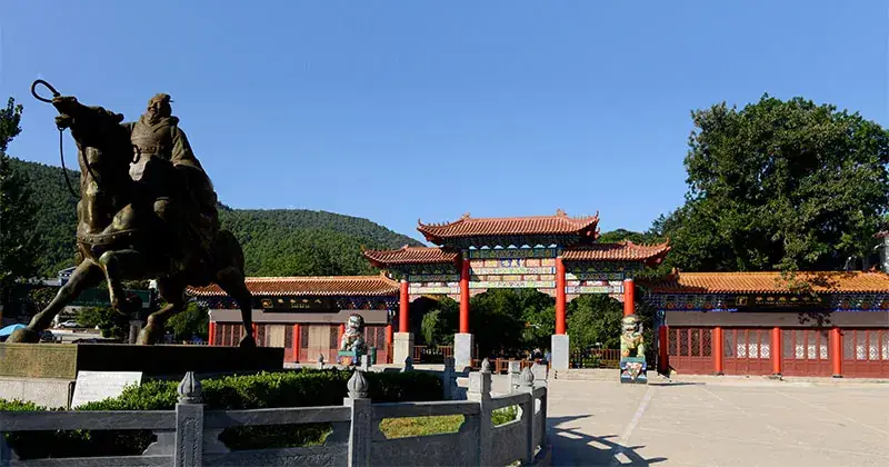
Huangcangyu shelters a wooded valley of limestone outcrops, caves and springs. Ruiyun Temple provides a built landmark among the trees, while Huangcang Cave is associated with the local story of Liu Bang taking refuge here…
Read the place guide → Gaixia Archaeological Site · 垓下遗址
Gaixia Archaeological Site垓下遗址
The Gaixia site in Lingbi County is a landscape of raised ground and earthworks north of the Tuo River, traditionally associated with the final Chu-Han fighting in 202 BCE.
Read the place guide →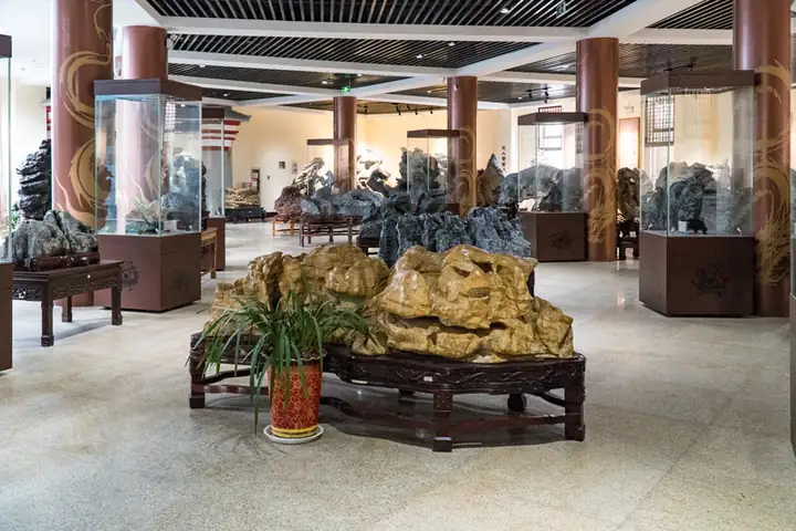 Lingbi Stone Culture Park · 灵璧奇石文化园
Lingbi Stone Culture Park灵璧奇石文化园
Lingbi Stone Culture Park brings ornamental stones, a central lake and garden pavilions together around Bianyang Tower, which houses museum displays.
Read the place guide →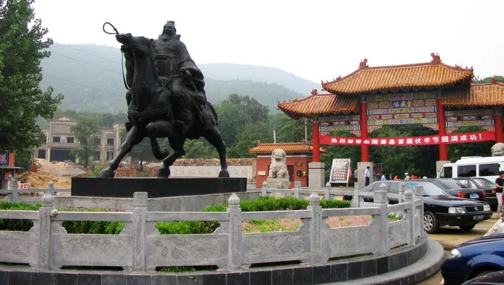 The entrance plaza of Huangcangyu scenic area, Xiao County, with a memorial gate and equestrian statue · 萧县皇藏峪景区入口广场,牌楼与骑马雕像 Source-recorded photograph date: Taken on 15 July 2007.
Huangcangyu Valley皇藏峪
Huangcangyu in Xiao County combines wooded hills, old trees, caves and springs with Ruiyun Temple and a tradition linking the mountain to Liu Bang.
Read the place guide →Local life & food
Suzhou local specialties
宿州市特色美食 · 9 specialties to discover
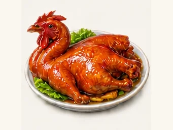 Fuliji braised chicken 符离集烧鸡AI illustration · AI 示意图
The meat is soft and savory, while the skin carries a deeper spice aroma. Leg and breast portions offer different levels of richness.
Source ↗Read the dish guide →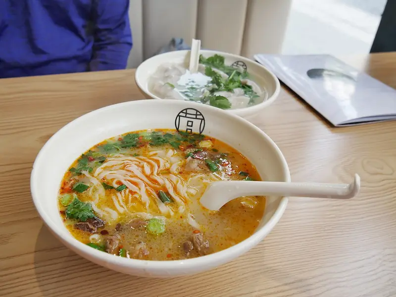 Xiaoxian Mutton Soup 萧县羊肉汤Reference photo of a similar dish · 同类菜品参考照片
Xiaoxian Mutton Soup (萧县羊肉汤) is the goat-meat soup of Xiao County (萧县) in Suzhou (宿州), in the north-east of Anhui.
Read the dish guide →
Photo adjustments
Full frame retained; EXIF orientation normalized, proportionally resized to at most 800 pixels and converted to WebP. No generated pixels or subject changes. Cards may crop the display.
 Pork Stewed with Dangshan Pears 砀山酥梨炖肉AI illustration · AI 示意图(仅供参考,非实拍)
Pork Stewed with Dangshan Pears (砀山酥梨炖肉) takes a red-braised form in a preparation presented by Suzhou Culture and Tourism (宿州文化旅游). It uses pork belly with alternating layers of fat and lean meat.
Read the dish guide →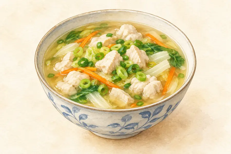 Suzhou Sa Soup 宿州sa汤AI illustration · AI 示意图(仅供参考,非实拍)
Suzhou Sa Soup (宿州sa汤) is the breakfast soup of Suzhou (宿州) in northern Anhui, not the Suzhou in Jiangsu: a raw egg is beaten in the bowl and cooked by a ladle of boiling-hot old-hen stock thickened with flour.
Read the dish guide → Langan Braised Beef 栏杆牛肉AI illustration · AI 示意图(仅供参考,非实拍)
Langan Braised Beef (栏杆牛肉) is beef slow-cooked in a spiced master stock in Langan (栏杆), an old town about 50 kilometres north-east of Suzhou (宿州) in northern Anhui, where the city paper Fuxiao Daily (拂晓报) calls the beef the town's best-known product.
Read the dish guide → Lingbi Iron-Pot Chicken with Flatbread 灵璧地锅鸡AI illustration · AI 示意图(仅供参考,非实拍)
Lingbi Iron-Pot Chicken with Flatbread (灵璧地锅鸡) is listed among the local specialties of Suzhou, Anhui. The name includes 鸡 (chicken).
Read the dish guide →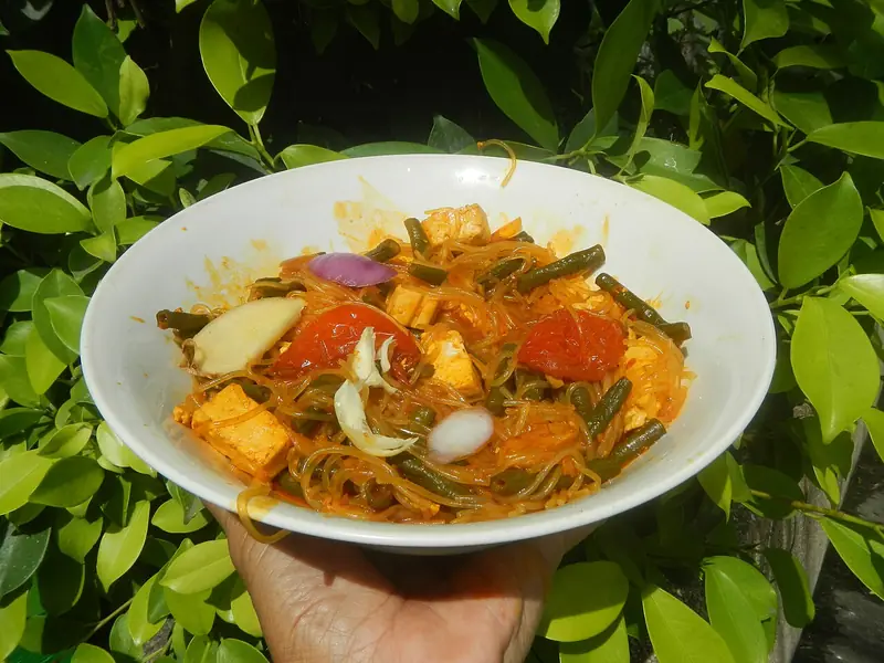 Sixian Dalukou Sweet Potato Noodles 泗县大路口山芋粉丝Reference photo of a similar dish · 同类菜品参考照片
Sixian Dalukou Sweet Potato Noodles (泗县大路口山芋粉丝) are dried sweet-potato starch noodles made by hand in Dalukou (大路口镇), a town in Si County (泗县), Suzhou, northern Anhui.
Read the dish guide →
Photo adjustments
Full frame retained; EXIF orientation normalized, proportionally resized to at most 800 pixels and converted to WebP. No generated pixels or subject changes. Cards may crop the display.
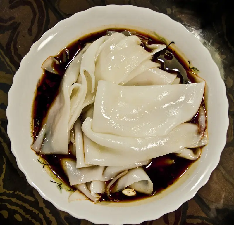 Cold Wheat Noodle Sheets 面皮
Cold Wheat Noodle Sheets (面皮) are thin, chewy sheets served cut and dressed with vegetables and sauces in Huaibei (淮北), Anhui.
Read the dish guide →
Photo adjustments
EXIF orientation normalized; resized without changing aspect ratio; converted to WebP. No subject edits.
All dish names · 全部菜名 (9)
More dishes from across Anhui are in the Anhui food guide.
Counties & districts in Suzhou
5 areas belong directly to Suzhou.
5 areas
Yongqiao District 埇桥区
Yongqiao District (simplified Chinese: 埇桥区; traditional Chinese: 埇橋區; pinyin: Yǒngqiáo Qū) is a district of the city of Suzhou, Anhui Province, China.
Explore the area →CountyDangshan County 砀山县
Dangshan County (simplified Chinese: 砀山县; traditional Chinese: 碭山縣; pinyin: Dàngshān Xiàn) is a county in the far north of Anhui Province, China.
Explore the area →CountyXiao County 萧县
Xiao County or Xiaoxian (simplified Chinese: 萧县; traditional Chinese: 蕭縣; pinyin: Xiāo Xiàn) is a county in the north of Anhui Province, China, bordering the provinces of Jiangsu to the north and northeast…
Explore the area →CountyLingbi County 灵璧县
Lingbi County (simplified Chinese: 灵璧县; traditional Chinese: 靈璧縣; pinyin: Língbì Xiàn) is a county in northern Anhui Province, China, bordering Jiangsu province to the north and northeast, and is under the…
Explore the area →No areas match this name.
Plan your visit
Getting there
Search for 宿州市 in a map app to find stations and your accommodation.
Where to stay →Build your route
Huangcangyu National Forest Park and Gaixia Archaeological Site are both listed here. The linked place guides have entrance and visit details.
Continue with Anhui →More in Anhui
Sources & geographic information
Administrative names and parent areas: Official geographic directory · Reference date 2026-09-06.
Some facts checked against 宿州市 — Wikipedia contributors, CC BY-SA 4.0.
Photo: Huangcangyu National Forest Park · Source photographer · License not provided. EXIF orientation normalized; resized without changing aspect ratio; converted to WebP. No subject edits.
Photo: Gaixia Archaeological Site · Source photographer · License not provided. EXIF orientation normalized; resized without changing aspect ratio; converted to WebP. No subject edits.
Photo: Lingbi Stone Culture Park · Source photographer · License not provided. EXIF orientation normalized; resized without changing aspect ratio; converted to WebP. No subject edits.
Photo: Huangcangyu Valley · WeelStone · CC BY-SA 3.0. Full frame retained; proportionally resized and converted to WebP. No retouching or changes to the photographed subject. Card displays may crop the view.

Map data © OpenStreetMap contributors. Pins mark approximate centres, not entrances or boundaries.