


Get to know Ningguo
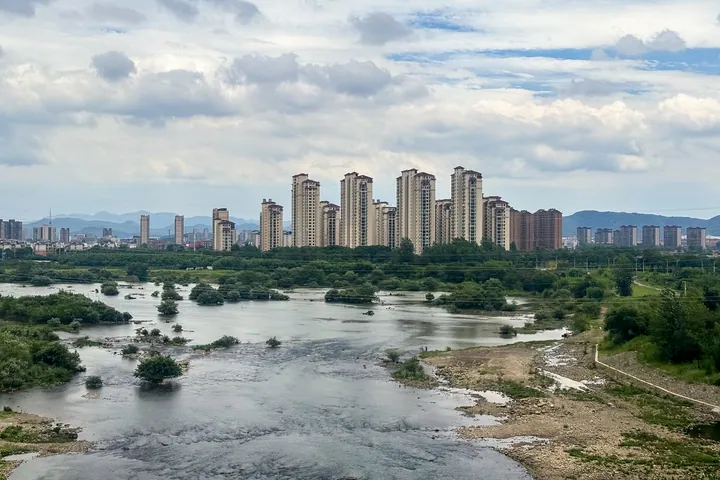
Photo adjustments
Full frame retained; proportionally resized and converted to WebP. No retouching or changes to the photographed subject. Card displays may crop the view.
- Administrative area
- County-level city · 县级市
- Part of
- Xuancheng
- Chinese name
- 宁国市
- Local areas
- County-level city guide
Area & population
- Area in the source
- 2,487.00 km²
- Population · 2019
- 399,000
Source: cited geographic source, as of the dates shown.
History
In 208 Sun Quan (孙权) split the southern part of Wanling County (宛陵县) to create Ningguo County. It became a county-level city on 11 March 1997. When the Gangkouwan Reservoir (港口湾水库) was built, the whole of the former Dong'an township (东岸乡) was moved in August 2000 to the Juntian Lake farm (军天湖农场) in Xuanzhou and set up as Tianhu town (天湖镇), still part of Ningguo. Yunti She Ethnic Township (云梯畲族乡) is the only She (畲族) ethnic township in Anhui.
What to see
Xialin Jiutian Silver Falls (夏霖九天银瀑), a 4A scenic area 29 kilometres from the city, sits on the Anhui–Zhejiang border at the northern foot of the Tianmu range, among gorges, waterfalls and bamboo-covered hills. Two main routes run through it: Lovers' Valley (情人谷) on the left to Shimen (石门), and Wolong Valley (卧龙谷) on the right to Guanyin Falls (观音瀑). Small villages such as Waishiqiao (外石桥) and Pingshanwu (平山坞) keep whitewashed walls and dark tiles.
Chujiatan (储家滩), 16 kilometres from the city in Longge village (龙阁村), is a 2.4-kilometre river bend of clear water reflecting the hills; it was named a Xuancheng wetland park in 2015, and villagers there sell tea, mushrooms, bamboo crafts and fire-dried fish. The Qianqiu She Culture Park (千秋畲族文化园), a 3A area 49 kilometres from the city, includes Qianqiu Pass (千秋关), the azaleas of Tanggong Mountain (汤公山) and river rafting.
Food and local products
Fire-dried fish with pan-stuck cornbread (火烘鱼锅贴) uses small wild sharpbelly (白条鱼) or black carp (青鱼) from local rivers and lakes, only three to four cun (寸, roughly 10 to 13 centimetres) long, dried over charcoal until golden and crisp, then stir-fried with yellow wine, vinegar, soy sauce and chopped chilli. Cornmeal cakes pressed around the pan brown underneath and soak up the sauce.
Xuan stone (宣石), a mainly white ornamental rock, comes from the hills around Nanji (南极), Wanjia (万家), Zhongxi (中溪) and Hule (胡乐). The Ming garden manual Yuanye (园冶) records it as a product of Ningguo, and the winter rockery of the Ge Garden (个园) in Yangzhou is built from it. Ningguo hickory nuts (宁国山核桃) are a national geographical indication product.
Highlights
- Xialin Jiutian Silver Falls 夏霖九天银瀑: 4A mountain scenic area of gorges and waterfalls at the northern foot of the Tianmu range.
- Chujiatan 储家滩: 2.4 km river bend named a Xuancheng wetland park in 2015.
- Qianqiu She Culture Park 千秋畲族文化园: 3A area in Anhui's only She ethnic township, with Qianqiu Pass.
- Xuan stone 宣石: White ornamental stone used for the winter rockery of the Ge Garden in Yangzhou.
- Fire-dried fish with pan-stuck cornbread 火烘鱼锅贴: Charcoal-dried small fish braised with cornmeal cakes around the pan.
Sources for this guide
宁国市 - 维基百科,自由的百科全书 · Wikipedia (Chinese) · CC BY-SA 4.0
夏霖九天银瀑景区-宁国市人民政府 · Ningguo Culture and Tourism Bureau
储家滩景点-宁国市人民政府 · Ningguo Culture and Tourism Bureau
千秋畲族文化园-宁国市人民政府 · Ningguo Culture and Tourism Bureau
宣石-宁国市人民政府 · Ningguo Municipal People's Government (Ningguo Stone Appreciation Association)
火烘鱼锅贴-宁国市人民政府 · Ningguo Culture and Tourism Bureau
Original English written from the listed sources and checked sentence by sentence against quoted extracts by a separate reviewer. Updated 2026-09-23.
Explore Ningguo
Core places to explore, with English and Chinese names.
Places to explore around Ningguo
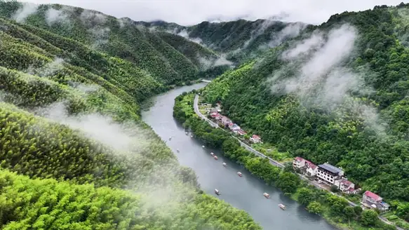 Chujiatan River Bend · 储家滩
Chujiatan River Bend储家滩
Chujiatan in Ningguo's Qinglong Township is a long, quiet river bend in Longge Village, known for mountain reflections.
Read the place guide → AI illustration · AI 示意图(仅供参考,非该地点实拍)
Xialin Jiutian Silver Waterfall夏霖九天银瀑
Xialin Jiutian Yinpu in Ningguo's Zhongxi Town is a landscape of wooded valleys, pools and waterfalls around Xialin Village.
Read the place guide →Plan your visit
Getting there
Ningguo is about 40 km in a straight line from central Xuancheng. Search for 宁国市 in a map app to find stations and your accommodation.
Where to stay →Build your route
Chujiatan River Bend and Xialin Jiutian Silver Waterfall are both listed here. The linked place guides have entrance and visit details.
Continue with Xuancheng →More in Xuancheng
Sources & geographic information
Administrative names and parent areas: Official geographic directory · Reference date 2026-09-06.
Some facts checked against 宁国市 — Wikipedia contributors, CC BY-SA 4.0.
Photo: Chujiatan River Bend · Source photographer · License not provided. EXIF orientation normalized; resized without changing aspect ratio; converted to WebP. No subject edits.
Map data © OpenStreetMap contributors. Pins mark approximate centres, not entrances or boundaries.