


Get to know Ning County
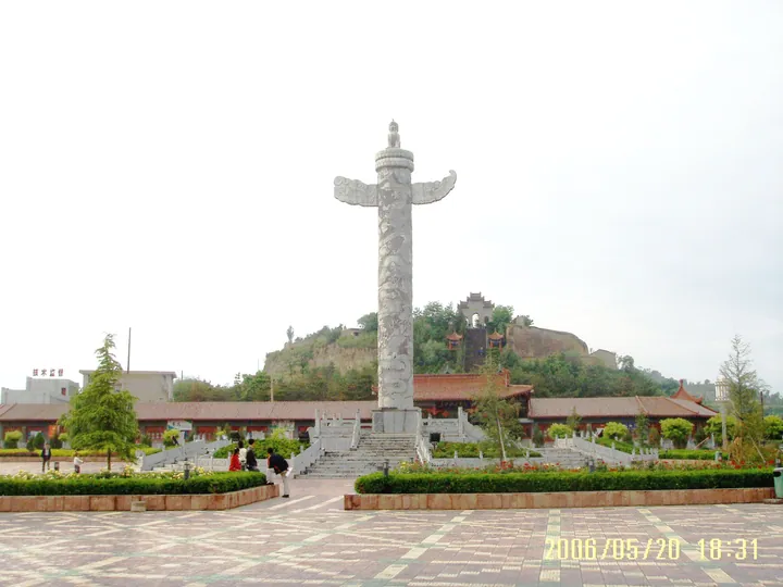
Photo adjustments
Full frame retained; proportionally resized and converted to WebP. No retouching or changes to the photographed subject. Card displays may crop the view.
- Administrative area
- County · 县
- Part of
- Qingyang
- Chinese name
- 宁县
- Local areas
- County guide
Area & population
- Area in the source
- 2,653.17 km²
- Population · 2018
- 561,240
- Administrative seat
- Xinning
Source: cited geographic source, as of the dates shown.
Setting and landscape
The climate is warm-temperate and semi-humid, with about 564 mm of rain a year. Nine rivers cross the county, among them the Jing (泾河) and the Malian (马莲河). Along its eastern side runs the Ziwu Ridge (子午岭), whose primeval forest the county describes as the largest and best-vegetated water-conservation forest on the Loess Plateau. The Luoshanfu (罗山府) and Guihuayuan (桂花园) forest parks are also in the county.
History
The county traces its story to Duke Liu (公刘), a Zhou ancestor said to have built a town at Miaozuiping (庙嘴坪) west of the county seat and founded the ancient state of Bin (豳国). After King Ping of Zhou moved his capital east, the Yiqu (义渠) people had their capital here, at present-day Xigou village in Jiaocun (焦村). Under the Qin the area first became a county, and the Qin Straight Road (秦直道) ran for about 60 km along the main ridge of the Ziwu range inside the county. In 553 the Western Wei renamed the prefecture Ningzhou (宁州), a name used until the Qing; it has been Ning County since 1913.
Older still is the Yangshao-culture site at Dongzhuang village (董庄村) beside the Jiulong River (九龙河), about 6,000 years old, where pottery and carbonised millet were dug up; the millet is the earliest grain yet found in Qingyang. Ning County is also where the first rural branch of the Communist Party in Gansu was founded.
What to see
Jining Tower (辑宁楼), the gate tower of the old prefectural office, stands in the county town. It was built in 923, when the Ningzhou prefect Niu Zhiye (牛知业) restored the office; the brick-and-timber tower faces south and measures 15 m by 5 m, about 7 m high. Beibin ancient city (北豳古城) is another named historic site.
Food and local products
Signature farm products are apples, Cao apricots (曹杏), Huanggan peaches (黄甘桃), Jiulong golden jujubes (九龙金枣), edible fungi and Zaosheng cattle (早胜牛); in 2021 the county gained approval for a national modern agricultural park centred on apples. Folk crafts include sachets (香包), embroidery, paper-cutting and stone carving. At Miqiao (米桥) town, dozens of embroiderers make sachets under Bai Caixia (白彩霞), a provincial-level intangible heritage inheritor.
Getting oriented
The Yinchuan–Xi'an high-speed railway (银西高铁) and the Yinchuan–Baise expressway (银百高速) pass through the county town, and the Fuzhou–Yinchuan expressway (福银高速) crosses the county. Qingyang airport is 50 km to the north.
Highlights
- Jining Tower 辑宁楼: South-facing brick-and-timber gate tower of the old Ningzhou prefectural office, built in 923.
- Ziwu Ridge forest 子午岭: Primeval forest along the eastern side of the county, described by the county as the largest water-conservation forest on the Loess Plateau.
- Dongzhuang Yangshao site 董庄村仰韶文化遗址: About 6,000 years old; carbonised millet found here is the earliest grain yet discovered in Qingyang.
- Zaosheng cattle 早胜牛: Local cattle listed by the county among its signature farm products.
Sources for this guide
县情概况_走进宁县_宁县人民政府 · Ning County People's Government
建置沿革_走进宁县_宁县人民政府 · Ning County People's Government
观光旅游_走进宁县_宁县人民政府 · Ning County People's Government
历史文化_走进宁县_宁县人民政府 · Ning County People's Government
Original English written from the listed sources and checked sentence by sentence against quoted extracts by a separate reviewer. Updated 2026-09-23.
Explore Ning County
Core places to explore, with English and Chinese names.
Ning County 宁县
Plan your visit
Getting there
Ning County is about 35 km in a straight line from central Qingyang. Search for 宁县 in a map app to find stations and your accommodation.
Where to stay →More in Qingyang
Sources & geographic information
Administrative names and parent areas: Official geographic directory · Reference date 2026-09-06.
Map data © OpenStreetMap contributors. Pins mark approximate centres, not entrances or boundaries.