


Get to know Potou District
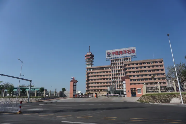
Photo adjustments
Full frame retained; proportionally resized and converted to WebP. No retouching or changes to the photographed subject. Card displays may crop the view.
- Administrative area
- District · 市辖区
- Part of
- Zhanjiang
- Chinese name
- 坡头区
- Local areas
- District guide
Area & population
- Area in the source
- 424.00 km²
- Population · 2010 census
- 333,700
Source: cited geographic source, as of the dates shown.
Getting oriented
The district government is in Nandiao Subdistrict (南调街道). The Shenyang–Haikou Expressway (沈海高速公路), the Shantou–Zhanjiang Expressway (汕湛高速) and National Highway 228 serve the district. On its west coast, just north of the Zhanjiang Bay Bridge (湛江海湾大桥), stands the Zhanjiang Olympic Sports Centre (湛江奥林匹克体育中心), built as the main venue of the 14th Guangdong Provincial Games; its stadium is modelled on a conch shell and its three halls on white shells scattered on a beach.
What to see
Nansan Island (南三岛) is flat and hill-free, where forest meets the sea and aquaculture is widespread; it is one of the "Eight Views of Zhanjiang" (湛江八景), and with Donghai Island (东海岛) and Naozhou Island (硇洲岛) it screens the approaches to Zhanjiang port. Lighthouse Park (灯塔公园), where Dengta Road meets the bay, is built around a 39-metre navigation lighthouse.
The French barracks (广州湾法国(坡头)营盘), built in 1900 under the French legation of Guangzhouwan (广州湾), stands inside the Potou town government compound: a two-storey L-shaped block with watchtowers pierced by gun ports. In 1936 more than ten thousand local people besieged it in protest against a French poll tax and forced labour, and five villagers were killed; their tomb (抗法五烈士墓) at Jiuyou village is visited every year on the third day of the third lunar month.
The Luohou Wang Temple (罗侯王庙) at the Maxie ferry was founded in 1352 and rebuilt in 1893; on Lantern Festival night boats carry lanterns and the god's statue around the harbour. The Chen Ancestral Hall (乾塘陈氏大宗) at Qiantang dates from 1315, and its name board was written by Chen Lanbin (陈兰彬), the first Qing envoy to the United States. The district government calls the Zhenxiao Memorial Arch (贞孝牌坊) of 1842 the only all-brick arch with carved stone plaques in western Guangdong.
Food and local products
Markets sell prawns, oysters, abalone, peanut worms and crabs. Shimen oysters (石门蚝) come from the Guandu (官渡镇) coast and are fried, braised or roasted in the shell with garlic. Nansan's "three reds" are duck eggs with red yolks from ducks feeding on the mudflats, red-fleshed sweet potatoes and carrots. Qiantang (乾塘镇) lotus root gives two crops a year. Potou white-cut goose (坡头白切鹅) is best known from the restaurants of Gaolingzai in Potou town, and boji chui (簸箕炊) is a rice-flour cake steamed in a woven bamboo tray, either salty with sesame, spring onion and garlic or sweet.
Highlights
- Nansan Island 南三岛: Flat, forested island listed among the Eight Views of Zhanjiang.
- Guangzhouwan French barracks at Potou 广州湾法国(坡头)营盘: Built by the French in 1900; besieged by local people in 1936.
- Luohou Wang Temple 罗侯王庙: Founded 1352 at the Maxie ferry; holds a sea procession on Lantern Festival night.
- Qiantang Chen Ancestral Hall 乾塘陈氏大宗: Founded 1315; name board by Chen Lanbin, the first Qing envoy to the United States.
- Shimen oysters 石门蚝: Large, fleshy oysters from the Guandu coast.
Sources for this guide
坡头区 - 维基百科,自由的百科全书 · Chinese Wikipedia · CC BY-SA 4.0
旅游资源_坡头区政府网站 · Potou District People's Government, Zhanjiang
美食资源_坡头区政府网站 · Potou District People's Government, Zhanjiang
旅游资源_坡头区政府网站 · Potou District People's Government, Zhanjiang
Original English written from the listed sources and checked sentence by sentence against quoted extracts by a separate reviewer. Updated 2026-09-23.
Explore Potou District
Core places to explore, with English and Chinese names.
Potou District 坡头区
Plan your visit
Getting there
Potou District is about 10 km in a straight line from central Zhanjiang. Search for 坡头区 in a map app to find stations and your accommodation.
Where to stay →More in Zhanjiang
Sources & geographic information
Administrative names and parent areas: Official geographic directory · Reference date 2026-09-06.
Some facts checked against 坡头区 — Wikipedia contributors, CC BY-SA 4.0.
Map data © OpenStreetMap contributors. Pins mark approximate centres, not entrances or boundaries.