


Get to know Huaiyin District
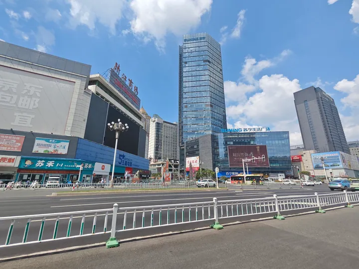
Photo adjustments
Full frame retained; proportionally resized and converted to WebP. No retouching or changes to the photographed subject. Card displays may crop the view.
- Administrative area
- District · 市辖区
- Part of
- Huai'an
- Chinese name
- 淮阴区
- Local areas
- District guide
Area & population
- Area in the source
- 1,264.10 km²
- Population · 2020
- 748,791
Source: cited geographic source, as of the dates shown.
Setting and landscape
The district sits on the lower Huai River and has no mountains but a great deal of water. Hongze Lake (洪泽湖) lies on its southern edge, and the Liutang River (六塘河) separates it from Shuyang (沭阳) to the north. Huai'an District and Lianshui (涟水) adjoin it on the east and Siyang (泗阳) on the west. The climate straddles the line between the northern subtropics and the warm temperate zone, and half to four-fifths of the year's rain falls in the June-September flood season.
History
The district government presents Huaiyin as a county with more than 2,300 years of history. The state of Wu set up a Huaiyin county here after conquering the state of Xu in 512 BC, and in 201 BC the Han founder made the general Han Xin (韩信) Marquis of Huaiyin, with the county as his fief. The government also tells the local tale of Piaomu (漂母) and "a thousand in gold for one meal" (一饭千金), and builds its civic culture around Piaomu's kindness and Han Xin's gratitude. In 349 the commander Xun Xian (荀羡) built a new walled town just south of the Qin and Han city at Ganluo (甘罗城). From 1761 Qingjiangpu was the seat of Qinghe County (清河县), which by then held the old Huaiyin lands, and in 1914 Qinghe was renamed Huaiyin County to avoid a clash with Qinghe in Hebei.
What to see
Matou (马头镇), the site of the old Huaiyin city, holds Han Xin's hometown site (韩信故里). Xinhua Daily places the town inside the heritage area of the Qingkou hub (清口枢纽), where the Yellow River, the Huai and the Grand Canal met. Its name comes from the matou sao (马头埽), a horse-head-shaped bundle of brushwood, timber and earth used to close breaches and protect banks; the town was wrongly written as Matou "wharf" (码头镇) from the 1930s and got its original name back in 2018. The Cemetery of the 82 Martyrs (八十二烈士陵园) at Liulaozhuang (刘老庄) is a provincial-level protected site.
Food and local products
Chinese Wikipedia lists the district's specialities as lion's-head meatballs stewed with crab meat (清炖蟹粉狮子头), steamed hairy crab (清蒸大闸蟹), jade-green shrimp (翡翠虾仁) and Zhaoji vermicelli (赵集粉丝).
Highlights
- Han Xin's hometown 韩信故里: Site in Matou town, at the old Huaiyin city, linked to the Han general Han Xin.
- Qingkou hub heritage area 清口枢纽: Where the Yellow River, the Huai River and the Grand Canal met, around Matou town.
- Cemetery of the 82 Martyrs 八十二烈士陵园: Provincial-level protected site at Liulaozhuang.
- Zhaoji vermicelli 赵集粉丝: One of the district's listed specialities.
Sources for this guide
淮阴区 - 维基百科,自由的百科全书 · Chinese Wikipedia · CC BY-SA 4.0
淮阴区人民政府-走进淮阴区 · Huaiyin District People's Government
读城·马年说马|江苏十三城,一城说一个“马地名”_中国江苏网 · Xinhua Daily (Jiangsu) via jschina.com.cn
Original English written from the listed sources and checked sentence by sentence against quoted extracts by a separate reviewer. Updated 2026-09-25.
Explore Huaiyin District
Core places to explore, with English and Chinese names.
Huaiyin District 淮阴区
Plan your visit
Getting there
Huaiyin District is about 15 km in a straight line from central Huai'an. Search for 淮阴区 in a map app to find stations and your accommodation.
Where to stay →More in Huai'an
Sources & geographic information
Administrative names and parent areas: Official geographic directory · Reference date 2026-09-06.
Some facts checked against 淮阴区 — Wikipedia contributors, CC BY-SA 4.0.
Map data © OpenStreetMap contributors. Pins mark approximate centres, not entrances or boundaries.