

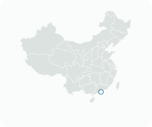
Get to know Baixa de Macau

- Administrative area
- Statistical area · 統計分區
- Part of
- Macau
- Chinese name
- 中區
- Local areas
- Statistical area guide
What to see
Senado Square is a long, triangular paved square of about 3,700 square metres linking Largo de São Domingos with Avenida de Almeida Ribeiro. It was laid with Portuguese pavement and closed to traffic in the early 1990s. The Cultural Affairs Bureau describes it as the city's centre for centuries and still its favourite place for public celebrations, framed by pastel neo-classical buildings.
Facing the square is the Leal Senado Building (民政總署大樓), which gave it its name. It was built in 1784 as the municipal chamber. Its name recalls the title of loyalty granted to the city by King John IV of Portugal in 1654, and the first floor holds a ceremonial meeting room, a carved library modelled on that of the Mafra Convent, and a small chapel.
Sam Kai Vui Kun (三街會館), a Guandi temple, stands close to the old Chinese Bazaar that now works as St. Dominic's Market. Plaques found there record a restoration in 1792; the temple was tied to the Chinese trade associations that preceded the Chinese Chamber of Commerce, and edicts from the mainland authorities were read out in front of it.
St. Dominic's Church (玫瑰堂) was founded in 1587 by three Spanish Dominicans who had come from Acapulco, and the first Portuguese newspaper printed on Chinese soil, A Abelha da China, appeared here on 12 September 1822. Lou Kau Mansion (盧家大屋), believed to date from 1889, is a two-storey grey-brick courtyard house built for the merchant Lou Kau, with oyster-shell windows among its decorations.
Other listed buildings in the zone include the Cathedral (大堂), the Holy House of Mercy (仁慈堂), St. Augustine's Church (聖奧斯定教堂), the Dom Pedro V Theatre (崗頂劇院) and the Sir Robert Ho Tung Library (何東圖書館).
Getting oriented
The streets around St. Dominic's Church, also called Pan Cheong Tong (板樟堂), have large shopping centres and snack shops and are on the main route to the Ruins of St. Paul's (大三巴牌坊) and Mount Fortress (大炮台).
Highlights
- Senado Square 議事亭前地: Pedestrian square of about 3,700 square metres, paved in Portuguese stone in the early 1990s.
- Leal Senado Building 民政總署大樓: Municipal chamber built in 1784, with a carved library modelled on the Mafra Convent library.
- Sam Kai Vui Kun 三街會館: Guandi temple of the Chinese trade associations, restored in 1792 according to plaques from the site.
- St. Dominic's Church 玫瑰堂: Founded in 1587; A Abelha da China was first published here in 1822.
- Lou Kau Mansion 盧家大屋: Grey-brick courtyard house of the merchant Lou Kau, believed built in 1889.
Sources for this guide
中区 (澳门) - 维基百科 · Wikipedia (Chinese) · CC BY-SA 4.0
Senado Square - Wikipedia · Wikipedia (English) · CC BY-SA 4.0
Senado Square - The Historic Centre of Macao World Heritage · Cultural Affairs Bureau of the Macao SAR Government
Leal Senado Building - The Historic Centre of Macao World Heritage · Cultural Affairs Bureau of the Macao SAR Government
Sam Kai Vui Kun (Kuan Tai Temple) - The Historic Centre of Macao World Heritage · Cultural Affairs Bureau of the Macao SAR Government
St. Dominic's Church - The Historic Centre of Macao World Heritage · Cultural Affairs Bureau of the Macao SAR Government
Lou Kau Mansion - The Historic Centre of Macao World Heritage · Cultural Affairs Bureau of the Macao SAR Government
Original English written from the listed sources and checked sentence by sentence against quoted extracts by a separate reviewer. Updated 2026-09-23.
Find Baixa de Macau
A reliable area-level map point is not available in the current sources.
Plan your visit
Getting there
Search for 中區 in a map app to find stations and your accommodation.
Where to stay →More in Macau
Sources & geographic information
Administrative names and parent areas: Official geographic directory · Reference date 2026-09-06.
DSEC statistical-zone directory
MGTO: Strolling Through the Historic Centre of Macao
Some facts checked against 中区 (澳门) — Wikipedia contributors, CC BY-SA 4.0.
Some facts checked against Senado Square — Wikipedia contributors, CC BY-SA 4.0.
Map data © OpenStreetMap contributors. Pins mark approximate centres, not entrances or boundaries.