

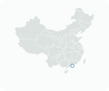
Get to know Zona A das Novas Zonas Urbanas e Zona de Administração de Macau na Ilha Fronteiriça Artificial da Ponte Hong Kong-Zhuhai-Macau

- Administrative area
- Statistical area · 統計分區
- Part of
- Macau
- Chinese name
- 新城A區及港珠澳大橋澳門口岸管理區
- Local areas
- Statistical area guide
Setting and landscape
New Urban Zone A covers 1.38 square kilometres and is the largest of the reclamation areas of Macau's New Urban Zone (澳門新城區). It belongs to the parish of Our Lady of Fátima (花地瑪堂區) and is separated from the north-eastern shore of the peninsula by a channel; a government request to reclaim that channel was not approved by the State Council. The artificial island lies east of Zone A and holds both Macau's border post and Zhuhai's road port, divided by patrol roads and fences. Its ground stands 5 metres above sea level, designed to withstand a once-in-300-years flood tide in the Pearl River estuary.
History
Reclamation of the island began on 15 December 2009, the first works of the whole bridge project, and was finished on 28 November 2013. At midnight on 15 March 2018 the Macau border building and its area were handed over to Macau. The bridge and both ports were inaugurated on 23 October 2018 and opened to traffic the next day. The bridge is a 55-kilometre system of three cable-stayed bridges, an undersea tunnel and four artificial islands, running from this island east to the Hong Kong Link Road.
In 2014 the government announced a new land-use concept for Zone A centred on public housing, with a larger share of land for public facilities. Its detailed plan, known as East-2 (東區-2) and the first detailed district plan in Macau, was published in the official gazette on 18 March 2024 and took effect the next day. The plan protects sightlines to the Guia Lighthouse (東望洋燈塔) through landscape belts and view corridors.
Getting oriented
For most visitors this is arrival geography rather than a sightseeing district: the island is where road traffic from Hong Kong over the bridge reaches Macau. A 3-kilometre bridge opened in October 2024 gives the border area an alternative road link to Taipa (氹仔). The Light Rapid Transit East Line (澳門輕軌東線) is planned to run through Zone A between the Border Gate (關閘), the Taipa reclamation zone E1 and Macau International Airport.
Sources for this guide
澳門行政區劃 - 維基百科,自由的百科全書 · Chinese Wikipedia · CC BY-SA 4.0
新城A區 - 維基百科,自由的百科全書 · Chinese Wikipedia · CC BY-SA 4.0
港珠澳大橋珠澳口岸 - 維基百科,自由的百科全書 · Chinese Wikipedia · CC BY-SA 4.0
Hong Kong–Zhuhai–Macau Bridge - Wikipedia · English Wikipedia · CC BY-SA 4.0
Original English written from the listed sources and checked sentence by sentence against quoted extracts by a separate reviewer. Updated 2026-09-23.
Find Zona A das Novas Zonas Urbanas e Zona de Administração de Macau na Ilha Fronteiriça Artificial da Ponte Hong Kong-Zhuhai-Macau
A reliable area-level map point is not available in the current sources.
Plan your visit
Getting there
Search for 新城A區及港珠澳大橋澳門口岸管理區 in a map app to find stations and your accommodation.
Where to stay →More in Macau
Sources & geographic information
Administrative names and parent areas: Official geographic directory · Reference date 2026-09-06.
DSEC statistical-zone directory
Government Information Bureau: Macao boundary crossing area of the Hong Kong-Zhuhai-Macao Bridge
DSAT: Hong Kong-Zhuhai-Macao Bridge traffic information
Some facts checked against 澳門行政區劃 — Wikipedia contributors, CC BY-SA 4.0.
Some facts checked against 新城A區 — Wikipedia contributors, CC BY-SA 4.0.
Some facts checked against 港珠澳大橋珠澳口岸 — Wikipedia contributors, CC BY-SA 4.0.
Some facts checked against Hong Kong–Zhuhai–Macau Bridge — Wikipedia contributors, CC BY-SA 4.0.
Map data © OpenStreetMap contributors. Pins mark approximate centres, not entrances or boundaries.