


Get to know Enping
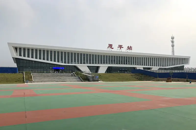
Photo adjustments
EXIF orientation normalized; resized without changing aspect ratio; converted to WebP. No subject edits.
- Administrative area
- County-level city · 县级市
- Part of
- Jiangmen
- Chinese name
- 恩平市
- Local areas
- County-level city guide
Area & population
- Area in the source
- 1,698.00 km²
- Population · 2020 census
- 483,907
Source: cited geographic source, as of the dates shown.
Setting and landscape
Kaiping (开平) and Taishan (台山) lie to the east, Yangjiang (阳江) to the south, Yangchun (阳春) to the west and Xinxing County (新兴县) in Yunfu to the north. The whole city is south of the Tropic of Cancer, with a south-subtropical maritime monsoon climate. It is one of China's rainstorm centres, averaging 2,613 mm of rain a year, with a wet season from April to September and typhoons between June and October. The city describes the Qixingkeng Nature Reserve (七星坑自然保护区) as the only well-protected original secondary forest in the Pearl River Delta.
History
The county began in AD 220 as Siping (思平县) and took the name Enping in 757. It was folded into Yangjiang in 972; a fort was built in 1466 on ground now inside the city government compound, and the county was restored on its site in 1479. It became a city in 1994. With Xinhui, Kaiping and Taishan, Enping traditionally forms the Siyi (四邑, "four counties"), and people speak the Enping dialect (恩平话) of Cantonese. Its emigrant communities live in more than 110 countries and regions, above all Venezuela.
What to see
Guangdong Enping Geothermal National Geopark (广东恩平地热国家地质公园), approved by the Ministry of Land and Resources in August 2005, covers about 91.45 square kilometres in the northwest, mainly in Naji (那吉镇), Datian (大田镇) and Liangxi (良西镇) towns. Its features include hot springs, granite landforms, giant quartz veins and the old Jinshan gold mine. Jinjiang Hot Spring (锦江温泉) and Shanquanwan Hot Spring (山泉湾温泉) are national 4A scenic areas.
The Feng Ru Hometown Cultural Tourism Area (冯如故里文化旅游区) at Changmei village (昌梅村), Niujiang town (牛江镇), has a full-size replica of the aircraft "Feng Ru No. 1", Feng Ru's Qing-dynasty brick-and-timber former home, an aviation history hall and an exhibition on Enping's overseas Chinese in Latin America. Xiema Juren Village (歇马举人村) at Shengtang (圣堂) is listed as a Chinese Historical and Cultural Village.
Food and local products
Lecai (簕菜), a wild leaf eaten as a vegetable, appears as a local dish in the 1985 county gazetteer, and steeping its leaves as tea is a local custom. The leaves are picked around Qingming and from September to November, and rolling them is the key step in making the tea. The craft joined the Jiangmen municipal intangible heritage list in 2021.
Highlights
- Guangdong Enping Geothermal National Geopark 广东恩平地热国家地质公园: China's first national geopark named for geothermal resources, approved in August 2005.
- Feng Ru Hometown Cultural Tourism Area 冯如故里文化旅游区: Feng Ru's Qing-dynasty former home and a full-size replica of the "Feng Ru No. 1" aircraft at Changmei village.
- Xiema Juren Village 歇马举人村: Chinese Historical and Cultural Village at Shengtang.
- Qixingkeng Nature Reserve 七星坑自然保护区: Described by the city as the only well-protected original secondary forest in the Pearl River Delta.
- Lecai tea 簕菜茶: Tea made from the wild lecai leaf; the craft was listed as Jiangmen municipal intangible heritage in 2021.
Sources for this guide
恩平概况 - 恩平市人民政府门户网站 · Enping Municipal People's Government
历史沿革 - 恩平市人民政府门户网站 · Enping Municipal People's Government
旅游概况 - 恩平市人民政府门户网站 · Enping Municipal People's Government
恩平优品①|簕菜茶 - 恩平市人民政府门户网站 · Enping Municipal People's Government (Enping Media Centre column)
恩平市 - 维基百科,自由的百科全书 · Wikipedia (Chinese) · CC BY-SA 4.0
Original English written from the listed sources and checked sentence by sentence against quoted extracts by a separate reviewer. Updated 2026-09-23.
Explore Enping
Core places to explore, with English and Chinese names.
Places to explore around Enping
 Xiema Scholars' Village ·
 Plan your visit
Getting there
Enping is about 90 km in a straight line from central Jiangmen. Search for 恩平市 in a map app to find stations and your accommodation.
Where to stay →Build your route
Start with Xiema Scholars' Village. The linked place guides have entrance and visit details.
Continue with Jiangmen →More in Jiangmen
Sources & geographic information
Administrative names and parent areas: Official geographic directory · Reference date 2026-09-06.
Some facts checked against 恩平市 — Wikipedia contributors, CC BY-SA 4.0.
Photo: Xiema Scholars' Village · Source photographer · License not provided. EXIF orientation normalized; resized without changing aspect ratio; converted to WebP. No subject edits.
Map data © OpenStreetMap contributors. Pins mark approximate centres, not entrances or boundaries.