


Get to know Jiangcheng District
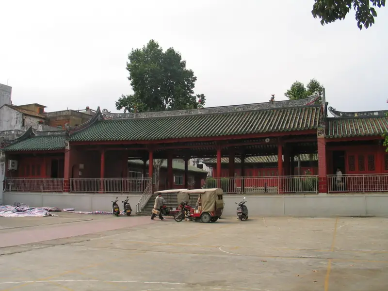
Photo adjustments
Full frame retained; EXIF orientation normalized, proportionally resized to at most 800 pixels and converted to WebP. No generated pixels or subject changes. Cards may crop the display.
- Administrative area
- District · 市辖区
- Part of
- Yangjiang
- Chinese name
- 江城区
- Local areas
- District guide
Area & population
- Area in the source
- 453.00 km²
Source: cited geographic source, as of the dates shown.
Setting and landscape
Most of the district is river and coastal plain, with hills only in Shuangjie (双捷), Buchang (埠场), Baisha (白沙) and Chengdong (城东); the highest point is Luoqin Mountain (罗琴山), 448.7 metres, on the border with Yangxi County. The Moyang River splits into eastern and western channels, the eastern one wrapping around the city, before reaching the sea at Beijin (北津). The climate is maritime subtropical monsoon, with southeasterly winds for most of the year and typhoons in summer and autumn.
History
People were living here in the late Neolithic, about 4,000 years ago. The area came under Gaoliang County (高凉县) in the Western Han, and when the Sui renamed it Yangjiang County, Jiangcheng became the county seat. The district's party history office describes it as the long-standing political, military and cultural centre of western Guangdong. Jiangcheng District itself was created in 1988, when Yangjiang County became Yangjiang city.
What to see
The old town holds the Nan'en Road historic district (南恩路历史文化街区), a Guangdong-listed street of Lingnan arcaded buildings that was once Yangjiang's main street, and the Confucian school, Tianhou temple and Shijue Temple (石觉寺) are among the historic sites scattered through the same old town. Taifu Road (太傅路) keeps Lingnan arcades, the premises of long-established shops and scholars' former homes. Yuanyang Lake Park (鸳鸯湖公园) has the Moyang Tower (漠阳楼) museum and the Yangjiang Kite Museum (阳江风筝馆); Beishan Park (北山公园) has a stone pagoda. In Napeng village (那蓬村) in Buchang, the brick-and-tile former home of Guan Shanyue (关山月), a leading painter of the Lingnan school, anchors a village whose walls are painted with Lingnan-style pictures, and the Shanwai beaches (山外海滩) lie close by. In Shuangjie, a memorial hall honours Lady Xian (冼夫人) and General Feng Ang (冯盎).
Food and local products
Baisha (白沙) is known for Baisha Maxiang white-cut goose (白沙麻香白切鹅), whose cooking technique is on Yangjiang's municipal intangible-heritage list; the Baisha goose banquet adds goose rice (鹅乸饭) and goose-bone soup.
Highlights
- Nan'en Road historic district 南恩路历史文化街区: Guangdong-listed arcade street, formerly Yangjiang's main street.
- Guan Shanyue's former home 关山月故居: Home of the Lingnan-school painter in Napeng village, Buchang, with painted village walls.
- Yuanyang Lake Park 鸳鸯湖公园: City park with the Moyang Tower museum and the Yangjiang Kite Museum.
- Baisha white-cut goose 白沙麻香白切鹅: Goose dish whose cooking technique is on Yangjiang's intangible-heritage list.
Sources for this guide
历史沿革 -阳江市江城区人民政府门户网站 · Jiangcheng District Party History Office, Yangjiang
自然地理 -阳江市江城区人民政府门户网站 · Jiangcheng District Party History Office, Yangjiang
请到江城过国庆 | 品白沙“全鹅宴”,赏鼍城美景!这份旅游指南快收好 -阳江市江城区人民政府门户网站 · Jiangcheng District People's Government (Jiangcheng Fabu)
春睡茶寮、丹青旅拍、民宿集群!关山月故居再上新 -阳江市江城区人民政府门户网站 · Jiangcheng District People's Government
Original English written from the listed sources and checked sentence by sentence against quoted extracts by a separate reviewer. Updated 2026-09-23.
Explore Jiangcheng District
Core places to explore, with English and Chinese names.
Jiangcheng District 江城区
Plan your visit
Getting there
Jiangcheng District is about 3 km in a straight line from central Yangjiang. Search for 江城区 in a map app to find stations and your accommodation.
Where to stay →More in Yangjiang
Sources & geographic information
Administrative names and parent areas: Official geographic directory · Reference date 2026-09-06.
Map data © OpenStreetMap contributors. Pins mark approximate centres, not entrances or boundaries.