


Get to know Yangchun
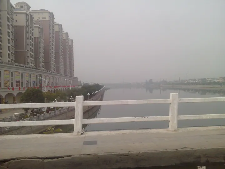
Photo adjustments
Full frame retained; proportionally resized and converted to WebP. No retouching or changes to the photographed subject. Card displays may crop the view.
- Administrative area
- County-level city · 县级市
- Part of
- Yangjiang
- Chinese name
- 阳春市
- Local areas
- County-level city guide
Area & population
- Area in the source
- 4,055.00 km²
- Population · 2010 census
- 849,504
Source: cited geographic source, as of the dates shown.
Setting and landscape
Most of the land is mountains and hills. The Moyang River runs the length of the city, lined by narrow valley basins and small plains, and the climate is a southern subtropical monsoon one averaging about 22°C, with around 2,380 mm of rain a year. Limestone is the main mineral and lies mostly in the Yangchun basin and the surrounding hills; the city government also points to plentiful geothermal water. Yangchun holds the title of a China National Geopark, and Chinese Wikipedia lists it as the second-largest county-level unit in Guangdong by area, after Yingde (英德).
History
People lived here more than 14,000 years ago. The area fell under the Nanhai commandery (南海郡) from 221 BC, and county government began in 238 AD, when the state of Wu set up Moyang County (莫阳县). In 523 the Liang dynasty replaced it with Yangchun commandery and Yangchun County. Under the Tang, Chunzhou (春州) was founded in 621 with its seat in today's Chuncheng. Yangchun was merged with Yangjiang as Liangyang County (两阳县) from 1958 to 1961, came under Yangjiang in 1988 and became a county-level city on 4 May 1994.
What to see
Two sites are national key cultural relics protection units: the Dushizai cave site (独石仔洞穴遗址) and the Shiwang coin-minting site (石望铸钱遗址). The city government also lists cliff inscriptions at Kongtong Rock (崆峒岩摩崖石刻) and at Tongzhen Rock in Chunwan (春湾通真岩摩崖石刻).
Lingxiao Cave (凌霄岩) in Helang town (河塱镇) is a karst cave with an underground river. It rises 177 metres above the water in four levels: the river runs along the bottom, the second level is a pillar-filled hall named Lingxiao Hall (凌霄大殿), and the upper two are further cave chambers. It is listed as a national geopark.
The intangible cultural heritage named by the city government includes Yangchun root carving (阳春根雕), the Double Ninth market at Bimian (陂面镇重阳古墟), the Gaoliuhe market at Heshui (合水镇高流河墟) and the firecracker fair at General Liang Zhennan's mansion in Shiwang (石望镇梁镇南将军府炮会).
Food and local products
Yangchun is known as the home of Chun amomum (春砂仁) and of Mashui tangerines (马水桔), and both carry China's geographical-indication product status.
Getting oriented
The government seat is Chuncheng subdistrict (春城街道). Local speech includes Yangchun Cantonese (阳春白话), Hakka and the Yao (Mien) language. Besides other parts of Yangjiang, Yangchun borders counties and districts of Maoming (茂名) and Yunfu (云浮), and Enping (恩平) in Jiangmen. Yangchun Station sits on the Guangzhou–Maoming (广茂) and Yangchun–Yangjiang (阳阳) railways, and Yangchun East Station is on the Guangzhou–Zhanjiang high-speed railway (广湛高铁).
Highlights
- Lingxiao Cave 凌霄岩: Four-level karst cave above an underground river, 177 m high, listed as a national geopark.
- Dushizai cave site 独石仔洞穴遗址: Cave site that is a national key cultural relics protection unit.
- Shiwang coin-minting site 石望铸钱遗址: Coin-minting site that is a national key cultural relics protection unit.
- Chun amomum 春砂仁: Geographical-indication product; Yangchun is called its hometown.
- Mashui tangerine 马水桔: Tangerine with China geographical-indication status.
Sources for this guide
自然环境 - 阳春市人民政府门户网站 · Yangchun Municipal People's Government
历史沿革 - 阳春市人民政府门户网站 · Yangchun Municipal People's Government
人口文化 - 阳春市人民政府门户网站 · Yangchun Municipal People's Government
阳春市 - 维基百科,自由的百科全书 · Chinese Wikipedia · CC BY-SA 4.0
凌霄岩 - 维基百科,自由的百科全书 · Chinese Wikipedia · CC BY-SA 4.0
Original English written from the listed sources and checked sentence by sentence against quoted extracts by a separate reviewer. Updated 2026-09-23.
Explore Yangchun
Core places to explore, with English and Chinese names.
Places to explore around Yangchun
 Lingxiao Cave · 凌霄岩
Lingxiao Cave凌霄岩
Four-level underground-river karst cave in Helang Town, Yangchun, with a column-filled main hall; a Guangdong provincial scenic area and national geopark.
Read the place guide → Chunwan Stone Forest · 春湾石林
Chunwan Stone Forest春湾石林
Chunwan Stone Forest (春湾石林), also called Lianhua Cave Stone Forest, is a group of rock peaks and named boulders at Chunwan town in Yangchun, under Yangjiang in Guangdong. It sits in the northeast of the Chunwan Scenic Area, which holds a national AAAA rating.
Read the place guide →Plan your visit
Getting there
Yangchun is about 40 km in a straight line from central Yangjiang. Search for 阳春市 in a map app to find stations and your accommodation.
Where to stay →Build your route
Lingxiao Cave and Chunwan Stone Forest are both listed here. The linked place guides have entrance and visit details.
Continue with Yangjiang →More in Yangjiang
Sources & geographic information
Administrative names and parent areas: Official geographic directory · Reference date 2026-09-06.
Some facts checked against 阳春市 — Wikipedia contributors, CC BY-SA 4.0.
Some facts checked against 凌霄岩 — Wikipedia contributors, CC BY-SA 4.0.
Photo: Lingxiao Cave · Source photographer · License not provided. EXIF orientation normalized; resized without changing aspect ratio; converted to WebP. No subject edits.
Photo: Chunwan Stone Forest · Source photographer · License not provided. EXIF orientation normalized; resized without changing aspect ratio; converted to WebP. No subject edits.
Map data © OpenStreetMap contributors. Pins mark approximate centres, not entrances or boundaries.