


Get to know Yangxi County
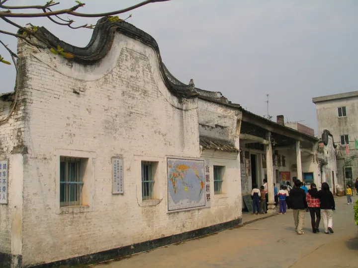
Photo adjustments
Full frame retained; proportionally resized and converted to WebP. No retouching or changes to the photographed subject. Card displays may crop the view.
- Administrative area
- County · 县
- Part of
- Yangjiang
- Chinese name
- 阳西县
- Local areas
- County guide
Area & population
- Area in the source
- 1,271.00 km²
Source: cited geographic source, as of the dates shown.
Setting and landscape
Plains make up only 17 percent of the land. The highest point, Ehuangzhang (鹅凰嶂) at 1,337 metres, stands in the north-west on the border with Dianbai District (电白区) and Yangchun (阳春), and the mountainous parts are mainly Xinxu (新墟镇) and Tangkou (塘口镇) towns and the north-west of Chengcun (程村镇) and Zhigong (织篢镇). The coast runs for about 174 km. Between Santouzui (散头咀) and Shapa town (沙扒镇) it is formed by three sickle-shaped sandy bays joined by headlands; sand makes up 40 percent of the shoreline, and the longer sandy stretches include Hebei beach at Shangyang (上洋镇河北沙滩) and Moon Bay at Shapa (沙扒镇月亮湾). Mangroves and grass flats grow in places in the high-tide zone. The climate is a maritime monsoon one on the border between the southern subtropics and the tropics, with warm winters and long summers.
History
People lived here in the Neolithic. The area became part of the Nanhai commandery (南海郡) after 214 BC and from 622 belonged to Duling County (杜陵县), which the Song abolished in 972 and merged into Nan'enzhou (南恩州), that is, Yangjiang. In the Republican era, until 1950, it formed two districts of Yangjiang County, and in 1988, when Yangjiang became a city, Yangxi was made a county of its own, with its seat at Zhigong town. The county government names Yangxi as the home of Lady Xian (冼夫人), and lists the Shuangyu old city (双鱼古城), Qixian Academy (七贤书院), Jingye Temple (净业寺), the Tangkou fort (塘口古堡), the old village of Dazhou (大洲村) and the Shangyang old houses (上洋古屋群) among its historic sites.
What to see
At Qixian Academy, two double-flowered white wintersweet trees (重瓣白腊梅) more than 190 years old stand in the courtyard and bloom each winter; the Yangxi County Museum looks after them and runs cultural events around the blossom. The county government describes its tourism assets as five bays, four springs and three mountains, and holds one 4A and six 3A scenic areas.
Food and local products
Chengcun oysters (程村蚝) and Yangxi red-yolk duck eggs (阳西红心鸭蛋) are national geographical-indication products, and the county calls itself a home of oysters and a centre of condiment making. In Xinxu town, zongzi are wrapped in the leaves of wild screwpine (露兜) folded into a four-cornered funnel, filled with glutinous rice plus pork belly, salted egg yolk or mung beans, and boiled for several hours over a wood fire. The Xinxu screwpine zongzi (新墟露兜粽) are on the county's intangible heritage list, and one customer quoted by the county media centre says they have a taste like Chinese medicine.
Highlights
- Moon Bay beach, Shapa 沙扒镇月亮湾沙滩: One of the longer sandy stretches on Yangxi's coast.
- Qixian Academy 七贤书院: Historic academy whose two wintersweet trees are over 190 years old.
- Ehuangzhang 鹅凰嶂: The county's highest point at 1,337 m, in the north-west.
- Chengcun oyster 程村蚝: National geographical-indication product.
- Xinxu screwpine zongzi 新墟露兜粽: Zongzi wrapped in wild screwpine leaves, on the county's intangible heritage list.
Sources for this guide
阳西概况 -阳西县人民政府网站 · Yangxi County People's Government
自然地理 -阳西县人民政府网站 · Yangxi County People's Government
建置沿革 -阳西县人民政府网站 · Yangxi County People's Government
七贤书院:百年古梅香如故 -阳西县人民政府网站 · Yangxi County Media Centre (Yangxi County People's Government website)
端午乡土味道:新墟非遗露兜粽 -阳西县人民政府网站 · Yangxi County Media Centre (Yangxi County People's Government website)
Original English written from the listed sources and checked sentence by sentence against quoted extracts by a separate reviewer. Updated 2026-09-23.
Explore Yangxi County
Core places to explore, with English and Chinese names.
Yangxi County 阳西县
Plan your visit
Getting there
Yangxi County is about 40 km in a straight line from central Yangjiang. Search for 阳西县 in a map app to find stations and your accommodation.
Where to stay →More in Yangjiang
Sources & geographic information
Administrative names and parent areas: Official geographic directory · Reference date 2026-09-06.
Map data © OpenStreetMap contributors. Pins mark approximate centres, not entrances or boundaries.