


Get to know Dahua Yao Autonomous County
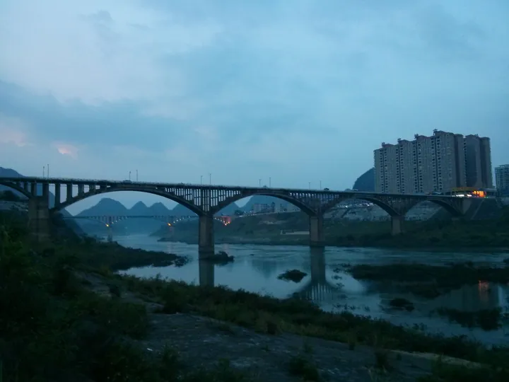
Photo adjustments
Full frame retained; proportionally resized and converted to WebP. No retouching or changes to the photographed subject. Card displays may crop the view.
- Administrative area
- Autonomous county · 自治县
- Part of
- Hechi
- Chinese name
- 大化瑶族自治县
- Local areas
- Autonomous county guide
Area & population
- Area in the source
- 2,754.00 km²
- Administrative seat
- Dahua Town
Source: cited geographic source, as of the dates shown.
Setting and landscape
The Duyang Mountains (都阳山脉) cross the county from north to south, and the land is high in the north and low in the south. Karst dominates: the county government describes "a thousand hills and ten thousand hollows", and Qibainong Township (七百弄乡) alone has more than 1,300 depressions, called nong (弄), of which only 324 are inhabited. The highest peak, Nong'er Mountain (弄耳山), rises to 1,108 metres in Qibainong. The Hongshui River flows 160 kilometres through the county, and 14 underground rivers have been traced. The Dahua and Yantan (岩滩) hydropower stations are both large national plants, and 13 of the county's townships lie in the reservoir areas of the Yantan, Dahua and Bailongtan (百龙滩) stations.
History
Dahua is a young county. The State Council approved it on 23 December 1987, and its government was formally set up on 20 October 1988, joining the border areas of Du'an (都安), Bama (巴马) and Mashan (马山) counties, with Dahua town (大化镇) as the seat; it has belonged to Hechi city since October 2002. The county traces its administrative beginnings to the Ming dynasty: in 1425 Duyang Bao (都阳堡), one of thirteen divisions drawn up in Si'en (思恩) native department, lay within today's county, and in 1528 the Duyang native inspectorate (都阳土巡检司) was set up. During the Agrarian Revolution Deng Xiaoping and Zhang Yunyi carried out revolutionary work in the area.
What to see
Dahua Qibainong National Geopark (大化七百弄国家地质公园) covers 323.4 square kilometres in the north of the county. Announcing its opening, set for 23 November 2012, China.com.cn described it as the only geopark in China whose main landscape is high peak clusters with deep depressions; its 45 geological sites include Qiaoxu Cave (乔圩洞), Shiguo Tiandu (石国天都) and the depression called "the first nong under heaven" (天下第一弄). Along the river, the Hongshui River Hundred-li Scenic Gallery (红水河百里风情画廊) is one of the county's four national AAAA scenic areas.
The Zhuzhu Festival (祝著节) of the Bunu Yao (布努瑶), on the 29th day of the fifth lunar month, honours the creator goddess Miluotuo (密洛陀); the county calls it the most important Yao festival. Villagers bring five-colour glutinous rice to sacrifices and hold martial-arts displays, crossbow contests, bronze-drum dances and antiphonal singing, and at night elders sing hymns to Miluotuo around the fire pit.
Highlights
- Dahua Qibainong National Geopark 大化七百弄国家地质公园: 323.4 sq km of high peak clusters and deep depressions in the north of the county; its opening was announced for November 2012.
- Hongshui River Hundred-li Scenic Gallery 红水河百里风情画廊: National AAAA scenic area along the Hongshui River.
- Zhuzhu Festival 祝著节: Bunu Yao festival for the goddess Miluotuo on the 29th day of the fifth lunar month.
Sources for this guide
大化瑶族自治县概况 · Dahua Yao Autonomous County People's Government Office
历史沿革 · Dahua Yao Autonomous County People's Government Office
自然地理 · Dahua Yao Autonomous County People's Government Office
布努瑶“祝著节” · Dahua Yao Autonomous County People's Government Office
广西大化七百弄国家地质公园即将开园 · China.com.cn (reporting Guangxi News Network)
Original English written from the listed sources and checked sentence by sentence against quoted extracts by a separate reviewer. Updated 2026-09-24.
Explore Dahua Yao Autonomous County
Core places to explore, with English and Chinese names.
Places to explore around Dahua Yao Autonomous County
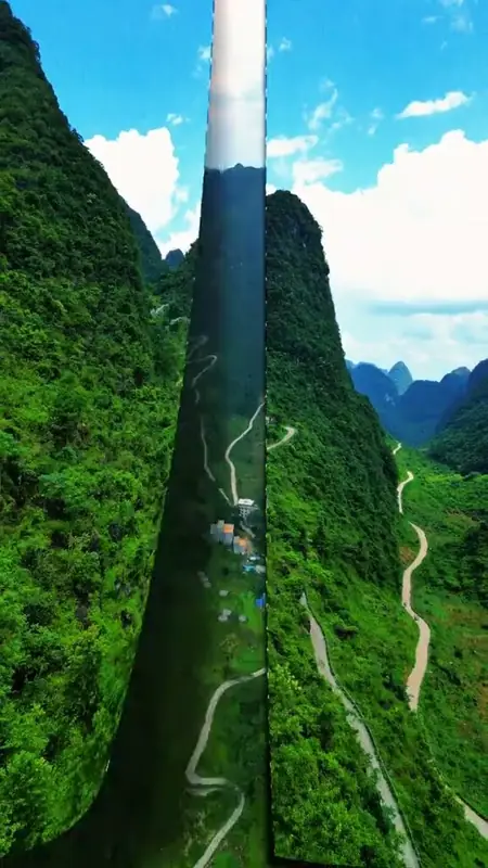 Qibainong Geopark ·
 Plan your visit
Getting there
Dahua Yao Autonomous County is about 105 km in a straight line from central Hechi. Search for 大化瑶族自治县 in a map app to find stations and your accommodation.
Where to stay →Build your route
Start with Qibainong Geopark. The linked place guides have entrance and visit details.
Continue with Hechi →More in Hechi
Sources & geographic information
Administrative names and parent areas: Official geographic directory · Reference date 2026-09-06.
Photo: Qibainong Geopark · Source photographer · License not provided. EXIF orientation normalized; resized without changing aspect ratio; converted to WebP. No subject edits.
Map data © OpenStreetMap contributors. Pins mark approximate centres, not entrances or boundaries.