


Get to know Xingren City
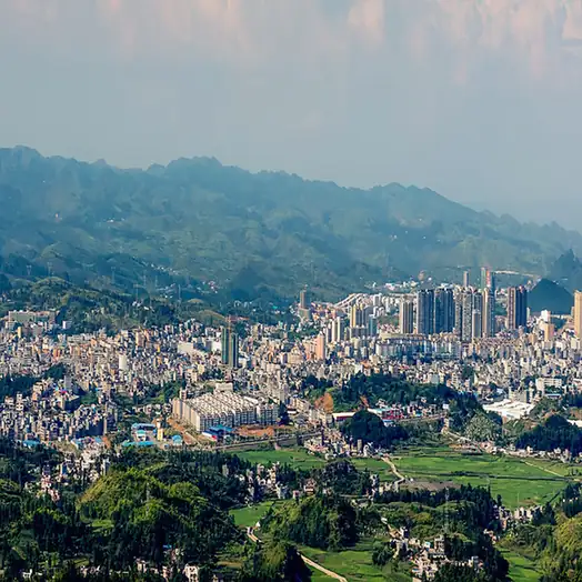
Photo adjustments
EXIF orientation normalized; resized without changing aspect ratio; converted to WebP. No subject edits.
- Administrative area
- County-level city · 县级市
- Part of
- Qianxinan Buyei and Miao Autonomous Prefecture
- Chinese name
- 兴仁市
- Local areas
- County-level city guide
Area & population
- Area in the source
- 1,785.00 km²
- Population · 2020 census
- 425,770
- Administrative seat
- Chengbei Subdistrict
Source: cited geographic source, as of the dates shown.
Setting and landscape
The average elevation is 1,253 metres and the mean annual temperature 15.2°C; the city government records no more than four days a year below freezing and no more than twenty above 30°C. Xingyi station on the Nanning-Kunming railway (南昆铁路) and Xingyi Wanfenglin Airport (兴义万峰林机场) are each about 50 kilometres away, and the Qingxing (晴兴) and Huixing (惠兴) expressways pass through the city.
History
After the Yelang (夜郎) state, the Han set up Loujiang County (漏江县) in 111 BC beside the Nijiang River (泥江河). In 1383 the Ming general Wu Fu (吴复), Marquis of Anlu, built Xincheng (新城), and in 1390 a Xincheng garrison post was set up at today's city centre. Xincheng became an assistant magistrate's seat in 1798 and broke away from Pu'an as a provisional Xincheng County in 1911. Because other provinces had counties of the same name, the Republican interior ministry renamed it Xingren in July 1914, after a line in the Great Learning (大学): when one family is humane, the whole state rises in humaneness. The county produced Guizhou's first gold at the end of 1986 and became a county-level city on 28 September 2018.
What to see
The Fangmaping alpine grassland (放马坪高山草原), a national 4A scenic area 24 kilometres north of the city where Panjiazhuang (潘家庄) and Xiashan (下山) towns meet, covers 21,000 mu of natural pasture at an average of 1,630 metres. It is a provincial scenic area and has grass sledding, camping and flower fields, a Yi (彝族) culture square and the Ximatang (洗马塘) pond.
Food and local products
Xingren beef rice noodles (兴仁牛肉粉) come in a rich broth with soft but springy noodles, topped with either plain sliced beef (清片) or red-braised beef (红烧). Noodle shops set out toasted chilli powder, soy sauce, vinegar, garlic, pickled chillies with garlic shoots and pickled cabbage for diners to add.
Miao communities in Tunjiao (屯脚), Baling (巴铃) and other towns make batik on home-grown hemp cloth, drawing patterns in melted beeswax with a knife before dyeing. Women twist hemp fibre even while walking or carrying water, hence the local saying "twisting thread while carrying water, splicing hemp while walking". The city government notes that the craft is now practised mostly by older people.
Highlights
- Fangmaping alpine grassland 放马坪高山草原: National 4A scenic area of natural pasture at about 1,630 m, 24 km north of the city.
- Xingren beef rice noodles 兴仁牛肉粉: Rich broth with plain-sliced or red-braised beef and self-served pickles and chilli.
- Miao batik 苗族蜡染: Beeswax-resist dyeing on hemp cloth woven at home.
Sources for this guide
兴仁市基本情况简介 · Xingren City People's Government
兴仁市建置沿革 · Xingren City People's Government
放马坪高山草原景区 · Xingren City People's Government
兴仁牛肉粉 · Xingren City People's Government
兴仁苗族蜡染艺术 · Xingren City People's Government
Original English written from the listed sources and checked sentence by sentence against quoted extracts by a separate reviewer. Updated 2026-09-24.
Explore Xingren City
Core places to explore, with English and Chinese names.
Xingren City 兴仁市
Plan your visit
Getting there
Xingren City is about 45 km in a straight line from central Qianxinan Buyei and Miao Autonomous Prefecture. Search for 兴仁市 in a map app to find stations and your accommodation.
Where to stay →More in Qianxinan Buyei and Miao Autonomous Prefecture
Sources & geographic information
Administrative names and parent areas: Official geographic directory · Reference date 2026-09-06.
Map data © OpenStreetMap contributors. Pins mark approximate centres, not entrances or boundaries.