


Get to know Chishui City

Photo adjustments
Full-frame source proportionally resized and converted to WebP for display. No subject alteration. Source-supplied marks and edits remain; cards may crop the view.
- Administrative area
- County-level city · 县级市
- Part of
- Zunyi City
- Chinese name
- 赤水市
- Local areas
- County-level city guide
Area & population
- Area in the source
- 1,882.57 km²
- Population · 2020
- 247,287
- Administrative seat
- Shizhong
Source: cited geographic source, as of the dates shown.
Setting and landscape
The city sits in the transition from the Yunnan–Guizhou Plateau to the Sichuan Basin. The city government describes its more than 1,300 square kilometres of Danxia landform as the largest in China. Ground rises from 221 m in the hilly northwest to 1,730 m among the gorges of the southeast. The Chishui River, a first-order tributary of the Yangtze, is the largest of 352 rivers here. The average annual temperature is 18.1°C.
Chishui is dense with spiny tree ferns (桫椤, Alsophila), a nationally protected Jurassic relic; the Chishui Alsophila National Nature Reserve (赤水桫椤国家级自然保护区) alone holds 47,000 of them.
History
Chishui was first set up as an administrative unit in 1109 under the Northern Song, with its seat at today's Fuxing town (复兴镇). The Qing created Chishui sub-prefecture in 1908, which became Chishui County in 1914 and a city in December 1990. In 1929 communists led by Liang Yeguang (梁业广) founded the earliest Communist Party organisation in Guizhou here, and in January 1935 the Red Army's arrival opened the Four Crossings of the Chishui River (四渡赤水) campaign.
What to see
Chishui Danxia became a World Natural Heritage site in 2010 as part of China Danxia (中国丹霞). The State Council listed the Chishui scenic area as a national scenic area in 1994; its landscape is one of waterfalls, bamboo, lakes, tree ferns and Danxia landforms, with Long March sites.
Named scenic areas include the Chishui Great Waterfall (赤水大瀑布), a national 4A scenic area, Sidonggou (四洞沟) and the Bamboo Sea National Forest Park (竹海国家森林公园), along with the old towns of Datong (大同古镇) and Bing'an (丙安古镇).
Food and local products
Douhua (豆花), soft bean curd, is everywhere in Chishui and is one of the main dishes served to guests. Most of what is sold is black douhua made from black soybeans rather than yellow ones; it is eaten with chilli, with rice as douhua fan (豆花饭) or with noodles as douhua mian (豆花面).
Chishui sun-dried vinegar (赤水晒醋) received national geographical-indication protection in July 2015. The Qianlaoweng (黔老翁) process, as the city government describes it, uses rice and glutinous rice with wheat bran and a starter made from more than 100 herbs, ferments the mash indoors, then packs it into jars that are set out in the sun; the whole cycle takes more than two years.
Getting oriented
The city government gives distances from the urban area of 70 km to Luzhou (泸州), 240 km to Chongqing and 300 km to Zunyi. The Chengdu–Zunyi Expressway (蓉遵高速) passes through the city.
Highlights
- Chishui Danxia 赤水丹霞: Part of the China Danxia World Natural Heritage site since 2010.
- Chishui Great Waterfall 赤水大瀑布: A national 4A scenic area.
- Chishui Alsophila National Nature Reserve 赤水桫椤国家级自然保护区: Holds 47,000 spiny tree ferns, a Jurassic relic.
- Bing'an Ancient Town 丙安古镇: Old town listed among Chishui's cultural scenic areas.
- Chishui sun-dried vinegar 赤水晒醋: Geographical-indication product since July 2015, sun-fermented for over two years.
Sources for this guide
赤水市人民政府门户网站·自然地理 · Chishui City People's Government
赤水正宗晒醋,认准“黔老翁”- 赤水市人民政府门户网站·小吃特产 · Chishui City People's Government
赤水豆花 - 赤水市人民政府门户网站·小吃特产 · Chishui City People's Government
赤水市 - 维基百科,自由的百科全书 · Wikipedia (Chinese) · CC BY-SA 4.0
Original English written from the listed sources and checked sentence by sentence against quoted extracts by a separate reviewer. Updated 2026-09-25.
Explore Chishui City
Core places to explore, with English and Chinese names.
Places to explore around Chishui City
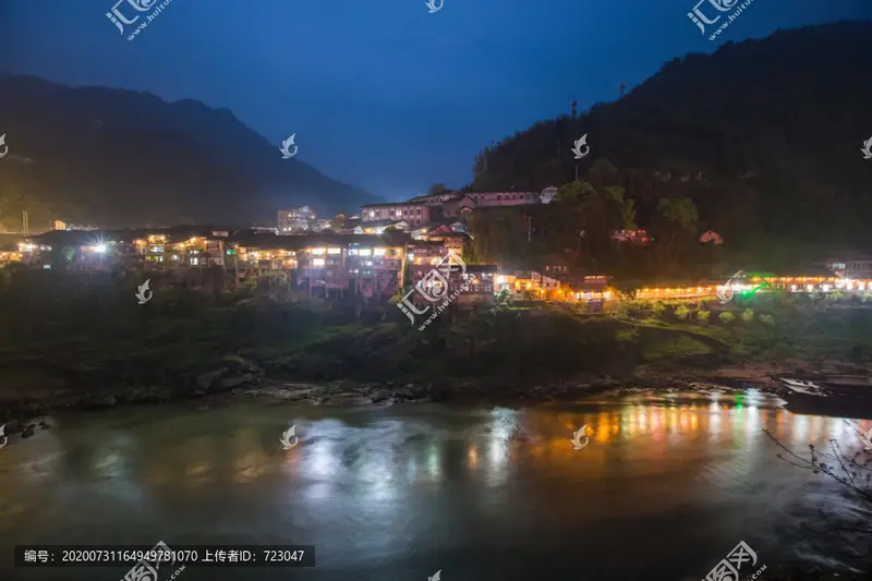 Bing'an Ancient Town · 丙安古镇
Bing'an Ancient Town丙安古镇
Bing’an rises on a cliff above the Chishui River, with timber houses supported along the steep edge and a stone-paved street running through the settlement. Donghua and Taiping gates mark the old town’s approaches. At Shuanglong…
Read the place guide → AI illustration · AI 示意图(仅供参考,非该地点实拍)
Foguang Cliff佛光岩
Foguangyan is a curved red danxia cliff in the south of Chishui City in the Zunyi area of Guizhou, with a waterfall dropping down the middle of it. It is one of the three sections of the Chishui Danxia tourist area, the core scenic area of the Chishui Danxia world natural heritage site.
Read the place guide → Sidonggou Waterfall Gorge · 四洞沟
Sidonggou Waterfall Gorge四洞沟
Bamboo-lined valley in Datong town, western Chishui, Guizhou, with four stepped waterfalls along about 4 km of stream.
Read the place guide →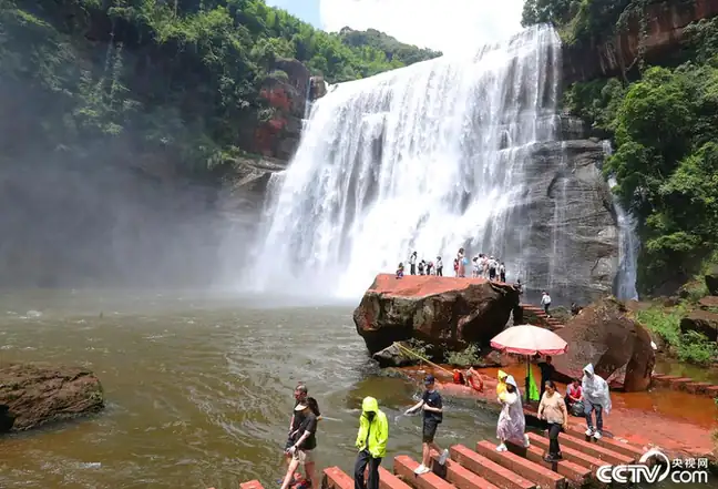 Chishui Great Waterfall · 赤水大瀑布
Chishui Great Waterfall赤水大瀑布
Chishui Great Waterfall drops into a wooded gorge within the region’s red-sandstone landscape. The main fall creates a broad sheet of water, while Meirenshu Waterfall divides into finer parallel streams that resemble the teeth…
Read the place guide →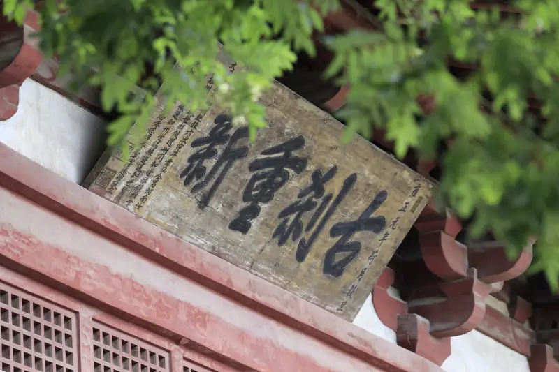 Datong Ancient Town · 大同古镇
Datong Ancient Town大同古镇
Datong is a riverside town on the western edge of Chishui City in the Zunyi area of Guizhou, 9 kilometres from the city centre and on the Sichuan border. The Datong River, a tributary of the Chishui, runs through the middle of it. The catalogue entry refers to the old town there.
Read the place guide → Chishui Bamboo Sea · 赤水竹海
Chishui Bamboo Sea赤水竹海
Chishui Bamboo Sea National Forest Park lies in Hushi town in Chishui City, in the Zunyi area of Guizhou, close to the Sichuan border at Luzhou and in the deeply cut belt where the Sichuan basin gives way to the Yunnan-Guizhou plateau. Its overall plan covers 11,200 hectares and takes in the gorges of the Chishui River and evergreen broadleaf forest as well as bamboo.
Read the place guide →Plan your visit
Getting there
Chishui City is about 165 km in a straight line from central Zunyi City. Search for 赤水市 in a map app to find stations and your accommodation.
Where to stay →Build your route
Bing'an Ancient Town and Foguang Cliff are both listed here. The linked place guides have entrance and visit details.
Continue with Zunyi City →More in Zunyi City
Sources & geographic information
Administrative names and parent areas: Official geographic directory · Reference date 2026-09-06.
Some facts checked against 赤水市 — Wikipedia contributors, CC BY-SA 4.0.
Photo: Bing'an Ancient Town · Source photographer · License not provided. EXIF orientation normalized; resized without changing aspect ratio; converted to WebP. No subject edits.
Photo: Sidonggou Waterfall Gorge · Source photographer · License not provided. EXIF orientation normalized; resized without changing aspect ratio; converted to WebP. No subject edits.
Photo: Chishui Great Waterfall · Source photographer · License not provided. EXIF orientation normalized; resized without changing aspect ratio; converted to WebP. No subject edits.
Photo: Datong Ancient Town · Source photographer · License not provided. EXIF orientation normalized; resized without changing aspect ratio; converted to WebP. No subject edits.
Photo: Chishui Bamboo Sea · Source photographer · License not provided. EXIF orientation normalized; resized without changing aspect ratio; converted to WebP. No subject edits.
Map data © OpenStreetMap contributors. Pins mark approximate centres, not entrances or boundaries.