


Get to know Suiyang County

Photo adjustments
Full-frame source proportionally resized and converted to WebP for display. No subject alteration. Source-supplied marks and edits remain; cards may crop the view.
- Administrative area
- County · 县
- Part of
- Zunyi City
- Chinese name
- 绥阳县
- Local areas
- County guide
Area & population
- Area in the source
- 2,566.00 km²
- Population · 2017
- 560,000
- Administrative seat
- Yangchuan
Source: cited geographic source, as of the dates shown.
Setting and landscape
The county covers 2,566 square kilometres between Meitan (湄潭) to the east, Tongzi (桐梓) to the west, urban Zunyi to the south and Zheng'an (正安) to the north. Forest covers about 70 percent; the mean temperature is 15.1°C. It has four farming flats of over 10,000 mu and is known as the "granary of northern Guizhou".
History
Suiyang became a county in 611 under the Sui. When the Tang created Bozhou (播州) in 639, its seat lay in present-day Suiyang, and so did the seat of the Zunyi County named in 642. The Ming re-established Suiyang County in 1601 on its Song-dynasty land, and it moved from Sichuan to Guizhou with Zunyi in 1727. Two Southern Song natives, the brothers Ran Jin (冉琎) and Ran Pu (冉璞), built the Diaoyu Fortress (钓鱼城) at Hechuan (合川) against the Mongols. Sites of 1960s Third Front military industry, numbered 531, 535 and 409, remain.
What to see
Shuanghe Cave, in Wenquan town (温泉镇), is a four-level system formed in dolomite, with underground rivers, waterfalls, terraces, helictites and gypsum flowers. Explorers have mapped 439.7 km of passages with 115 connected entrances and a depth of 912 metres, and the county lists it as the world's longest dolomite cave and largest celestine cave. More than 40 giant panda fossils and subfossils, dated from about 100,000 to a few hundred years ago, have been found inside. It became a national geopark in 2004 and entered China's UNESCO World Heritage Tentative List in 2025.
The Kuankuoshui National Nature Reserve in the north of the county covers 26,231 hectares on the eastern slopes of the Dalou range. It is the main source of the Furong River (芙蓉江), a tributary of the Wujiang (乌江), and fifteen streams radiate from Taiyang Mountain (太阳山). The reserve protects dove trees (珙桐) and black leaf monkeys (黑叶猴) and has recorded 204 bird species.
Food and local products
Suiyang hollow noodles (绥阳空心面), locally called salt-water noodles (盐水面), are hair-thin and were a tribute item under the Ming and Qing. Refined flour is mixed with sesame oil, a little salt and a broth of pounded chicken bones, rolled into strands, strung between sticks and hung from high frames, then drawn down by hand until the strands turn hollow and left to dry. Huangyang xiaomila (黄杨小米辣) and "Suiyang bullet" (绥阳子弹头) chillies hold national agricultural geographical-indication registration. Pork stir-fried in sauce (酱爆肉), beef zha (牛肉鲝) and tuotuo pork (坨坨肉) belong to the county's "twelve flavours".
Highlights
- Shuanghe Cave 双河洞: 439.7 km of mapped dolomite cave passages; on China's UNESCO World Heritage Tentative List since 2025.
- Kuankuoshui National Nature Reserve 宽阔水国家级自然保护区: Forest reserve of 26,231 hectares in the Dalou range, home to dove trees and black leaf monkeys.
- Suiyang hollow noodles 绥阳空心面: Hand-pulled salted noodles that turn hollow as they are drawn; once a tribute item.
Sources for this guide
绥阳简介-绥阳县人民政府 · Suiyang County People's Government
历史沿革-绥阳县人民政府 · Suiyang County People's Government
双河洞景区 · Suiyang County People's Government
宽阔水国家级自然保护区(中国最美森林) · Suiyang County People's Government
绥阳空心面 · Suiyang County People's Government
Original English written from the listed sources and checked sentence by sentence against quoted extracts by a separate reviewer. Updated 2026-09-24.
Explore Suiyang County
Core places to explore, with English and Chinese names.
Places to explore around Suiyang County
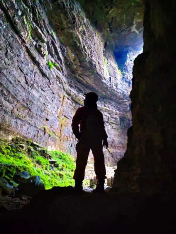 Shuanghe Cave · 双河洞
Shuanghe Cave双河洞
Dolomite cave system in Suiyang County, Guizhou, surveyed at 439.7 km in 2025, with giant panda and takin fossils in its sediments.
Read the place guide →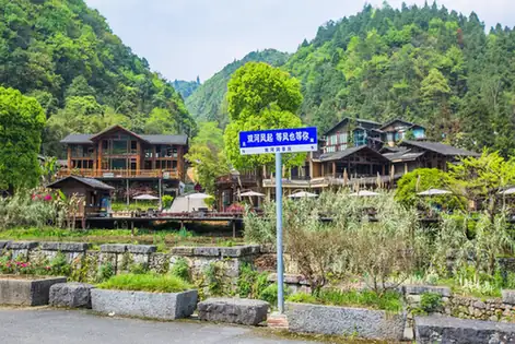 Shi'erbeihou Dafeng Cave · 十二背后大风洞
Shi'erbeihou Dafeng Cave十二背后大风洞
Dafengdong, also known as Guihuadong, is a show cave in Suiyang County in the Zunyi area of Guizhou, and a first-order branch of the much larger Shuanghe cave system in Wenquan town. Its own passage runs to 3.8 kilometres, and the system it belongs to has been surveyed by international joint expeditions since the late 1980s.
Read the place guide →Plan your visit
Getting there
Suiyang County is about 30 km in a straight line from central Zunyi City. Search for 绥阳县 in a map app to find stations and your accommodation.
Where to stay →Build your route
Shuanghe Cave and Shi'erbeihou Dafeng Cave are both listed here. The linked place guides have entrance and visit details.
Continue with Zunyi City →More in Zunyi City
Sources & geographic information
Administrative names and parent areas: Official geographic directory · Reference date 2026-09-06.
Photo: Shuanghe Cave · Source photographer · License not provided. EXIF orientation normalized; resized without changing aspect ratio; converted to WebP. No subject edits.
Photo: Shi'erbeihou Dafeng Cave · Source photographer · License not provided. EXIF orientation normalized; resized without changing aspect ratio; converted to WebP. No subject edits.
Map data © OpenStreetMap contributors. Pins mark approximate centres, not entrances or boundaries.