


Get to know Meitan County
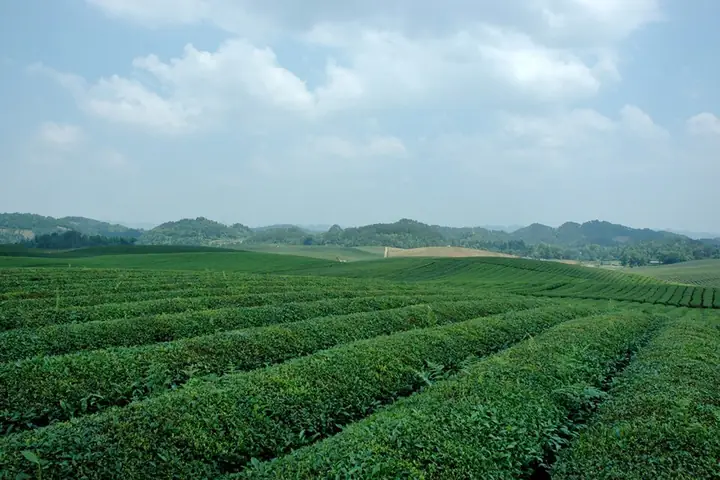
Photo adjustments
Full-frame source proportionally resized and converted to WebP for display. No subject alteration. Source-supplied marks and edits remain; cards may crop the view.
- Administrative area
- County · 县
- Part of
- Zunyi City
- Chinese name
- 湄潭县
- Local areas
- County guide
Area & population
- Area in the source
- 1,864.00 km²
- Population · 2010
- 377,354
- Administrative seat
- Meijiang
Source: cited geographic source, as of the dates shown.
Setting and landscape
The county stretches 96.5 km from north to south but is at most 25.5 km wide, between Fenggang (凤冈县) to the east, Suiyang (绥阳县) to the west, Weng'an (瓮安县) to the south and Zheng'an (正安县) to the north. It lies where the Yunnan–Guizhou Plateau gives way to the Hunan hills, at an average of 972.7 metres; karst landforms cover two-thirds of it. The highest point, Qusunkan (取笋坎), reaches 1,562 metres, and the lowest, 461 metres, is where the Lutang River (芦塘河) joins the Wujiang (乌江). Its rivers, all in the Wujiang system, are not navigable. The climate is subtropical humid monsoon, with a mean of 15.5°C and 286 frost-free days.
History
The Kangxi-era county gazetteer explains the name: the river curls around the town and meets the water from the Meishui Bridge to form a deep pool curved like an eyebrow. The county was founded in 1601, after the Bozhou (播州) rebellion was put down. In 1939 the Central Experimental Tea Farm (中央实验茶场) was set up here, and in 1940 National Zhejiang University (浙江大学) moved to Zunyi, Meitan and Yongxing old town (永兴古镇), teaching there for seven years. The university set up the Meijiang Poetry Society (湄江吟社) in 1943, and that autumn the university and the tea farm opened the Meitan Practical Vocational School, which the county government calls the earliest vocational school in southwest China.
What to see
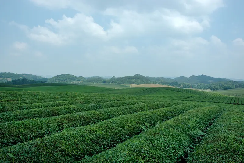
The Chinese Tea Sea in Yongxing, 19 km from the county town, has more than 43,000 mu of contiguous tea gardens; National Road 326 runs through it. Nearer town, the 4A Tea Sea Ecological Park (茶海生态园) is an open landscape of about 37 square kilometres of tea villages, including Hetaoba (核桃坝) and Tianjiagou (田家沟). The 4A Tianxia Diyi Hu Chinese Tea Culture Expo Park (天下第一壶中华茶文化博览园) centres on a teapot-shaped structure certified by Shanghai's Great World Guinness as the largest teapot model; from inside it visitors look over tea gardens and the town. The Maoba tribute-rice area (茅坝贡米之乡景区) in Maoba village became a 3A scenic area in 2022.
Food and local products
Meitan Cuiya has flat, straight, yellow-green leaves and a bright, tender-green liquor with a fresh or chestnut aroma. Its forerunner, Meitan Meijian tea (湄潭眉尖茶), was once sent as tribute, and Zhejiang University brought West Lake Longjing (西湖龙井) techniques to the county. It became a national geographical-indication product in 2014, and its making technique joined the Guizhou intangible heritage list in 2015. Maoba village is also the home of Maogong rice (茅贡米).
Highlights
- Chinese Tea Sea 中国茶海: More than 43,000 mu of contiguous tea gardens in Yongxing town.
- Meitan Cuiya 湄潭翠芽: Flat-leaf green tea; national geographical indication since 2014.
- Yongxing old town 永兴古镇: One of the places where Zhejiang University taught during its seven wartime years in the Zunyi area.
Sources for this guide
自然地理-湄潭县人民政府 · Meitan County People's Government
历史沿革-湄潭县人民政府 · Meitan County People's Government
湄潭县旅游景区简介-湄潭县人民政府 · Meitan County People's Government
国家工业遗产丨湄潭中央实验茶场与浙大-湄潭县人民政府 · Meitan County People's Government
湄潭翠芽-湄潭县人民政府 · Meitan County People's Government
Original English written from the listed sources and checked sentence by sentence against quoted extracts by a separate reviewer. Updated 2026-09-24.
Explore Meitan County
Core places to explore, with English and Chinese names.
Places to explore around Meitan County
 Meitan Sea of Tea (
Plan your visit
Getting there
Meitan County is about 45 km in a straight line from central Zunyi City. Search for 湄潭县 in a map app to find stations and your accommodation.
Where to stay →Build your route
Start with Meitan Sea of Tea. The linked place guides have entrance and visit details.
Continue with Zunyi City →More in Zunyi City
Sources & geographic information
Administrative names and parent areas: Official geographic directory · Reference date 2026-09-06.
Photo: Meitan Sea of Tea · 补壁斋 · CC BY-SA 3.0. Full frame retained; EXIF orientation normalized, proportionally resized to at most 800 pixels and converted to WebP. No generated pixels or subject changes. Cards may crop the display.

Map data © OpenStreetMap contributors. Pins mark approximate centres, not entrances or boundaries.