


Get to know Xishui County
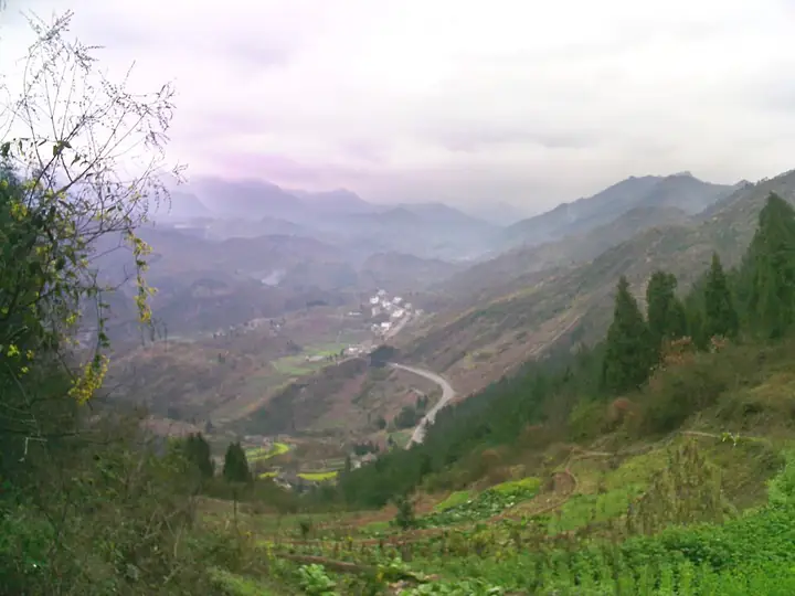
Photo adjustments
Full-frame source proportionally resized and converted to WebP for display. No subject alteration. Source-supplied marks and edits remain; cards may crop the view.
- Administrative area
- County · 县
- Part of
- Zunyi City
- Chinese name
- 习水县
- Local areas
- County guide
Area & population
- Area in the source
- 3,063.28 km²
- Population · 2010
- 522,541
- Administrative seat
- Donghuang
Source: cited geographic source, as of the dates shown.
History
In the Spring and Autumn and Warring States periods the area was known as Xibu or the state of Xi (鳛部、鳛国). It was moved from Sichuan to Guizhou in 1728, and Xishui County has existed under that name since 1915. Surviving remains include Han-dynasty cliff carvings, sites of the Bo people (僰人) and the Jiulongtun military stockade (九龙囤). The county traces its liquor history to gouju wine (枸酱酒) and the envoy Tang Meng's (唐蒙) mission to Nanyue (南越). In the Qing, Yuan Jindao (袁锦道) set up 48 workshops at Sanchahe (三岔河), which the county counts as the start of early industry in Guizhou.
In 1935 the Central Red Army made the first, second and fourth of its four crossings of the Chishui River within Xishui, and the county calls itself the main battlefield of that campaign.
What to see
Tucheng Ancient Town (土城古镇), on the Chishui River, holds a cluster of 17 memorial halls and museums. Among them, the Four Crossings of the Chishui River Memorial Hall (四渡赤水纪念馆), opened in 2007, is a national first-grade museum and a 4A scenic area. Others include a memorial hall to the women of the Red Army, the Guizhou Shipping Museum (贵州航运博物馆) and an exhibition on salt transport along the Chishui. The Qinggangpo battle site (青杠坡战斗遗址) is also in the county.
Besides Tucheng and the memorial hall, the county's 4A scenic areas are the China Danxia Valley (中国·丹霞谷) and the Xijiu liquor valley (习酒酒谷). The county government also points to the Feige sea of clouds (飞鸽云海), the red cliffs of Chibi Danxia (赤壁丹霞), an old tree called the Thousand-Year Fir King (千年杉王) and the Miao village of Hetang (荷塘苗乡).
Setting and landscape
Danxia landform covers 1,300 square kilometres of the county. Xishui also holds 50,000 hectares of mid-subtropical evergreen broadleaf forest, described by the county government as the best preserved at latitude 28° north; it forms the largest nature reserve in Guizhou by area. Elevations run from 275 metres to 1,871.9 metres, and the average annual temperature is 13.6°C.
Food and local products
Xishui is a core production area for sauce-aroma baijiu in the Chishui River valley, home to the Xijiu Group (习酒集团) and Moutai's 201 plant (茅台201厂).
Getting oriented
Chongqing's Qijiang District (綦江区) lies to the east and Gulin County (古蔺县) in Sichuan to the south. Three expressways cross the county: the Renxichi (仁习赤), Jiangxigu (江习古) and Xizheng (习正) routes.
Highlights
- Tucheng Ancient Town 土城古镇: Chishui River town with 17 memorial halls and museums.
- Four Crossings of the Chishui River Memorial Hall 四渡赤水纪念馆: Opened 2007 in Tucheng; a national first-grade museum and 4A scenic area.
- China Danxia Valley 中国·丹霞谷: One of the county's 4A scenic areas, in a county with 1,300 square kilometres of Danxia landform.
- Xijiu liquor valley 习酒酒谷: 4A scenic area tied to Xishui's sauce-aroma baijiu industry.
Sources for this guide
习水旅游概况 · Xishui County People's Government
习水简介 · Xishui County People's Government
【展馆推介】四渡赤水纪念馆 · Xishui County People's Government
Original English written from the listed sources and checked sentence by sentence against quoted extracts by a separate reviewer. Updated 2026-09-24.
Explore Xishui County
Core places to explore, with English and Chinese names.
Places to explore around Xishui County
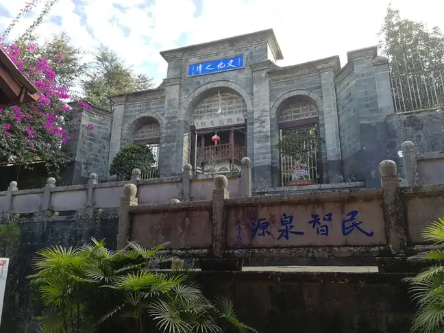 Tucheng Ancient Town ·
 Plan your visit
Getting there
Xishui County is about 105 km in a straight line from central Zunyi City. Search for 习水县 in a map app to find stations and your accommodation.
Where to stay →Build your route
Start with Tucheng Ancient Town. The linked place guides have entrance and visit details.
Continue with Zunyi City →More in Zunyi City
Sources & geographic information
Administrative names and parent areas: Official geographic directory · Reference date 2026-09-06.
Photo: Tucheng Ancient Town · Source photographer · License not provided. EXIF orientation normalized; resized without changing aspect ratio; converted to WebP. No subject edits.
Map data © OpenStreetMap contributors. Pins mark approximate centres, not entrances or boundaries.