


Get to know Lingshui Li Autonomous County
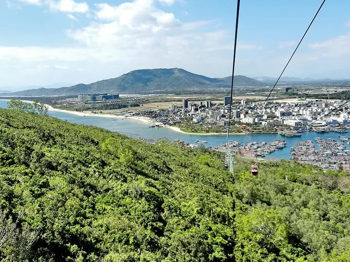
Photo adjustments
Full frame retained; resized proportionally to a maximum dimension of 960 pixels and converted to WebP quality 88. No crop, retouch, generated elements, or subject alteration. Final website rendition: full frame retained, proportionally resized to at most 720 pixels and converted to WebP. No additional retouching or subject alteration. Card displays may crop the view.
- Administrative area
- Autonomous county · 自治县
- Part of
- Hainan
- Chinese name
- 陵水黎族自治县
- Local areas
- Autonomous county guide
Area & population
- Area in the source
- 1,128.00 km²
- Population · 1999
- 318,691
- Administrative seat
- Yelin Town
Source: cited geographic source, as of the dates shown.
Setting and landscape
The county government sums up its scenery as "three bays, three islands, two lakes, two hot springs, one mountain and one river". The bays are Qingshui Bay (清水湾), Xiangshui Bay (香水湾) and Tufu Bay (土福湾), and the islands Fenjiezhou Island (分界洲岛), Nanwan Monkey Island (南湾猴岛) and Coconut Island (椰子岛). The lakes are the Xincun (新村) and Li'an (黎安) lagoons, the hot springs are at Gaofeng (高峰) and Nanping (南平), and the mountain and river are Diaoluo Mountain and the Ling River (陵河). The yearly mean temperature is around 25°C, and China News Service puts the coastline at 118.57 km.
History
A Lingshui County was created under the Sui dynasty in 610 and demoted to a town in 1074 under the Song. In 1958 it was merged with Ya County (崖县) and Baoting (保亭), was restored in 1961, and became a Li autonomous county in 1987. The former Lingshui County Soviet Government site (陵水县苏维埃政府旧址), which the county government describes as the first county-level soviet regime in the Qiongya (琼崖) revolutionary base, is a national key cultural relics protection site. On 9 April 1965 US Navy F-4B fighters and PLA Navy J-5 jets fought an air battle over the county.
What to see
People's Daily describes Fenjiezhou Island as China's first island scenic area rated 5A, with reef, cliff and wreck diving. Nanwan Monkey Island, on the Nanwan peninsula in the south, is a macaque reserve reached by a cable car of more than 2,000 m over the sea. Below the cable car, in Xincun harbour (新村港), more than 600 floating fish farms of the Tanka (疍家) boat people form what is known as a "sea market" (海上街市). Qingshui Bay has a 12 km shoreline whose sand squeaks underfoot. Diaoluo Mountain National Forest Park covers lowland primary tropical rainforest with over a hundred waterfalls; the Fengguoshu (枫果树) falls drop 350 m.
Food
Lingshui sour rice noodles (陵水酸粉) taste sour, spicy and sweet and come with plenty of condiments, and are sometimes simply called Hainan noodles.
Highlights
- Fenjiezhou Island 分界洲岛: Described by People's Daily as China's first 5A-rated island scenic area, with diving over reefs, cliffs and a wreck.
- Nanwan Monkey Island 南湾猴岛: A macaque reserve on the Nanwan peninsula, reached by a sea-crossing cable car of more than 2,000 m.
- Tanka fish rafts 疍家渔排: Over 600 floating fish farms in Xincun harbour, known as the "sea market".
- Qingshui Bay 清水湾: A 12 km stretch of coast with squeaking sand.
- Lingshui sour rice noodles 陵水酸粉: Sour, spicy and sweet noodles with plenty of condiments.
Sources for this guide
陵水黎族自治县 - 维基百科,自由的百科全书 · Chinese Wikipedia · CC BY-SA 4.0
历史沿革——2024年亮点_陵水黎族自治县人民政府网 · Lingshui Li Autonomous County People's Government
【环游海南】海南陵水,满满的都是好风景! · People's Daily Online, Hainan channel
人这一辈子,一定要去一趟陵水!-中国新闻网 · China News Service
Original English written from the listed sources and checked sentence by sentence against quoted extracts by a separate reviewer. Updated 2026-09-25.
Explore Lingshui Li Autonomous County
Core places to explore, with English and Chinese names.
Places to explore around Lingshui Li Autonomous County
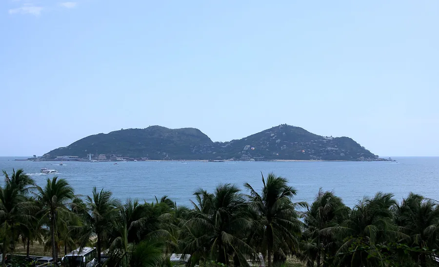 Fenjiezhou, or Boundary Island, seen across the sea off Lingshui, Hainan; 12 February 2013.
Boundary Island分界洲岛
Boundary Island lies just offshore near the meeting of Wanning and Lingshui. A ferry crossing leads to a compact island of rocky coast, sea viewpoints and developed marine recreation. The land-based paths offer a worthwhile…
Read the place guide →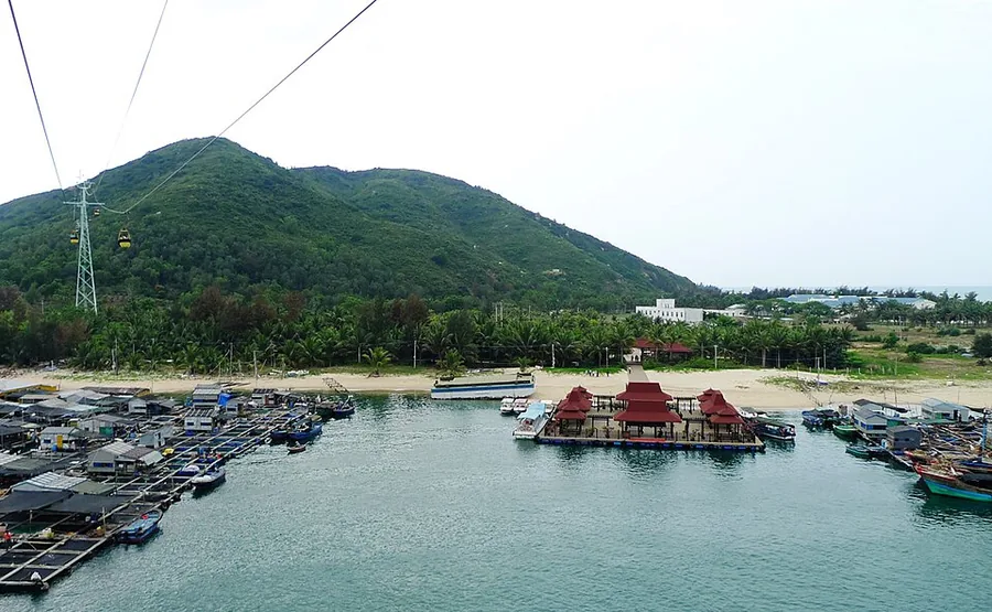 The cable-car approach over the harbour toward Nanwan Monkey Island, March 2009.
Nanwan Monkey Island南湾猴岛
Nanwan Monkey Island is actually a peninsula reached from Xincun, with a visitor area devoted to macaques and a memorable approach over the harbour. The cable-car journey, when operating, overlooks fishing rafts and the…
Read the place guide →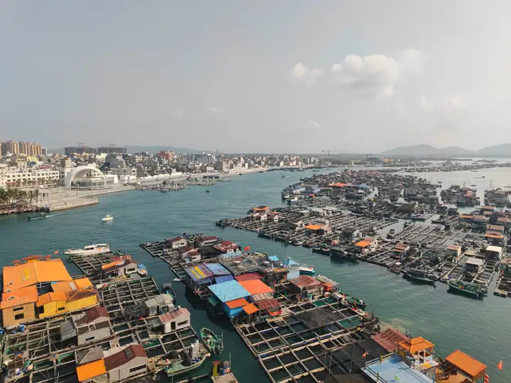 Xincun Tanka Raft Community · 疍家渔排文化区
Xincun Tanka Raft Community疍家渔排文化区
The Tanka raft area at Xincun in Lingshui is a waterfront cultural landscape associated with boat-based livelihoods and the sheltered waters of Xincun Bay.
Read the place guide →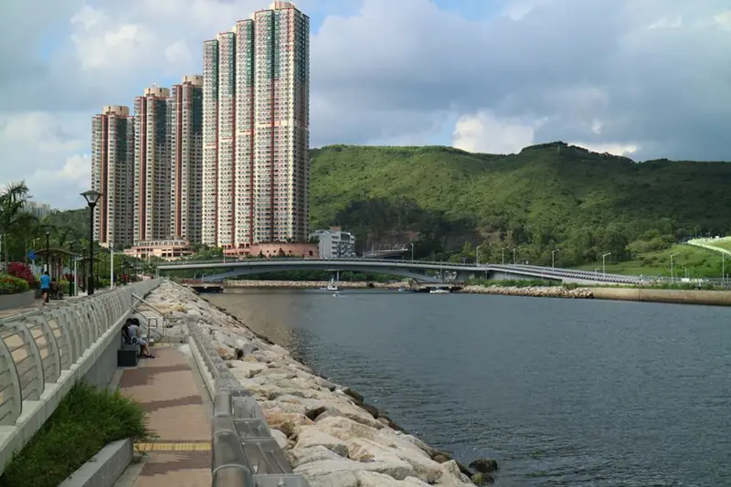 Clear Water Bay · 清水湾
Clear Water Bay清水湾
Clear Water Bay, or Qingshui Bay, is Lingshui’s long resort coast between the Yingzhou and Xincun areas. Its appeal is space: a broad beach, sea views and a slower pace than central Sanya. Choose a specific public access or…
Read the place guide →Local life & food
Lingshui Li Autonomous County local specialties
陵水黎族自治县特色美食 · 8 specialties to discover
 Lingshui sour noodles 陵水酸粉
The noodles are soft and slippery, with a tangy, savory coating and crunchy or chewy accents from the toppings.
Source ↗Read the dish guide →.jpg)
Photo adjustments
EXIF orientation applied where present; resized proportionally to at most 640 px on the long edge and encoded as WebP. No crop, retouching, recoloring or subject changes.
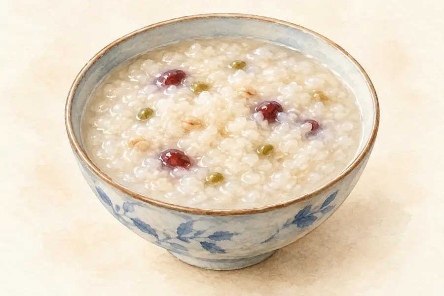 Tanka Pufferfish Congee 疍家气鼓鱼粥AI illustration · AI 示意图(仅供参考,非实拍)
Tanka Pufferfish Congee (疍家气鼓鱼粥) is a rice congee of the Tanka (疍家), Hainan's boat-dwelling fishing people, made with a spiny reef fish they call qiguyu (气鼓鱼).
Read the dish guide → Pipa Crab 琵琶蟹AI illustration · AI 示意图(仅供参考,非实拍)
Pipa Crab (琵琶蟹) is a Hainan crab named for its shell, which is shaped like a frog and like a pipa (琵琶), the Chinese lute.
Read the dish guide → Qingbuliang 清补凉
The drinkable base is sweet and cooling, while the toppings provide soft, chewy and crisp contrasts. Coconut-rich versions are more creamy than clear ones.
Source ↗Read the dish guide →.jpg)
Photo adjustments
EXIF orientation applied where present; resized proportionally to at most 640 px on the long edge and encoded as WebP. No crop, retouching, recoloring or subject changes.
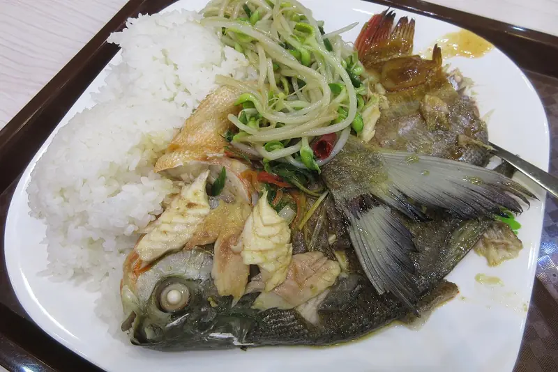 Xincun Seafood 新村海鲜
Xincun Seafood (新村海鲜) is the seafood cooked by the Tanka (疍家) boat people of Xincun Town (新村镇) in the south of Lingshui Li Autonomous County (陵水黎族自治县), much of it served in restaurants on the fish rafts of Xincun harbour (新村港).
Read the dish guide →
Photo adjustments
EXIF orientation normalized; resized without changing aspect ratio; converted to WebP. No subject edits.
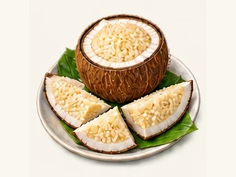 Coconut rice 椰子饭AI illustration · AI 示意图
The rice is dense and softly chewy, with a gentle coconut fragrance and sweetness; a thin layer of coconut flesh may add bite.
Source ↗Read the dish guide →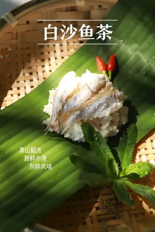 Li Fermented Fish and Rice 黎家鱼茶
Li Fermented Fish and Rice (黎家鱼茶), known in Hainan as yucha, is a Li (黎族) dish of raw fish mixed with cooked rice and salt and left to ferment in a sealed jar.
Source ↗Read the dish guide →Photo adjustments
EXIF orientation normalized; resized without changing aspect ratio; converted to WebP. No subject edits.
 Pan-Fried Spanish Mackerel 香煎马鲛鱼AI illustration · AI 示意图(仅供参考,非实拍)
Pan-Fried Spanish Mackerel (香煎马鲛鱼) is listed among the local specialties of Lingshui Li Autonomous County, Hainan. The name includes 鱼 (fish). 煎 describes pan-frying.
Read the dish guide →More dishes from across Hainan are in the Hainan food guide.
Plan your visit
Getting there
Search for 陵水黎族自治县 in a map app to find stations and your accommodation.
Where to stay →Build your route
Boundary Island and Nanwan Monkey Island are about 30 km apart in a straight line. The linked place guides have entrance and visit details.
Continue with Hainan →More in Hainan
Sources & geographic information
Administrative names and parent areas: Official geographic directory · Reference date 2026-09-06.
Some facts checked against 陵水黎族自治县 — Wikipedia contributors, CC BY-SA 4.0.
Photo: Boundary Island · Zhangmoon618 · CC BY-SA 3.0. Proportionally resized and converted to WebP without cropping, retouching or changing the photographed subject.

Photo: Nanwan Monkey Island · Lucius Kwok · CC BY-SA 2.0. Proportionally resized and converted to WebP without cropping, retouching or changing the photographed subject.

Photo: Xincun Tanka Raft Community · Source photographer · License not provided. EXIF orientation normalized; resized without changing aspect ratio; converted to WebP. No subject edits.

Photo: Clear Water Bay · ChrisChun · CC BY-SA 4.0. EXIF orientation normalized; resized without changing aspect ratio; converted to WebP. No subject edits.

Map data © OpenStreetMap contributors. Pins mark approximate centres, not entrances or boundaries.