


Get to know Nanpi County
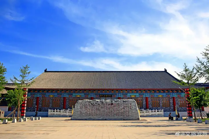
Photo adjustments
EXIF orientation normalized; resized without changing aspect ratio; converted to WebP. No subject edits.
- Administrative area
- County · 县
- Part of
- Cangzhou
- Chinese name
- 南皮县
- Local areas
- County guide
Area & population
- Area in the source
- 836.00 km²
- Population · 2020
- 347,473
Source: cited geographic source, as of the dates shown.
Setting and landscape
The county is flat, lying on average 7 to 13 metres above sea level. Besides the canal, the Zhangwei New River (漳卫新河) and the Xuanhui River (宣惠河) cross it, and Dalangdian (大浪淀) is also within its bounds. Rainfall averages 568 millimetres a year and the mean temperature is 12.3°C.
History
When Duke Huan of Qi marched north to rescue the state of Yan (燕) from the Shanrong (山戎), he built a walled town here to make leather, known as Pi (皮城), about 5 kilometres northeast of today's county town. Because there was a "Northern Pi Pavilion" (北皮亭) at Zhangwu (章武) to the north, this town became Nanpi, "southern Pi". The Qin set up Nanpi County in 221 BC, the seat of Bohai Commandery (勃海郡) moved to Nanpi in 122 AD, and under the Eastern Wei the county town moved to its present site.
The Nanpi government lists among its notable natives Zhang Zhidong, counted with Zeng Guofan (曾国藩), Li Hongzhang (李鸿章) and Zuo Zongtang (左宗棠) as one of the four great ministers of the late-Qing revival; the Tang geographer Jia Dan (贾耽); and Liu Xikui (刘喜奎), the first actress to perform in modern-dress drama.
What to see
The Stone Vajra (石金刚) in the county town are a pair of Tang-dynasty stone guardian figures, one stern and one kindly, finely carved with lively expressions; they became a Hebei provincial protected site on 23 July 1982. The same day, the tomb of Yin Jifu (尹吉甫墓), locally called the General's Grave (将军坟), at Huangjiawa (黄家洼村), was also listed. Yin Jifu was a minister of the Western Zhou whom the county describes as a statesman, military leader and poet; his burial mound stands 1.9 metres high.
Food and local products
Nanpi's farm specialities are Yali pears (鸭梨), golden-thread jujubes (金丝小枣) and adzuki beans (小豆). Millet-flour wotou buns (小米面窝头) have a long history here, and quanlu mian (全卤面), a version of noodles in thick gravy (打卤面), belongs to Nanpi and its neighbours. The county grows alfalfa on about 50,000 mu and makes glassware, mostly by hand, in more than a thousand designs, including crackle-ice, bubble and frosted finishes, all exported to over 30 countries and regions.
Getting oriented
Nanpi is 35 kilometres from urban Cangzhou, 148 kilometres from Tianjin and 234 kilometres from Beijing. The Tianjin–Pukou section of the Beijing–Shanghai railway and the Handan–Huanghua railway cross the county, and National Highway 104 runs through its west.
Highlights
- Stone Vajra 石金刚: Two Tang-dynasty stone guardian figures in the county town; Hebei provincial protected site since 1982.
- Tomb of Yin Jifu 尹吉甫墓: Burial mound of the Western Zhou minister Yin Jifu at Huangjiawa, known locally as the General's Grave; provincial protected site since 1982.
- Nanpi glassware 南皮玻璃器皿: Mostly hand-made glass in more than a thousand designs, exported to over 30 countries and regions.
- Quanlu mian 全卤面: Noodles in thick gravy, a local dish of Nanpi and neighbouring areas.
Sources for this guide
南皮县 - 维基百科,自由的百科全书 · Wikipedia (Chinese) · CC BY-SA 4.0
地方特产_南皮县人民政府 · Nanpi County People's Government
著名人物_南皮县人民政府 · Nanpi County People's Government
行政区划_南皮县人民政府 · Nanpi County People's Government
石金刚 - 维基百科,自由的百科全书 · Wikipedia (Chinese) · CC BY-SA 4.0
尹吉甫墓 - 维基百科,自由的百科全书 · Wikipedia (Chinese) · CC BY-SA 4.0
Original English written from the listed sources and checked sentence by sentence against quoted extracts by a separate reviewer. Updated 2026-09-24.
Explore Nanpi County
Core places to explore, with English and Chinese names.
Nanpi County 南皮县
Plan your visit
Getting there
Nanpi County is about 30 km in a straight line from central Cangzhou. Search for 南皮县 in a map app to find stations and your accommodation.
Where to stay →More in Cangzhou
Sources & geographic information
Administrative names and parent areas: Official geographic directory · Reference date 2026-09-06.
Some facts checked against 南皮县 — Wikipedia contributors, CC BY-SA 4.0.
Some facts checked against 石金刚 — Wikipedia contributors, CC BY-SA 4.0.
Some facts checked against 尹吉甫墓 — Wikipedia contributors, CC BY-SA 4.0.
Map data © OpenStreetMap contributors. Pins mark approximate centres, not entrances or boundaries.