


Get to know Yunhe District
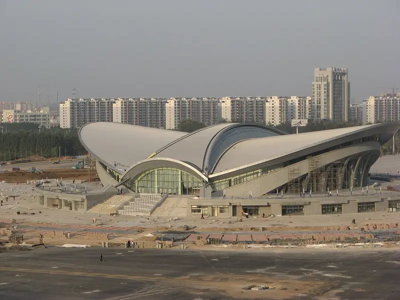
Photo adjustments
Full frame retained; EXIF orientation normalized, proportionally resized to at most 800 pixels and converted to WebP. No generated pixels or subject changes. Cards may crop the display.
- Administrative area
- District · 市辖区
- Part of
- Cangzhou
- Chinese name
- 运河区
- Local areas
- District guide
Area & population
- Area in the source
- 118.05 km²
- Population · 2020 census
- 511,086
- Administrative seat
- Shuiyuesi Subdistrict
Source: cited geographic source, as of the dates shown.
Setting and history
The district was created in March 1980. When the city's suburban district was abolished in October 1997, most of Nanchentun (南陈屯) and Xiaowangzhuang (小王庄) townships were moved into it. Qingchi Avenue (清池大道) marks its boundary with Xinhua District (新华区). The climate is warm-temperate and monsoonal, with 500 to 700 millimetres of rain a year.
In Cangzhou the canal is the South Canal (南运河), which crosses eight of the city's counties and districts over 216 kilometres. The stretch through central Cangzhou is well preserved and winds through many bends past old sites, and boats began running on the urban section again in September 2022.
What to see
Three towers stand less than 500 metres apart beside the canal: Qingfeng Tower (清风楼), Nanchuan Tower (南川楼) and Langyin Tower (朗吟楼). The last two are rebuilt landmarks inside Nanchuan Old Street (南川老街), which lies between Nanhu Lake (南湖) and the canal beside the old Nanchuan ferry. Nanchuan Tower was first built early in the Ming Jiajing reign as property of the Changlu salt administration (长芦盐运司); Langyin Tower is named after a poem attributed to Lü Dongbin (吕洞宾).
Hebei's list of provincial protected sites includes the Cangzhou Confucian Temple (沧州文庙) on Xiaoshi Street, dating from the Ming and Qing; the Zhengtai tea house (正泰茶庄) of 1914 just east of it; the Ming-era North Great Mosque (清真北大寺) on Jiefang Road; and the Ming tomb of Liu Tao (刘焘墓), a general who fought Japanese pirates. The district also holds the city museum and library, and parks such as Canal Park (运河公园), Nanhu Park (南湖公园), the Grand Canal Forest Park (大运河森林公园) and the Hundred Lions Garden (百狮园).
Food and local products
Local specialities served in Nanchuan Old Street include Dusheng steamed buns (杜生包子), hotpot chicken (火锅鸡) and donkey-meat flatbread sandwiches (驴肉火烧).
Getting oriented
The district lies 180 kilometres from Beijing and 110 kilometres from Tianjin. The Beijing–Shanghai high-speed railway and the Shuozhou–Huanghua railway (朔黄铁路) have stations at the city, four expressways meet around it, and national highways 104 and 307 pass through.
Highlights
- Nanchuan Old Street 南川老街: Canal-side street between Nanhu Lake and the old Nanchuan ferry, with the rebuilt Nanchuan and Langyin towers.
- Qingfeng Tower 清风楼: One of the three canal-side towers standing less than 500 metres apart.
- Cangzhou Confucian Temple 沧州文庙: Ming and Qing temple on Xiaoshi Street, a Hebei provincial protected site.
- North Great Mosque 清真北大寺: Ming mosque on Jiefang Road, a Hebei provincial protected site.
Sources for this guide
运河概况_运河区人民政府 · Yunhe District People's Government, Cangzhou
运河为脉 以文兴旅——沧州依托大运河文化带建设深化文旅融合发展_运河区人民政府 · Yunhe District People's Government, Cangzhou
文化中国行·特色街区探访丨南川老街 品史观景乐在其中-中国雄安官网 · Xiong'an New Area official website (report by Changcheng Net)
运河区 - 维基百科,自由的百科全书 · Chinese Wikipedia · CC BY-SA 4.0
运河区各级文物保护单位列表 - 维基百科,自由的百科全书 · Chinese Wikipedia · CC BY-SA 4.0
Original English written from the listed sources and checked sentence by sentence against quoted extracts by a separate reviewer. Updated 2026-09-24.
Explore Yunhe District
Core places to explore, with English and Chinese names.
Places to explore around Yunhe District
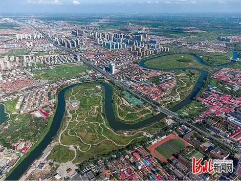 Cangzhou Grand Canal Old Town Pedestrian Area ·
 Plan your visit
Getting there
Yunhe District covers the centre of Cangzhou. Search for 运河区 in a map app to find stations and your accommodation.
Where to stay →Build your route
Start with Cangzhou Grand Canal Old Town Pedestrian Area. The linked place guides have entrance and visit details.
Continue with Cangzhou →More in Cangzhou
Sources & geographic information
Administrative names and parent areas: Official geographic directory · Reference date 2026-09-06.
Some facts checked against 运河区 — Wikipedia contributors, CC BY-SA 4.0.
Some facts checked against 运河区各级文物保护单位列表 — Wikipedia contributors, CC BY-SA 4.0.
Photo: Cangzhou Grand Canal Old Town Pedestrian Area · Source photographer · License not provided. EXIF orientation normalized; resized without changing aspect ratio; converted to WebP. No subject edits.
Map data © OpenStreetMap contributors. Pins mark approximate centres, not entrances or boundaries.