


Get to know Renqiu
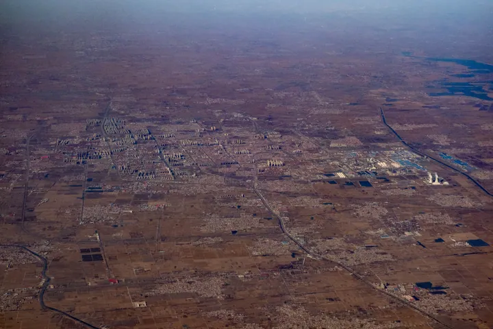
Photo adjustments
Full frame retained; proportionally resized and converted to WebP. No retouching or changes to the photographed subject. Card displays may crop the view.
- Administrative area
- County-level city · 县级市
- Part of
- Cangzhou
- Chinese name
- 任丘市
- Local areas
- County-level city guide
Area & population
- Area in the source
- 1,012.00 km²
- Population · 2020 census
- 816,401
Source: cited geographic source, as of the dates shown.
Setting and landscape
Renqiu sits on a low plain of ridges, slopes, hollows and lakes, with depressions scattered across it and narrow strips of higher ground running between them. The land falls gently from southwest to northeast, from about 11 metres above sea level to 4.5 metres. Baiyangdian, called the "West Lake of the North" (北地西湖) and the "Pearl of North China" (华北明珠), lies about 10 kilometres northwest of the urban area; 64.8 square kilometres of its water fall within Renqiu, and the lake is a national 5A scenic area.
History
According to the old Sanjunji (三郡记), the city takes its name from Ren Qiu (任丘), a Western Han general who built a wall here in AD 2 to guard against raiders from the sea; the historian Wang Zhongluo (王仲荦) recorded that earlier scholars already doubted this account. The city government lists the physician Bian Que (扁鹊), the Western Han classicist Han Ying (韩婴) and the Three Kingdoms general Zhang He (张郃) among Renqiu's famous natives. In 1938 the Central Hebei (冀中) party committee, administrative office and military command moved to Renqiu to lead resistance against Japan.
What to see
The Yabazhuang Longshan culture site (哑叭庄龙山文化遗址), known locally as "Gedading" (疙瘩顶), lies 3.5 kilometres west of the city; digs in 1989 and 1990 by the Hebei Provincial Institute of Cultural Relics with the Cangzhou prefecture relics office recovered more than 1,300 objects of pottery, stone, bone, horn, shell and jade. The Gaoguo marquisate capital site (高郭侯国国都遗址), a town site used from the Warring States to the Western Han, lies north of Houzhaogezhuang village (后赵各庄) in Qingta township (青塔乡); it was first excavated in 2008 during construction of the Daguang Expressway (大广高速).
Local intangible heritage includes Renqiu drum-song (任丘大鼓) and Dongjiang laodiao opera (东姜老调); the Xin'anzhuang music society (辛安庄音乐会) is on the national list.
Getting oriented
Renqiu is 114 kilometres from Cangzhou city, and its urban area lies 151 kilometres south of Beijing. The Beijing–Kowloon Railway (京九铁路) runs through the city with a stop at Renqiu station, and the Daguang Expressway and National Highway 106 cross its territory.
Highlights
- Baiyangdian 白洋淀: Lake about 10 km northwest of the city, a national 5A scenic area; 64.8 km² of its water lies in Renqiu.
- Yabazhuang Longshan culture site 哑叭庄龙山文化遗址: Neolithic site 3.5 km west of the city; more than 1,300 objects recovered in 1989–1990.
- Xin'anzhuang music society 辛安庄音乐会: Village music society on the national intangible heritage list.
Sources for this guide
任丘市人民政府 · Renqiu Municipal People's Government
任丘市人民政府 · Renqiu Municipal People's Government
任丘市人民政府 · Renqiu Municipal People's Government
任丘市 - 维基百科,自由的百科全书 · Wikipedia (Chinese) · CC BY-SA 4.0
Original English written from the listed sources and checked sentence by sentence against quoted extracts by a separate reviewer. Updated 2026-09-24.
Explore Renqiu
Core places to explore, with English and Chinese names.
Plan your visit
Getting there
Renqiu is about 80 km in a straight line from central Cangzhou. Search for 任丘市 in a map app to find stations and your accommodation.
Where to stay →More in Cangzhou
Sources & geographic information
Administrative names and parent areas: Official geographic directory · Reference date 2026-09-06.
Some facts checked against 任丘市 — Wikipedia contributors, CC BY-SA 4.0.
Map data © OpenStreetMap contributors. Pins mark approximate centres, not entrances or boundaries.