


Get to know Yongqing County
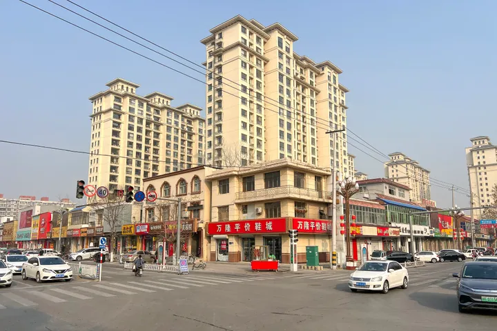
Photo adjustments
Full frame retained; proportionally resized and converted to WebP. No retouching or changes to the photographed subject. Card displays may crop the view.
- Administrative area
- County · 县
- Part of
- Langfang
- Chinese name
- 永清县
- Local areas
- County guide
Area & population
- Area in the source
- 774.00 km²
- Administrative seat
- Yongqingxian Subdistrict (永清县街道)
Source: cited geographic source, as of the dates shown.
History
The name dates from 742, when Emperor Xuanzong of the Tang renamed the local county "Yongqing", taken from a phrase meaning lasting peace on the frontier. After the Later Zhou retook the Yijin Pass (益津关) in 959, a second Yongqing County was set up at present-day Bazhou (霸州), and for a time two counties of the same name stood side by side, the northern one under the Liao and the southern one under the Song.
In the modern era Yongqing was folded into Ba County in 1958 and restored as a county in 1961. The county government names the Yuan chancellor Shi Tianze (史天泽), the historian Lei Haizong (雷海宗) and the anti-Japanese war general Lü Zhengcao (吕正操) among its notable natives, and calls the county the birthplace of the Yang family generals (杨家将) story cycle.
What to see
The county holds two sites on the national protection list. The Song-Liao frontier tunnels (宋辽边关古战道遗址) are underground passages the early Northern Song dug against Liao raids; found in the mid-20th century, they spread across five counties, with about 300 square kilometres of the network in Yongqing, and were listed in 2006. The Daxinge Stone Pagoda (大辛阁石塔) is a Liao-dynasty stone pagoda at Daxinge, listed by Hebei in 1982 and raised to national status in 2013.
The Yongqing Costume Museum (永清服装博物馆) in the county's high-tech zone was founded in 2014 by Zhao Bo (赵波), a Hebei intangible-heritage inheritor. It holds more than 2,000 pieces in five display halls and one hall for fashion shows, covering Chinese dress history, cloud collars, Qing court clothing, Republican-era qipao and the dress of China's 56 ethnic groups. The museum treats a Qing yellow kesi silk jacket with a longevity and ruyi pattern as its prize piece.
Food and local products
Dafanzhuang (大范庄) in Biguzhuang Town (别古庄镇) grows Yali pears on the sandy soil left by the old course of the Yongding River (永定河). The county history records pear orchards there in the Tongzhi reign of the Qing, and from 1971 the Tianjin fruit company bought the crop for export through Tianjin port, the origin of the "Hebei Yali pear" (河北鸭梨) label. The county government also lists fruit-stone carving (永清核雕) and clothing among its specialty trades.
Highlights
- Song-Liao frontier tunnels 宋辽边关古战道遗址: Early Northern Song underground passages against the Liao; national protected site since 2006.
- Daxinge Stone Pagoda 大辛阁石塔: Liao-dynasty stone pagoda; national protected site since 2013.
- Yongqing Costume Museum 永清服装博物馆: Founded 2014; more than 2,000 pieces of historic and ethnic dress.
- Dafanzhuang Yali pears 大范庄鸭梨: Grown on the old Yongding River course since the Qing; exported via Tianjin from 1971.
Sources for this guide
永清简介 · Yongqing County People's Government
历史文化 · Yongqing County People's Government
边关地道遗址 · Wikipedia (Chinese) · CC BY-SA 4.0
大辛阁石塔 · Wikipedia (Chinese) · CC BY-SA 4.0
到永清服装博物馆——看一场历史大秀 赏华夏服饰之美 · Yongqing County People's Government
名扬海外的大范庄河北鸭梨 · Yongqing County People's Government
Original English written from the listed sources and checked sentence by sentence against quoted extracts by a separate reviewer. Updated 2026-09-24.
Explore Yongqing County
Core places to explore, with English and Chinese names.
Yongqing County 永清县
Plan your visit
Getting there
Yongqing County is about 30 km in a straight line from central Langfang. Search for 永清县 in a map app to find stations and your accommodation.
Where to stay →More in Langfang
Sources & geographic information
Administrative names and parent areas: Official geographic directory · Reference date 2026-09-06.
Some facts checked against 边关地道遗址 — Wikipedia contributors, CC BY-SA 4.0.
Some facts checked against 大辛阁石塔 — Wikipedia contributors, CC BY-SA 4.0.
Map data © OpenStreetMap contributors. Pins mark approximate centres, not entrances or boundaries.