


Get to know Pingshan County

Photo adjustments
Full frame retained; resized proportionally to a maximum dimension of 960 pixels and converted to WebP quality 88. No crop, retouch, generated elements, or subject alteration. Final website rendition: full frame retained, proportionally resized to at most 720 pixels and converted to WebP. No additional retouching or subject alteration. Card displays may crop the view.
- Administrative area
- County · 县
- Part of
- Shijiazhuang
- Chinese name
- 平山县
- Local areas
- County guide
Area & population
- Area in the source
- 2,641.00 km²
- Population · 2020 census
- 423,333
Source: cited geographic source, as of the dates shown.
Setting and landscape
The land rises from east to northwest in the shape of a winnowing basket open to the east, from 120 metres at Dongshuinian village (东水碾村) to 2,281 metres on Tuoliang (驼梁), the county's highest point. The Hutuo River flows in from Yu County (盂县) in Shanxi and passes through the Gangnan (岗南水库) and Huangbizhuang (黄壁庄水库) reservoirs, built on the main stream after centuries of floods; its tributary the Ye River (冶河) flows through the county town.
History
In 380 BC the state of Zhongshan (中山国) moved its capital to Lingshou, at today's Shangsanji township (上三汲乡); the Zhongshan city site (中山古城遗址) is on the national heritage list and the Lingshou city of Zhongshan (中山灵寿故城) on the provincial list. The county took the name Pingshan in AD 756. In 1948 the Communist Party central organs gathered here: Mao Zedong reached Xibaipo in May 1948, the campaigns of Liaoshen, Huaihai and Pingjin were run from a 44-square-metre command room, and the Second Plenary Session of the Seventh Central Committee met in the central organs' canteen from 5 March 1949. The People's Daily (人民日报) was founded in Lizhuang village (里庄村) in June 1948 as the organ of the North China Bureau.
What to see
The former Central Committee site at Xibaipo is a major national heritage site, and the Xibaipo scenic area was rated 5A in 2011. The original village was moved when the Gangnan Reservoir was approved in 1958; in 1959 heritage specialists surveyed and recorded the houses, and CCTV reports that today's buildings closely reproduce the originals. The Xibaipo memorial hall has a corridor carved with 37 telegrams Mao drafted for the front.
Xibaipo and Tiangui Mountain (天桂山) together form a national scenic area, and Tiangui Mountain and Tuoliang are each rated 4A. The Wanshou Temple pagoda forest (万寿寺塔林) and the Yujia Mountain cliff carvings (瑜伽山摩崖造像) are on the national heritage list, and the Huhushui power plant site (沕沕水电厂旧址), dating from 1947–1948, is protected at provincial level.
Highlights
- Xibaipo 西柏坡: Seat of the Communist Party centre in 1948–1949; national heritage site and 5A scenic area.
- Tuoliang Mountain 驼梁: Highest point of the county at 2,281 metres; 4A scenic area.
- Tiangui Mountain 天桂山: 4A scenic area, part of the Xibaipo–Tiangui Mountain national scenic area.
- Huhushui power plant site 沕沕水电厂旧址: Power plant of 1947–1948, now a provincial heritage site.
- Zhongshan city site 中山古城遗址: Zhongshan city site on the national heritage list.
Sources for this guide
平山县 - 维基百科,自由的百科全书 · Wikipedia (Chinese) · CC BY-SA 4.0
CCTV.com · CCTV (China Central Television)
Original English written from the listed sources and checked sentence by sentence against quoted extracts by a separate reviewer. Updated 2026-09-25.
Explore Pingshan County
Core places to explore, with English and Chinese names.
Places to explore around Pingshan County
 Xibaipo · 西柏坡
Xibaipo西柏坡
Xibaipo presents the village headquarters from which the Communist leadership directed the final phase of the Chinese Civil War before moving to Beijing in 1949. The visit combines exhibition galleries with reconstructed…
Read the place guide → Tiangui Mountain · 天桂山
Tiangui Mountain天桂山
Tiangui Mountain in Pingshan County combines steep rocky scenery with Daoist temple compounds.
Read the place guide →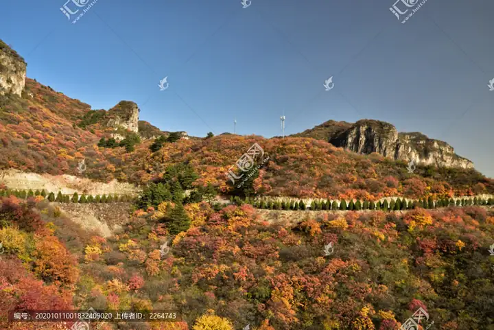 Huhushui Waterfalls · 沕沕水
Huhushui Waterfalls沕沕水
Huhushui in Pingshan County pairs a mountain waterfall landscape with a historic hydroelectric station.
Read the place guide → Tuoliang Mountain · 驼梁
Tuoliang Mountain驼梁
Tuoliang is a high mountain landscape in Pingshan County, with forested valleys giving way to open upland meadow.
Read the place guide →Plan your visit
Getting there
Pingshan County is about 35 km in a straight line from central Shijiazhuang. Search for 平山县 in a map app to find stations and your accommodation.
Where to stay →Build your route
Xibaipo and Tiangui Mountain are both listed here. The linked place guides have entrance and visit details.
Continue with Shijiazhuang →More in Shijiazhuang
Sources & geographic information
Administrative names and parent areas: Official geographic directory · Reference date 2026-09-06.
Some facts checked against 平山县 — Wikipedia contributors, CC BY-SA 4.0.
Photo: Xibaipo · N509FZ · CC BY-SA 4.0. Resized and WebP compressed; subject not altered.
.jpg)
Photo: Tiangui Mountain · Source photographer · License not provided. EXIF orientation normalized; resized without changing aspect ratio; converted to WebP. No subject edits.
Photo: Huhushui Waterfalls · Source photographer · License not provided. EXIF orientation normalized; resized without changing aspect ratio; converted to WebP. No subject edits.
Photo: Tuoliang Mountain · Source photographer · License not provided. EXIF orientation normalized; resized without changing aspect ratio; converted to WebP. No subject edits.
Map data © OpenStreetMap contributors. Pins mark approximate centres, not entrances or boundaries.