


Get to know Julu County
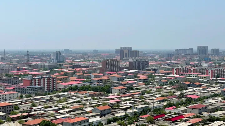
Photo adjustments
Full frame retained; proportionally resized and converted to WebP. No retouching or changes to the photographed subject. Card displays may crop the view.
- Administrative area
- County · 县
- Part of
- Xingtai
- Chinese name
- 巨鹿县
- Local areas
- County guide
Area & population
- Area in the source
- 623.00 km²
- Administrative seat
- Julu (巨鹿镇)
Source: cited geographic source, as of the dates shown.
History
The county government traces the name to the ancient Dalu (大陆, also written 大麓), called after the Dalu marsh (大陆泽). It says Lü Buwei (吕不韦) wrote Dalu as Julu in the Lüshi Chunqiu (吕氏春秋) during the Warring States period, and that Julu was one of the 36 commanderies set up by the Qin.
In the twelfth month of 207 BC Xiang Yu (项羽) destroyed the main Qin army below the walls of Julu, a decisive battle in the war that ended the Qin. The county also lists the Yellow Turban rising among the events that took place here, and counts the Tang chancellor Wei Zheng (魏徵) and the astronomer monk Yixing (一行) among its natives.
What to see
The Julu old town site (巨鹿故城遗址), also called the "Julu Song town" (巨鹿宋城), was the county seat under the Tang and Song. Founded in 685, it lies south-west of the present county town and is the county's only provincial protected site. On the fourth day of the eighth month of 1108 the Yellow River broke its banks and buried the town under about two zhang of silt; only part of the Sanming Temple (三明寺) stayed above the water. Liang Qichao (梁启超) called it "the Pompeii of the East".
People digging wells found the town and large amounts of porcelain in 1918. The county government says the National History Museum's dig of July 1921, especially at the Sanming Temple, is regarded by scholars as the start of urban archaeology in China. The world's only three surviving Song printing blocks came out of the site in 1919: one is in the New York Public Library and two in the Museum of Chinese History. Song wooden tables and chairs from the site are in the Nanjing Museum (南京博物院).
Food and local products
Julu is known as "China's home of honeysuckle" (金银花), and the county government describes it as the country's largest growing area and trading centre for the flower. Chinese Wikipedia also lists goji berries (枸杞), Chuanzhihong apricots (串枝红杏) and hard white wheat as local products.
Getting oriented
Two provincial roads cross the county, the Dingwei road (定魏线) running north–south and the Xingde road (邢德线) east–west, and the Xingtai–Hengshui Expressway (邢衡高速) also crosses from east to west. The Xingtai–Huanghua Railway (邢黄铁路), opened in December 2013, has a Julu station, and National Highway 230 passes through.
Highlights
- Julu old town site 巨鹿故城遗址: Tang–Song county town founded in 685 and buried by a Yellow River flood in 1108; provincial protected site.
- Sanming Temple 三明寺: Part of it stayed above the 1108 flood; its excavation in 1921 is regarded as the start of urban archaeology in China.
- Julu honeysuckle 金银花: Julu is called China's home of honeysuckle and its largest growing area and trading centre.
Sources for this guide
巨鹿简介 - 巨鹿县人民政府 · Julu County People's Government
巨鹿县人民政府 · Julu County People's Government
巨鹿故城遗址 - 巨鹿县人民政府 · Julu County People's Government
金银花之乡——巨鹿县 - 巨鹿县人民政府 · Julu County People's Government
巨鹿县 - 维基百科,自由的百科全书 · Wikipedia (Chinese) · CC BY-SA 4.0
Original English written from the listed sources and checked sentence by sentence against quoted extracts by a separate reviewer. Updated 2026-09-24.
Explore Julu County
Core places to explore, with English and Chinese names.
Julu County 巨鹿县
Plan your visit
Getting there
Julu County is about 50 km in a straight line from central Xingtai. Search for 巨鹿县 in a map app to find stations and your accommodation.
Where to stay →More in Xingtai
Sources & geographic information
Administrative names and parent areas: Official geographic directory · Reference date 2026-09-06.
Some facts checked against 巨鹿县 — Wikipedia contributors, CC BY-SA 4.0.
Map data © OpenStreetMap contributors. Pins mark approximate centres, not entrances or boundaries.