


Get to know Lincheng County
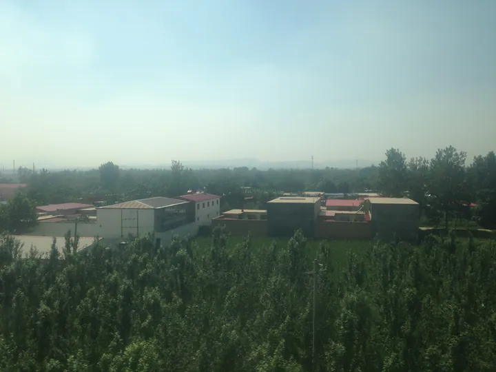
Photo adjustments
Full frame retained; proportionally resized and converted to WebP. No retouching or changes to the photographed subject. Card displays may crop the view.
- Administrative area
- County · 县
- Part of
- Xingtai
- Chinese name
- 临城县
- Local areas
- County guide
Area & population
- Area in the source
- 797.00 km²
- Administrative seat
- Lincheng Town (临城镇)
Source: cited geographic source, as of the dates shown.
Setting and landscape
The land falls in steps from west to east, from a highest peak of 1,508 m in the west to 38.7 m in the east. Mountains cover about 35 percent of the county, hills about half and plain under 15 percent, which the county sums up as "seven parts mountain, two parts water, one part field". Qishan Lake (岐山湖), also called the Xishu Reservoir (西竖水库), was built from 1958 by 30,000 labourers over two years; it was renamed Lincheng Reservoir in 1963 and has been called Qishan Lake since 1990.
History
In the Spring and Autumn period this was Linyi (临邑), a town of the state of Jin. The Western Han set up Fangzi County (房子县), with its seat at today's Cangfang village in Gaoyi (高邑); in 742 the Tang renamed the county Lincheng after an old town of that name ten li to the south-west and moved the seat to the present county town. The county government says silk floss from Fangzi was sent as tribute. Lincheng was merged into Neiqiu (内丘) in 1958 and restored in 1962.
What to see
Kongshan White Cloud Cave (崆山白云洞) formed in Cambrian limestone about 500 million years old. It was found in 1988, opened in 1990, and is a national scenic area, a national geopark and a 4A scenic area; Tiantai Mountain (天台山), another 4A area, is nearby.
In the county town, the Puli Temple Pagoda (普利寺塔) dates from 1052 and was repaired in 1538 and 1576. The seven-storey square brick pagoda imitates timber construction, stands 27.35 m on a 5.83 m stone platform and carries 1,041 Buddha figures, which gives it the popular name Thousand-Buddha Pagoda (千佛塔). It became a national protected site in 2001.
The Xing kiln sites (邢窑遗址) in the county run 16 km north to south, from Xishuangjing village (西双井村) to Ciyaogou village (磁窑沟村). Fifteen kiln sites, fired from the Northern Dynasties to the Ming, have been found, and the kilns were listed as a national protected site on 20 November 1996. Xing ware firing is on the national intangible heritage list.
Food and local products
Lincheng crisp fish (临城酥鱼) is made with wild carp, grass carp, silver carp or crucian carp from Qishan Lake. The fish is coloured with rock sugar, seasoned with scallion, ginger, garlic, Sichuan pepper and star anise, and simmered over a low fire for three to four hours until the bones are soft.
Getting oriented
The Beijing–Guangzhou Railway (京广铁路) has a Lincheng station.
Highlights
- Kongshan White Cloud Cave 崆山白云洞: Karst cave in Cambrian limestone, found in 1988; national scenic area, national geopark and 4A scenic area.
- Puli Temple Pagoda 普利寺塔: Northern Song brick pagoda of 1052 with 1,041 Buddha figures; national protected site since 2001.
- Xing kiln sites 邢窑遗址: Fifteen kiln sites from the Northern Dynasties to the Ming; national protected site since 1996.
- Lincheng crisp fish 临城酥鱼: Qishan Lake fish slow-simmered for three to four hours until the bones are soft.
Sources for this guide
自然地理 - 临城县人民政府 · Lincheng County People's Government
临城县 - 维基百科,自由的百科全书 · Wikipedia (Chinese) · CC BY-SA 4.0
崆山白云洞 - 临城县人民政府 · Lincheng County People's Government
普利寺塔 - 临城县人民政府 · Lincheng County People's Government
邢窑遗址 - 临城县人民政府 · Lincheng County People's Government
历史文化 - 临城县人民政府 · Lincheng County People's Government
临城酥鱼 - 临城县人民政府 · Lincheng County People's Government
Original English written from the listed sources and checked sentence by sentence against quoted extracts by a separate reviewer. Updated 2026-09-24.
Explore Lincheng County
Core places to explore, with English and Chinese names.
Places to explore around Lincheng County
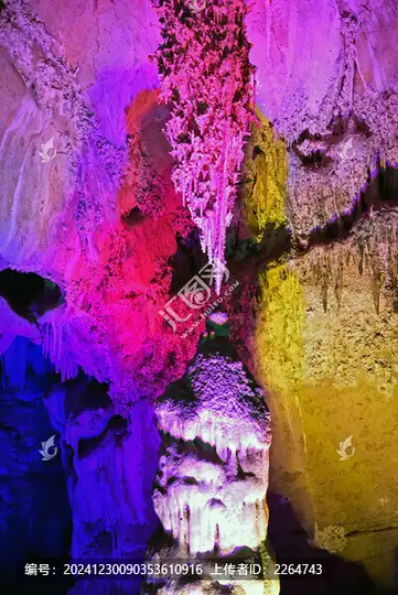 Kongshan White Cloud Cave ·
 Plan your visit
Getting there
Lincheng County is about 40 km in a straight line from central Xingtai. Search for 临城县 in a map app to find stations and your accommodation.
Where to stay →Build your route
Start with Kongshan White Cloud Cave. The linked place guides have entrance and visit details.
Continue with Xingtai →More in Xingtai
Sources & geographic information
Administrative names and parent areas: Official geographic directory · Reference date 2026-09-06.
Some facts checked against 临城县 — Wikipedia contributors, CC BY-SA 4.0.
Photo: Kongshan White Cloud Cave · Source photographer · License not provided. EXIF orientation normalized; resized without changing aspect ratio; converted to WebP. No subject edits.
Map data © OpenStreetMap contributors. Pins mark approximate centres, not entrances or boundaries.