


Get to know Ningjin County
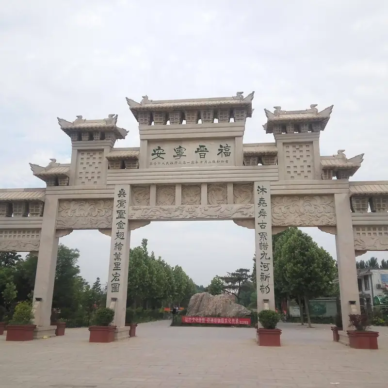
Photo adjustments
EXIF orientation normalized; resized without changing aspect ratio; converted to WebP. No subject edits.
- Administrative area
- County · 县
- Part of
- Xingtai
- Chinese name
- 宁晋县
- Local areas
- County guide
Area & population
- Area in the source
- 1,107.00 km²
- Administrative seat
- Fenghuang Town (凤凰镇)
Source: cited geographic source, as of the dates shown.
Setting and landscape
The land falls gently from north-west to south-east, with only about 12 metres between the highest point (36.5 m, at Mijiazhuang (米家庄)) and the lowest (24.4 m). Eleven rivers, among them the Xiao (洨河), Fuyang (滏阳河) and Old Zhang (老漳河), gather here, and the county has long been called the "lower end of nine rivers" (九河下梢). The south-east is a flood-retention depression that was once open water: Ningjin Marsh (宁晋泊), the northern part of the old Dalu Lake (大陆泽). The marsh lost its steady supply when the Hutuo River (滹沱河) moved north in 1839 and later dried up entirely.
Three fault zones cross the county, which lies in the North China earthquake region. On 22 March 1966 two earthquakes of magnitude 6.7 and 7.2 struck near Dongwang (东汪), flattening every house in a 137-square-kilometre zone; the county government counts it among the larger earthquakes of the past hundred years.
History
In the Western Han, in 196 BC, the counties of Yangshi (杨氏县) and Yingtao (廮陶县) were set up here under Julu commandery (巨鹿郡). The name Ningjin dates from 742, under the Tang, and was chosen for its meaning of peace and good fortune. Between 1820 and 1913 the first character was written differently to avoid the personal name of the Daoguang emperor. The county seat was laid out in the shape of a resting phoenix, following a local legend, and the county calls it the "phoenix city". Tales of Yao (尧) handing power to Shun (舜) and of the archer Ji Chang (纪昌) learning to shoot are also told here, and three villages in the county are named Jichangzhuang (纪昌庄).
Food and local products
Wheat and maize are the main crops. The county lists Xuehua pears (雪花梨), Ya pears (鸭梨) and edible fungi as its local specialities. It has also been named China's home of wire and cable (中国电线电缆之乡).
Getting oriented
The county seat is in Fenghuang Town (凤凰镇), and the county government puts Ningjin 50 kilometres from Shijiazhuang. The Beijing–Guangzhou railway, National Highway 107 and the Beijing–Hong Kong–Macau expressway run along its western side, while the Qingdao–Yinchuan expressway and National Highway 308 cross it. Neighbours are Zhao County (赵县) and Jinzhou (晋州) to the north, Xinhe (新河县), Jizhou (冀州区) and Xinji (辛集) to the east, Longyao (隆尧县) and Julu (巨鹿县) to the south, and Baixiang (柏乡县) to the west.
Sources for this guide
宁晋县基本概况 - 宁晋县人民政府 · Ningjin County People's Government
宁晋县情 - 宁晋县人民政府 · Ningjin County People's Government
Original English written from the listed sources and checked sentence by sentence against quoted extracts by a separate reviewer. Updated 2026-09-24.
Explore Ningjin County
Core places to explore, with English and Chinese names.
Ningjin County 宁晋县
Plan your visit
Getting there
Ningjin County is about 75 km in a straight line from central Xingtai. Search for 宁晋县 in a map app to find stations and your accommodation.
Where to stay →More in Xingtai
Sources & geographic information
Administrative names and parent areas: Official geographic directory · Reference date 2026-09-06.
Map data © OpenStreetMap contributors. Pins mark approximate centres, not entrances or boundaries.