


Get to know Nangong
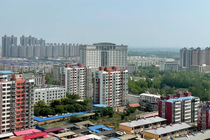
Photo adjustments
Full frame retained; proportionally resized and converted to WebP. No retouching or changes to the photographed subject. Card displays may crop the view.
- Administrative area
- County-level city · 县级市
- Part of
- Xingtai
- Chinese name
- 南宫市
- Local areas
- County-level city guide
Area & population
- Area in the source
- 863.30 km²
- Population · 2017
- 523,000
Source: cited geographic source, as of the dates shown.
History
Nangong County was set up in the early Western Han, covering about half its present area, and grew from the Jianwu era (25–40) onwards. It was folded into Xinhe (新河) in 1052 and restored in 1073, and its borders were roughly as they are now after Xinhe was split off again in 1232. The county became a city in 1986.
In the war against Japan the city government calls Nangong the "red capital" of South Hebei (冀南) and its "little Yan'an". It was the headquarters of the Eastern Advance Column of the Eighth Route Army's 129th Division, the South Hebei Military Region and the South Hebei administrative office, and Deng Xiaoping, Liu Bocheng and Xu Xiangqian all worked here.
What to see
The Putong Pagoda and Putong Temple (普彤塔, 普彤寺) are dated by the city government to AD 67, when the Indian monks Kasyapa Matanga (摄摩腾) and Dharmaratna (竺法兰) are said to have built them, one year before the White Horse Temple in Luoyang. The pagoda is a national protected site; the old temple is gone and the present one is a modern rebuilding.
The Houdige site (后底阁遗址), 29 km south-east of the city in Houdige village, Zizhong town (紫冢镇), was a town from the Northern Dynasties to the Tang. Digs in 2006 found Buddhist figures in stone and pottery, many of them finely carved white marble, and the site became a national protected site in 2013. The South Hebei Martyrs' Cemetery (冀南烈士陵园), one of Hebei's three major martyrs' cemeteries, has been a national protected site since 1988.
The Song Jun stele (宋君碑) of 591 is held up by the city government as a model of Sui clerical script. The late-Qing calligrapher Zhang Yuzhao (张裕钊) wrote and composed the stele on rebuilding the Nangong county school, a Hebei protected relic; the "Nangong style" (南宫体) of calligraphy he created is popular in Japan and South-East Asia.
Food and local products
Nangong makes wool felt and sheepskin shearling: Chinese Wikipedia records the titles "China's famous city of shearling and felt" (2004) and "China's capital of sheepskin shearling" (2012). It also grows cotton, wheat, maize, millet and peanuts, and was named a national "home of martial arts" in 1992.
Getting oriented
The Beijing–Kowloon Railway (京九铁路) runs through the east of the urban area and the Handan–Huanghua Railway (邯黄铁路) through the west. The Qingdao–Yinchuan, Daqing–Guangzhou and Xingtai–Hengshui expressways meet National Highways 106 and 308 here.
Highlights
- Putong Pagoda 普彤塔: Dated by the city government to AD 67; national protected site.
- Houdige site 后底阁遗址: Northern Dynasties to Tang town site with white-marble Buddhist figures; national protected site since 2013.
- South Hebei Martyrs' Cemetery 冀南烈士陵园: National protected site since 1988.
- Nangong-style calligraphy 南宫体: Style created by Zhang Yuzhao through his Nangong county school stele.
Sources for this guide
南宫市 - 维基百科,自由的百科全书 · Wikipedia (Chinese) · CC BY-SA 4.0
历史变迁--南宫市人民政府门户网站 · Nangong Municipal People's Government
闻名遐迩的红色抗战文化--南宫市人民政府门户网站 · Nangong Municipal People's Government
历史悠久的佛教文化--南宫市人民政府门户网站 · Nangong Municipal People's Government
蜚声海外的书法文化--南宫市人民政府门户网站 · Nangong Municipal People's Government
Original English written from the listed sources and checked sentence by sentence against quoted extracts by a separate reviewer. Updated 2026-09-24.
Explore Nangong
Core places to explore, with English and Chinese names.
Plan your visit
Getting there
Nangong is about 85 km in a straight line from central Xingtai. Search for 南宫市 in a map app to find stations and your accommodation.
Where to stay →More in Xingtai
Sources & geographic information
Administrative names and parent areas: Official geographic directory · Reference date 2026-09-06.
Some facts checked against 南宫市 — Wikipedia contributors, CC BY-SA 4.0.
Map data © OpenStreetMap contributors. Pins mark approximate centres, not entrances or boundaries.