


Get to know Shahe
- Administrative area
- County-level city · 县级市
- Part of
- Xingtai
- Chinese name
- 沙河市
- Local areas
- County-level city guide
Area & population
- Area in the source
- 999.00 km²
- Population · 2017
- 457,000
Source: cited geographic source, as of the dates shown.
Setting and landscape
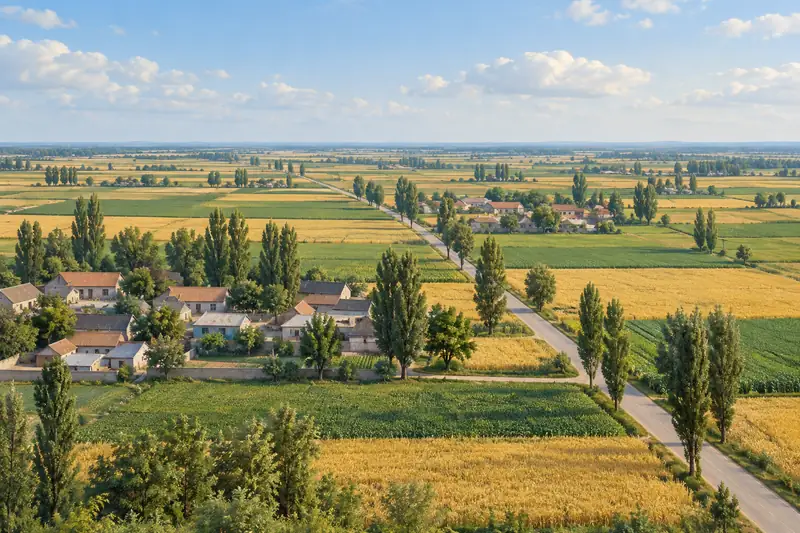
The land is high in the west and low in the east, split roughly into thirds between mountains, hills and plain: the Taihang ranges and foothills in the centre and west, the North China Plain in the east. Seven reservoirs sit in the western hills, and the main canal of the South–North Water Diversion central route runs through the city from north to south.
History
The area belonged to Jin (晋) in the Spring and Autumn period and to Zhao (赵) in the Warring States. Shahe County was created in 596, under the Sui, and became a county-level city in 1987. Among the figures linked to it are the Tang chancellor Song Jing (宋璟) and Zhang Wenqian (张文谦), a senior minister of the Yuan. Its heritage includes the Song Jing stele written by the calligrapher Yan Zhenqing (颜真卿) and a text of the "Plum Blossom Rhapsody" (梅花赋) in the Qianlong emperor's hand.
What to see
Provincial key scenic areas in Shahe include Qinwang Lake (秦王湖), also called the Dongshiling Reservoir (东石岭水库); Mount Beiwudang (北武当山), known locally as "Laoye Mountain" (老爷山); and the old stone houses of Taihang Chuanzhai (太行川寨古石楼群).
Two national intangible-heritage items belong to Shahe. The rattan-shield formation (沙河藤牌阵), listed in 2006, now survives only in Shilipu village (十里铺村); by local legend a man from the retreating army of Li Zicheng (李自成) taught it there. Shield-bearers holding a short sword spar with men armed with tridents, broadswords, spears or staves, directed by war drums and gongs. Shahe shadow play (沙河皮影戏), listed in 2021, uses cowhide and donkey-hide figures and singing styles that blend southern Hebei music with Shanxi clapper opera; the troupe of Xiaxie village (下解村) is named as its representative company.
Food and local products
Farms raise laying hens and grow wheat, rice and maize. Local specialities include Ya pears (鸭梨), chestnuts, walnuts, plums, apricots, grapes and persimmons. Shahe is a known source of iron ore, coal and china clay, and the city has more than a hundred glass makers.
Getting oriented
The Beijing–Guangzhou railway, the Beijing–Guangzhou high-speed railway and National Highway 107 run through the urban area, the Beijing–Hong Kong–Macau expressway passes through the city, and the Xingtai–Linqing and Xingtai–Fenyang expressways cross it. Xingtai Dalian Airport (邢台褡裢机场) is within Shahe.
Highlights
- Qinwang Lake 秦王湖: Also called the Dongshiling Reservoir; a provincial key scenic area.
- Mount Beiwudang 北武当山: Mountain known locally as Laoye Mountain, a provincial key scenic area.
- Shahe rattan-shield formation 沙河藤牌阵: Shield-and-weapon drill kept in Shilipu village, national intangible heritage since 2006.
Sources for this guide
沙河市 - 维基百科 · Wikipedia (Chinese) · CC BY-SA 4.0
新华网河北频道 政府网群 沙河 概况 · Xinhua News Agency, Hebei channel
沙河藤牌阵 - 中国非物质文化遗产网 · China Intangible Cultural Heritage Network (ihchina.cn)
皮影戏(沙河皮影戏) - 中国非物质文化遗产网 · China Intangible Cultural Heritage Network (ihchina.cn)
Original English written from the listed sources and checked sentence by sentence against quoted extracts by a separate reviewer. Updated 2026-09-24.
Explore Shahe
Core places to explore, with English and Chinese names.
Plan your visit
Getting there
Shahe is about 25 km in a straight line from central Xingtai. Search for 沙河市 in a map app to find stations and your accommodation.
Where to stay →More in Xingtai
Sources & geographic information
Administrative names and parent areas: Official geographic directory · Reference date 2026-09-06.
Some facts checked against 沙河市 — Wikipedia contributors, CC BY-SA 4.0.
Map data © OpenStreetMap contributors. Pins mark approximate centres, not entrances or boundaries.