


Get to know Raohe County
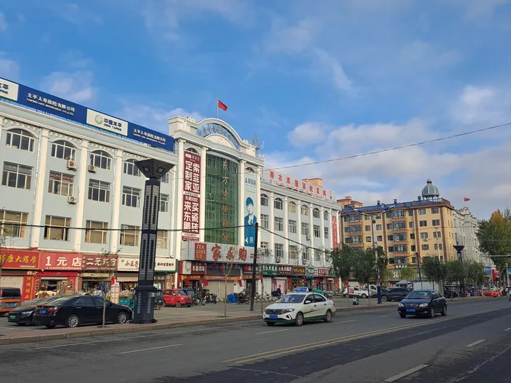
Photo adjustments
Full frame retained; proportionally resized and converted to WebP. No retouching or changes to the photographed subject. Card displays may crop the view.
- Administrative area
- County · 县
- Part of
- Shuangyashan
- Chinese name
- 饶河县
- Local areas
- County guide
Area & population
- Population · 2003
- 140,000
Source: cited geographic source, as of the dates shown.
History
The county was created in 1909, in the first year of the Xuantong reign, with its seat at Xiaojiaqi River (小佳气河). The seat moved to the mouth of the Naoli River (挠力河) at today's Dong'an (东安镇) in 1917 and to Tuanshanzi (团山子), now Raohe town, in 1925. From 1960 to 1964 Raohe was merged with Hulin (虎林) as Hurao County (虎饶县).
Raohe is where the Raohe People's Anti-Japanese Guerrilla Brigade (饶河民众反日游击大队) was founded, and the Raohe Anti-Japanese Guerrilla Monument (饶河抗日游击队纪念碑) is in the first batch of martyrs' memorial buildings under national protection. The Hezhen folk song "Ussuri Boat Song" (乌苏里船歌) originated here.
What to see
The Sipai Hezhen Folk Custom Park (四排赫哲族风情园) covers 1.2 hectares and is listed by the Shuangyashan government as the only folk park in the Ussuri basin devoted to Hezhen culture. It has a folk museum, a history hall, a craft workshop, traditional Hezhen houses, a shrine and a group of totem poles, and hosts the Hezhen River Lantern Festival every mid-July. On 2 May 2021 Sipai Hezhen Ethnic Township (四排赫哲族乡) held its ninth Ussuri river-opening festival, with shaman dances and the first net of the season cast into the river.
Dadingzi Mountain Forest Park (大顶子山森林公园), 19 km northwest of the county town, rises to 801 m, the county's second-highest peak, along a ridge of eight summits where many rhododendrons grow, above all Rhododendron dauricum (兴安杜鹃).
The Kalka tourist area (喀尔喀旅游区) is a provincial geopark with three parts: a basalt stone forest, the Naoli River wetland, and a fossil site at Dong'an with Late Jurassic to Early Cretaceous marine rocks holding ammonites.
Food and local products
Raohe is known as the "Honey Capital" (蜜都) for its Northeast black bee (东北黑蜂) honey. A national nature reserve of 270,000 hectares in the county protects the black bee and its nectar plants, and Raohe's black-bee honey, propolis, pollen and royal jelly carry national geographical-indication status. At the 2021 river-opening festival Hezhen fishermen cooked their specialities "river fish stewed in river water" (江水炖江鱼) and tala ha (塔拉哈).
Highlights
- Sipai Hezhen Folk Custom Park 四排赫哲族风情园: Hezhen folk museum, craft workshop and houses; River Lantern Festival in mid-July.
- Dadingzi Mountain Forest Park 大顶子山森林公园: Eight-summit ridge of 801 m, 19 km northwest of the county town.
- Kalka tourist area 喀尔喀旅游区: Provincial geopark with a basalt stone forest, Naoli River wetland and ammonite beds.
- Northeast black bee 东北黑蜂: Raohe's black-bee honey, propolis, pollen and royal jelly are national geographical-indication products.
Sources for this guide
饶河县 · Wikipedia (Chinese) · CC BY-SA 4.0
四排赫哲族风情园 · Shuangyashan Municipal People's Government (tourism listing)
大顶子山森林公园 · Shuangyashan Municipal People's Government (tourism listing)
喀尔喀旅游区 · Shuangyashan Municipal People's Government (tourism listing)
我县举行赫哲族第九届乌苏里江开江民俗文化节 · Raohe County People's Government
Original English written from the listed sources and checked sentence by sentence against quoted extracts by a separate reviewer. Updated 2026-09-24.
Explore Raohe County
Core places to explore, with English and Chinese names.
Places to explore around Raohe County
 Ussuri River Sipai Hezhe Folk Culture Area ·
 Plan your visit
Getting there
Raohe County is about 220 km in a straight line from central Shuangyashan. Search for 饶河县 in a map app to find stations and your accommodation.
Where to stay →Build your route
Start with Ussuri River Sipai Hezhe Folk Culture Area. The linked place guides have entrance and visit details.
Continue with Shuangyashan →More in Shuangyashan
Sources & geographic information
Administrative names and parent areas: Official geographic directory · Reference date 2026-09-06.
Some facts checked against 饶河县 — Wikipedia contributors, CC BY-SA 4.0.
Photo: Ussuri River Sipai Hezhe Folk Culture Area · Source photographer · License not provided. EXIF orientation normalized; resized without changing aspect ratio; converted to WebP. No subject edits.
Map data © OpenStreetMap contributors. Pins mark approximate centres, not entrances or boundaries.