


Get to know Suiling County
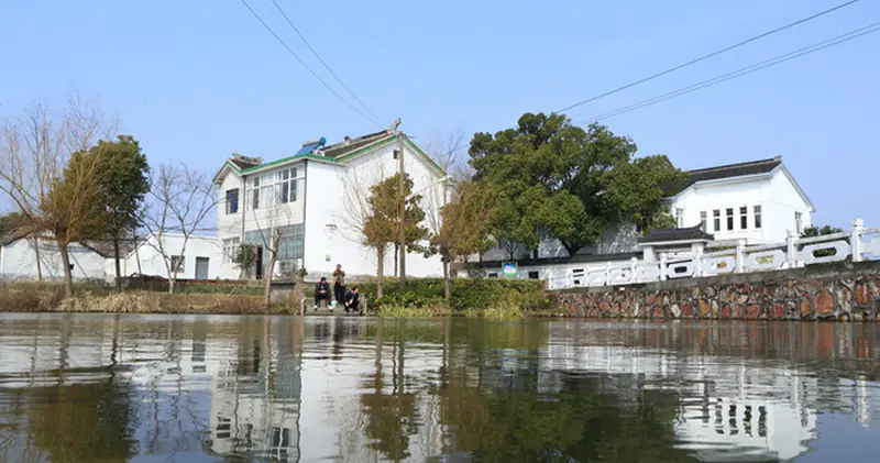
Photo adjustments
EXIF orientation normalized; resized without changing aspect ratio; converted to WebP. No subject edits.
- Administrative area
- County · 县
- Part of
- Suihua
- Chinese name
- 绥棱县
- Local areas
- County guide
Area & population
- Area in the source
- 4,350.25 km²
Source: cited geographic source, as of the dates shown.
Setting and landscape
The county government calls Suiling a typical half-mountain county and sums up its land as "six parts hills, one part water, three parts fields" (六山一水三分田). Three main rivers cross it, the Numin (努敏河), the Keyin (克音河) and the Morgen (墨尔根河), and the Hongqi (红旗) and Xiangyang (向阳) reservoirs are its two medium-sized reservoirs. Woodland covers more than three million mu, with white pine, larch, Mongolian Scots pine (樟子松), spruce and birch among some twenty tree species. The annual average temperature is 2.4°C and the frost-free season lasts about 132 days.
Suiling lies 70 kilometres from Suihua city and 180 kilometres from Harbin (哈尔滨). The Binbei Railway (滨北铁路) and the Qianjin–Nenjiang Expressway (前嫩高速公路) pass through the county.
History
The name comes from Suileng Mountain (绥楞山). A Suileng administrative bureau was set up in 1915 and raised to a county on 1 January 1917; the name took its present written form in June 1921. During the anti-Japanese resistance the county once held the seat of the provisional Northern Manchuria Provincial Committee (北满临时省委), and the resistance leaders Zhao Shangzhi (赵尚志), Yu Tianfang (于天放), Kim Chaek (金策) and Chen Lei (陈雷) all fought here. The county was liberated in 1945.
What to see
The Suiling county government lists the Jindouwan tourist area (金斗湾旅游区), Baimashi (白马石, "White Horse Rock"), Dongbei Lake Park (东北湖公园), a botanical garden and Qingyun Temple (青云寺) among its sights, together with a forest narrow-gauge railway (森林窄轨铁路), stands of primeval forest and wetlands.
Food and local products
Suiling is one of Heilongjiang's main producers of rice, soybeans and maize, and about one million mu of its farmland has selenium-rich soil. Its farmland, mostly black soil, peat soil and meadow soil, also grows wheat, sugar beet, melons and vegetables. From the hills come more than a hundred kinds of wild produce, including bracken fern, pine nuts and hazelnuts, and over 400 medicinal plants such as ginseng and schisandra (五味子).
Highlights
- Forest narrow-gauge railway 森林窄轨铁路: Listed by the Suiling county government among the county's sights.
- Qingyun Temple 青云寺: Listed by the county government among Suiling's historic and scenic sights.
- Jindouwan tourist area 金斗湾旅游区: Tourist area listed by the Suiling county government among the county's sights.
Sources for this guide
绥棱概况 - 绥棱县人民政府 · Suiling County People's Government
自然资源 - 绥棱县人民政府 · Suiling County People's Government
绥棱县 - 维基百科,自由的百科全书 · Wikipedia (Chinese) · CC BY-SA 4.0
Original English written from the listed sources and checked sentence by sentence against quoted extracts by a separate reviewer. Updated 2026-09-30.
Explore Suiling County
Core places to explore, with English and Chinese names.
Suiling County 绥棱县
Plan your visit
Getting there
Suiling County is about 65 km in a straight line from central Suihua. Search for 绥棱县 in a map app to find stations and your accommodation.
Where to stay →More in Suihua
Sources & geographic information
Administrative names and parent areas: Official geographic directory · Reference date 2026-09-06.
Some facts checked against 绥棱县 — Wikipedia contributors, CC BY-SA 4.0.
Map data © OpenStreetMap contributors. Pins mark approximate centres, not entrances or boundaries.