


Get to know Zhaodong
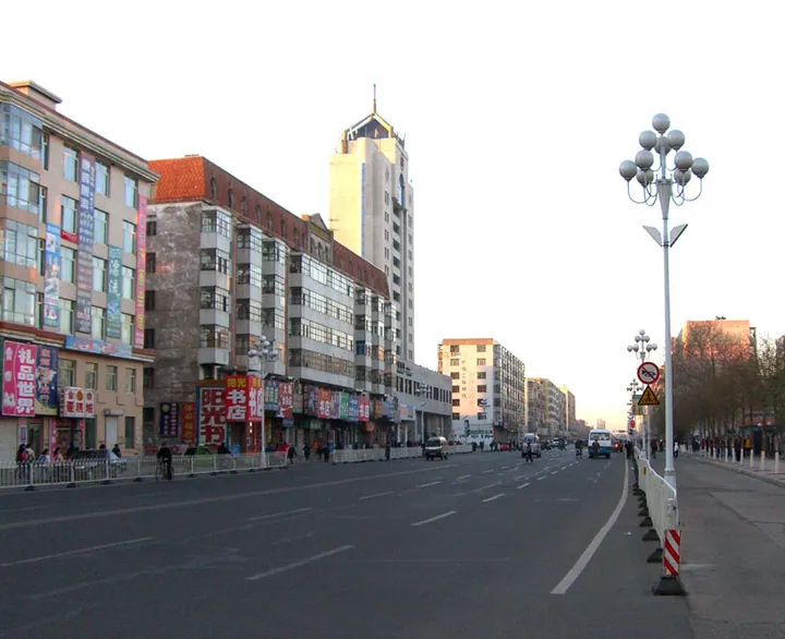
Photo adjustments
Full frame retained; proportionally resized and converted to WebP. No retouching or changes to the photographed subject. Card displays may crop the view.
- Administrative area
- County-level city · 县级市
- Part of
- Suihua
- Chinese name
- 肇东市
- Local areas
- County-level city guide
Area & population
- Area in the source
- 4,331.96 km²
- Population · 2018
- 859,001
Source: cited geographic source, as of the dates shown.
Setting and landscape
The city government places Zhaodong within the orbit of both Harbin (哈尔滨) and Daqing (大庆), and counts 68 kilometres of navigable Songhua River within its boundaries. It lies in the cold-region black-soil farming belt, with fertile fields, many water bodies and good grassland, and is a main area in the province for raising dairy cattle, beef cattle, pigs and poultry and for aquaculture. The Binzhou Railway (滨州铁路) and the Harbin–Qiqihar high-speed line (哈齐客专) run through the city, as do the Suihua–Manzhouli (绥满高速) and Harbin–Zhaodong (哈肇高速) expressways and National Highway 301.
History
Mohe (靺鞨) people lived here under the Sui and Tang, and Mongol herders became the main population from the late 13th century. Under the Qing the land belonged to the Rear Banner of the Gorlos Mongols (郭尔罗斯后旗), whose prince's residence moved in 1883 to Laoye Tun (老爷屯), in today's Sizhan town. An outpost called Zhaodong was set up at Changwucheng (昌五城) in 1908; it became a county on 11 July 1914, the county office moved to Mangou (满沟), today's Zhaodong town, in December 1937, and the county became a city on 8 September 1986.
The old name Mangou goes back to 1898, when the Chinese Eastern Railway built a station here. Because this was grazing land of the Gorlos Rear Banner, it was called the Mongol station, pronounced locally as Mangou. People also called the place Tiancaogang (甜草岗), "sweet-grass ridge", after the liquorice that grew on the higher ground.
What to see
The Balicheng site (八里城遗址), east of Caiyuanzi village in Sizhan town (四站镇), is the ruin of a Jin dynasty military town whose walls measured eight li around. Some identify it with Zhaozhou, founded in 1130, though this is disputed. It was listed by the province in 1957 and became a national key protected site in 2001.
Zhaoyueshan National Wetland Park (肇岳山国家级湿地公园), in the northwest of the city, has a hill, Zhaoyue Shan, 52 metres above sea level, whose summit looks over the city, and a gourd-shaped lake; fifteen nationally protected species, including the greater white-fronted goose and the common crane, use its waters. Along the north bank of the Songhua, the provincial riverside nature reserve (沿江省级自然保护区) stretches 68 kilometres through four towns and protects shrubland, meadow, marsh and open water, with wild soybean growing on its grasslands.
Highlights
- Balicheng site 八里城遗址: Jin dynasty military town in Sizhan town; national key protected site since 2001.
- Zhaoyueshan National Wetland Park 肇岳山国家级湿地公园: Urban wetland park in the city's northwest with a 52-metre hill and a gourd-shaped lake.
- Songhua riverside nature reserve 沿江省级自然保护区: Provincial reserve running 68 kilometres along the north bank of the Songhua River.
Sources for this guide
走进肇东 - 肇东市人民政府 · Zhaodong Municipal People's Government
历史沿革 - 肇东市人民政府 · Zhaodong Municipal People's Government
肇岳山国家级湿地公园 - 肇东市人民政府 · Zhaodong Municipal People's Government
沿江湿地自然保护区生态旅游 - 肇东市人民政府 · Zhaodong Municipal People's Government
八里城遗址 - 维基百科,自由的百科全书 · Wikipedia (Chinese) · CC BY-SA 4.0
物产资源 - 肇东市人民政府 · Zhaodong Municipal People's Government
Original English written from the listed sources and checked sentence by sentence against quoted extracts by a separate reviewer. Updated 2026-09-24.
Explore Zhaodong
Core places to explore, with English and Chinese names.
Plan your visit
Getting there
Zhaodong is about 100 km in a straight line from central Suihua. Search for 肇东市 in a map app to find stations and your accommodation.
Where to stay →More in Suihua
Sources & geographic information
Administrative names and parent areas: Official geographic directory · Reference date 2026-09-06.
Some facts checked against 八里城遗址 — Wikipedia contributors, CC BY-SA 4.0.
Map data © OpenStreetMap contributors. Pins mark approximate centres, not entrances or boundaries.