


Get to know Neihuang County
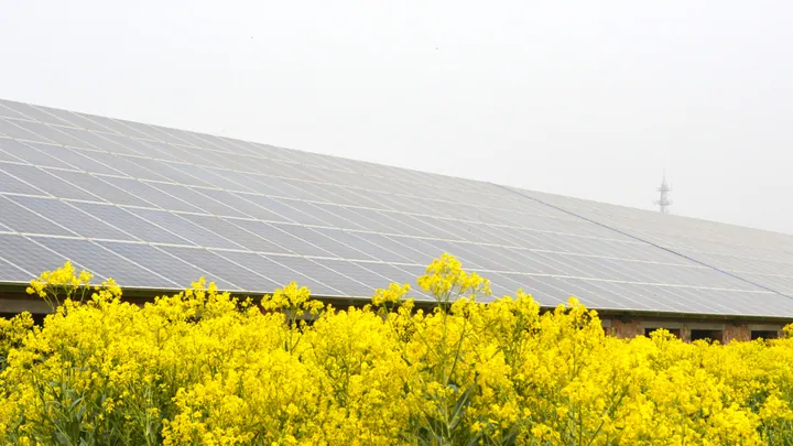
Photo adjustments
Full frame retained; proportionally resized and converted to WebP. No retouching or changes to the photographed subject. Card displays may crop the view.
- Administrative area
- County · 县
- Part of
- Anyang
- Chinese name
- 内黄县
- Local areas
- County guide
Area & population
- Area in the source
- 1,146.00 km²
- Population · 2019
- 667,100
Source: cited geographic source, as of the dates shown.
History
The county was first set up in 198 BC, under the Han founder Gaozu, and belonged to Wei commandery (魏郡). It was called Inner Huang (内黄) to tell it apart from Waihuang (外黄), 'Outer Huang', in Chenliu commandery (陈留郡). Chinese Wikipedia names it as the capital of the legendary rulers Zhuanxu (颛顼) and Diku (帝喾) and of the Shang king Taiwu (太戊), and as the birthplace of the Legalist statesman Shang Yang (商鞅).
What to see
The Sanyangzhuang Han site (三杨庄汉代遗址) at Liangzhuang (梁庄镇) is a large village of the late Western Han and a national key protected site. The Anyang city government describes it as the first large Han village of clearly identified character found by archaeologists in China: fourteen courtyards have been located, with roads, ponds and fields, and four of the courtyards have been excavated over 9,000 square metres. It has its own site museum and is compared to Pompeii.
West of Sanyangzhuang village stands the mausoleum of Zhuanxu and Diku (颛顼帝喾陵), a provincial protected site and 3A scenic area built for the second and third of the legendary Five Emperors. It faces south, with a bridge, gate, sacrificial hall and burial mounds along its axis. Tradition gives the eighteenth day of the third lunar month as Zhuanxu's birthday, when the Gaowang temple fair (高王庙会) is held, and since 2002 the county has held an ancestral festival.
Food and local products
The Neihuang county gazetteer, quoted by Anyang Daily, records jujube orchards of more than ten thousand mu here in the Tang and Song, taxed in silver. 'Neihuang jujubes' (内黄大枣) became a national geographical-indication product in 2009. The Thousand-Year Jujube Garden (千年古枣园), south of Qiankou village (千口村) in Liucun (六村乡), has 1,268 old trees in a 102-mu core area, the oldest numbered trees reckoned at 1,000 to 1,300 years, and was listed as a county protected site in 2005. Chinese Wikipedia also names hot peppers and dried tofu skin (腐竹) among local products.
Getting oriented
National Roads 230 and 341 cross the county.
Highlights
- Sanyangzhuang Han site 三杨庄汉代遗址: Late Western Han village site at Liangzhuang with fourteen courtyards found and four excavated; national key protected site with a site museum.
- Mausoleum of Zhuanxu and Diku 颛顼帝喾陵: Provincial protected site and 3A scenic area west of Sanyangzhuang village, the traditional tomb of two of the legendary Five Emperors.
- Thousand-Year Jujube Garden 千年古枣园: Orchard of 1,268 old jujube trees south of Qiankou village, the oldest reckoned at 1,000 to 1,300 years; county protected site since 2005.
Sources for this guide
风景名胜(2026年)_安阳市政府网站 · Anyang Municipal People's Government
河南安阳内黄:擦亮“红枣之乡”品牌 · Anyang Daily (reprinted by the China Agricultural Brand Research Center, Zhejiang University)
内黄县 - 维基百科,自由的百科全书 · Wikipedia (Chinese) · CC BY-SA 4.0
Original English written from the listed sources and checked sentence by sentence against quoted extracts by a separate reviewer. Updated 2026-09-24.
Explore Neihuang County
Core places to explore, with English and Chinese names.
Neihuang County 内黄县
Plan your visit
Getting there
Neihuang County is about 50 km in a straight line from central Anyang. Search for 内黄县 in a map app to find stations and your accommodation.
Where to stay →More in Anyang
Sources & geographic information
Administrative names and parent areas: Official geographic directory · Reference date 2026-09-06.
Some facts checked against 内黄县 — Wikipedia contributors, CC BY-SA 4.0.
Map data © OpenStreetMap contributors. Pins mark approximate centres, not entrances or boundaries.