


Get to know Wuyang County
- Administrative area
- County · 县
- Part of
- Luohe
- Chinese name
- 舞阳县
- Local areas
- County guide
Area & population
- Area in the source
- 776.00 km²
- Population · 2019
- 563,800
Source: cited geographic source, as of the dates shown.
Setting and landscape
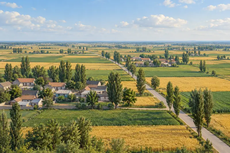
The land falls gently from south to north and from west to east, and its highest point is 102 metres. Low uplands lie in the south, several rivers cross the middle, and the north is flood-prone lowland centred on Nihewa (泥河洼). The Sha River National Wetland Park (沙河国家湿地公园), a 3A scenic area, lies in the Nihewa flood-detention zone where Beiwudu (北舞渡), Lianhua (莲花镇) and Taiwei (太尉镇) towns meet, with wide mudflats that draw migratory birds. Under the county lies a rock-salt deposit that the county government ranks first in China for grade and second for reserves.
History
The name goes back to the time of Yu of Xia (夏禹), when the settlement stood on the north bank of the Wu River (舞水). Wuyang County was set up under the Qin, and in 716 the Tang moved its seat from Beiwudu to the site of the present town. Fan Kuai (樊哙) of the Han and Sima Yi (司马懿) of Wei were made marquises here, and Wang Jian (王建), emperor of the Former Shu, was born here; the county has long been called a "land of emperors and marquises" (帝乡侯国). Wuyang peasant painting (舞阳农民画) was among Henan's first provincial intangible-heritage items.
What to see
The Jiahu site (贾湖遗址) in Jiahu village is an early Neolithic settlement dated 9,000 to 7,500 years ago. Ten excavations since 1983 by the Henan institute of archaeology and the University of Science and Technology of China have produced more than 6,000 objects, including bone flutes that the county describes as the oldest and most complete playable seven-note instruments in the world. It became a national key protected site in 2001, and the Jiahu Site Museum (贾湖遗址博物馆) has opened.
Two more national key protected sites are the Neolithic Agangsi site (阿岗寺遗址), 20 kilometres north of the county seat, whose finds mix Peiligang, Yangshao, Dawenkou, Longshan and Erlitou traits, and the Yuan-period main hall of Bi'an Temple (彼岸寺大殿) in Gaosi village (高寺村). In town, the Kaiyuan Temple (开元寺) and the City God Temple (城隍庙), founded in 1311, together house the Wuyang County Museum. At Beiwudu, the Shan-Shaan Guild Hall (山陕会馆) keeps a carved timber archway begun in 1825, which the county calls one of the finest Qing archways surviving in Henan.
Food and local products
The county lists Jiahu among the earliest places where alcohol was brewed. The Jiahu Liquor Culture Park (贾湖酒文化园) on Renmin East Road (人民东路), a 4A scenic area containing an old well called Wuquan (舞泉), shows traditional and mechanised liquor-making, and its hand-brewing technique is listed as intangible heritage.
Highlights
- Jiahu Site Museum 贾湖遗址博物馆: Museum of the Jiahu settlement, dated 9,000 to 7,500 years ago and known for its bone flutes.
- Agangsi site 阿岗寺遗址: Neolithic national key protected site 20 kilometres north of the county seat.
- Bi'an Temple main hall 彼岸寺大殿: Yuan-period hall; national key protected site since 2019.
- Shan-Shaan Guild Hall archway 山陕会馆牌楼: Qing archway at Beiwudu begun in 1825.
- Jiahu Liquor Culture Park 贾湖酒文化园: 4A scenic area showing traditional and modern liquor-making.
Sources for this guide
县情概况_走进舞阳_舞阳县人民政府 · Wuyang County People's Government
历史文化_走进舞阳_舞阳县人民政府 · Wuyang County People's Government
名胜古迹_走进舞阳_舞阳县人民政府 · Wuyang County People's Government
Original English written from the listed sources and checked sentence by sentence against quoted extracts by a separate reviewer. Updated 2026-09-24.
Explore Wuyang County
Core places to explore, with English and Chinese names.
Places to explore around Wuyang County
 AI illustration · AI
 Plan your visit
Getting there
Wuyang County is about 40 km in a straight line from central Luohe. Search for 舞阳县 in a map app to find stations and your accommodation.
Where to stay →Build your route
Start with Jiahu Site Museum. The linked place guides have entrance and visit details.
Continue with Luohe →More in Luohe
Sources & geographic information
Administrative names and parent areas: Official geographic directory · Reference date 2026-09-06.
Map data © OpenStreetMap contributors. Pins mark approximate centres, not entrances or boundaries.